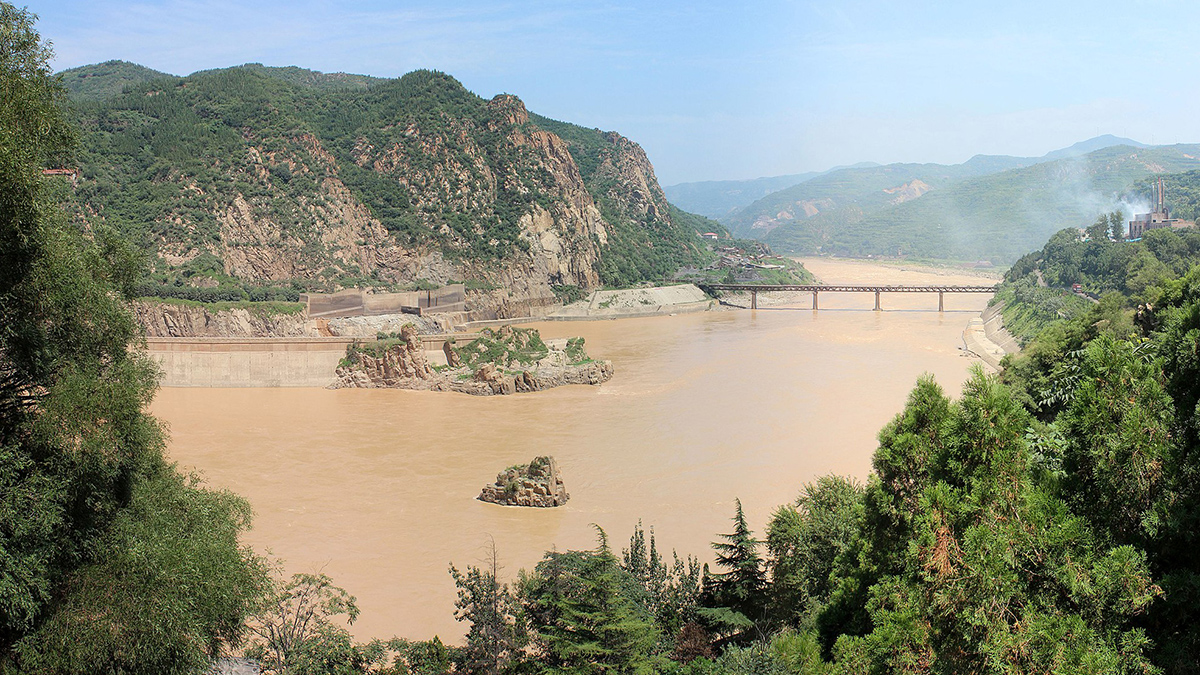
The mix of metals in China’s Yellow River stays relatively similar as it moves from the upper continental crust to biological life.
Water Resources Research

Posted inEditors' Highlights
How Does Subsurface Lithology Speak to Hillslope Morphology?
Subsurface flow hydrology connects soils and bedrock lithology to long-term catchment evolution in humid landscapes.
Posted inResearch Spotlights
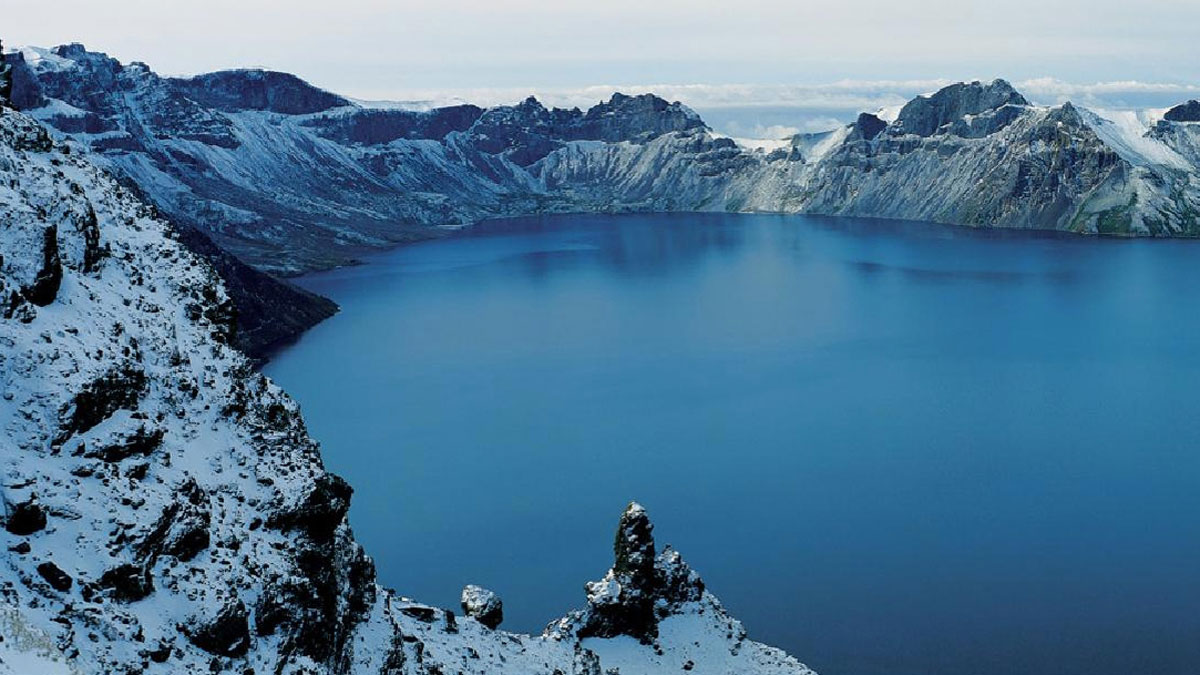
New Details About a Very Old Eruption and Flood
One of the most dramatic volcanic eruptions in history occurred more than 1,000 years ago. Scientists are still piecing together the aftermath.
Posted inEditors' Highlights
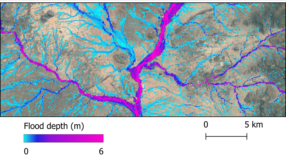
Future Global Flood Hazards at Unprecedented Accuracy
A global flood hazard map at 30-meter resolution is constructed using latest hydrology, topography, and climate data, and its accuracy is approaching that of local to regional scale flood inundation maps.
Posted inEditors' Highlights
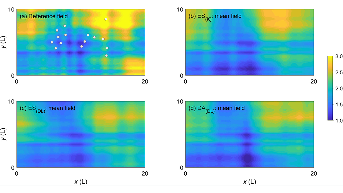
Learning Data Assimilation Without the Help of the Gaussian Assumption
Major Earth system processes are non-linear and non-Gaussian, and so should be our data assimilation approaches.

Posted inEditors' Highlights
When It Rains, It Pours!
Water that falls on a forest canopy during rainfall events reaches the ground at focused locations called “pour points”. This insight has a major impact on how we view hydrologic processes on the ground.
Posted inEditors' Highlights
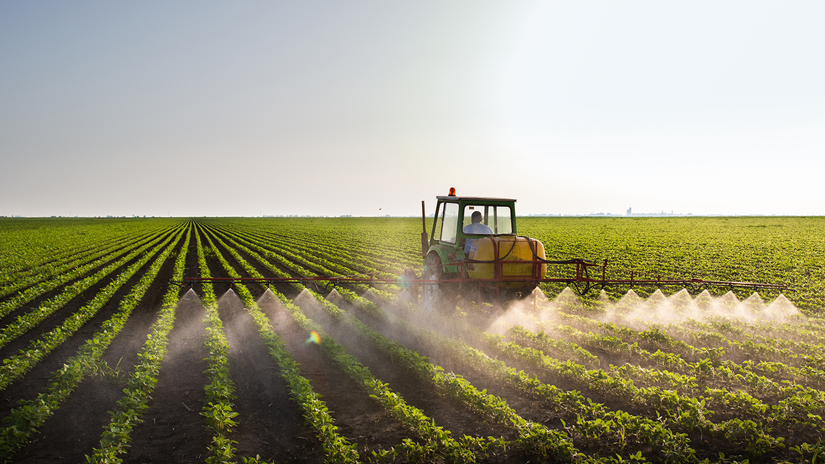
What Happens to Nutrients After They Leave Agricultural Fields?
To better quantify the fate of nutrients after they are released from agricultural fields, scientists examine storage and nitrate export regimes in agricultural hydrology systems.

Posted inEditors' Vox
Benefiting Society with Translational Water Research
A new special collection welcomes translational research contributions that bridge the gap between scientific knowledge and practical applications regarding water as a key societal resource or a risk.

Posted inEditors' Vox
AGU Publications Opens Science: Making Science Accessible and Equitable
To celebrate the Year of Open Science, we highlight our efforts to make AGU journals and books more open, accessible, and inclusive.

Posted inEditors' Vox
Advancing AI and Machine Learning Beyond Predictive Capabilities
A new cross-journal special collection invites contributions that unlock the next frontier in hydrology and Earth sciences through artificial intelligence and machine learning.