
Researchers tracked long-term sediment dynamics in Canada’s Quesnel Lake following the 2014 failure of a dam that spilled record-breaking amounts of contaminated mining waste.
Water Resources Research
Posted inResearch Spotlights
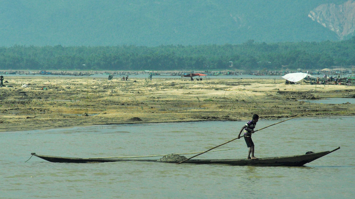
Bangladeshis Feel Increased Consequences of Sedimentation
In northern Bangladesh, residents are losing their livelihoods, homes, and personal safety when water carries sand and gravel into their communities.
Posted inResearch Spotlights
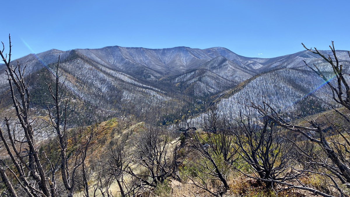
How Wildfires Affect Snow in the American West
Data from 45 burned sites help researchers better understand climate change and wildfires’ impact on snowpack.
Posted inEditors' Highlights
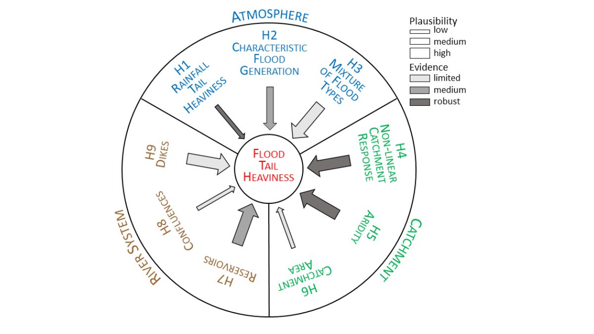
Nine Reasons Why Extreme Floods may be Worse Than Expected
The implications of nature not conforming to statistical assumptions can be devastating; researchers describe why extreme floods may be bigger than we assume.
Posted inEditors' Highlights
AI Algorithm Provides More Accurate Forecasts of Water Use
The new graph convolutional recurrent neural network (GCRNN) will enable water utilities to forecast water use, even if some sensors fail.

Posted inResearch Spotlights
Missouri River Floodplain Expansion, Services, and Resiliency
Benefits might accrue for both wildlife and climate resiliency if more floodplains along the lower Missouri River were allowed to flood.

Posted inResearch Spotlights
Algorithm Detects Thousands of Missing Levees from U.S. Database
An existing levee database accounts for just one fifth of the country’s actual total levee count, limiting the study of how these embankments affect riparian ecosystem health in the United States.
Posted inEditors' Highlights
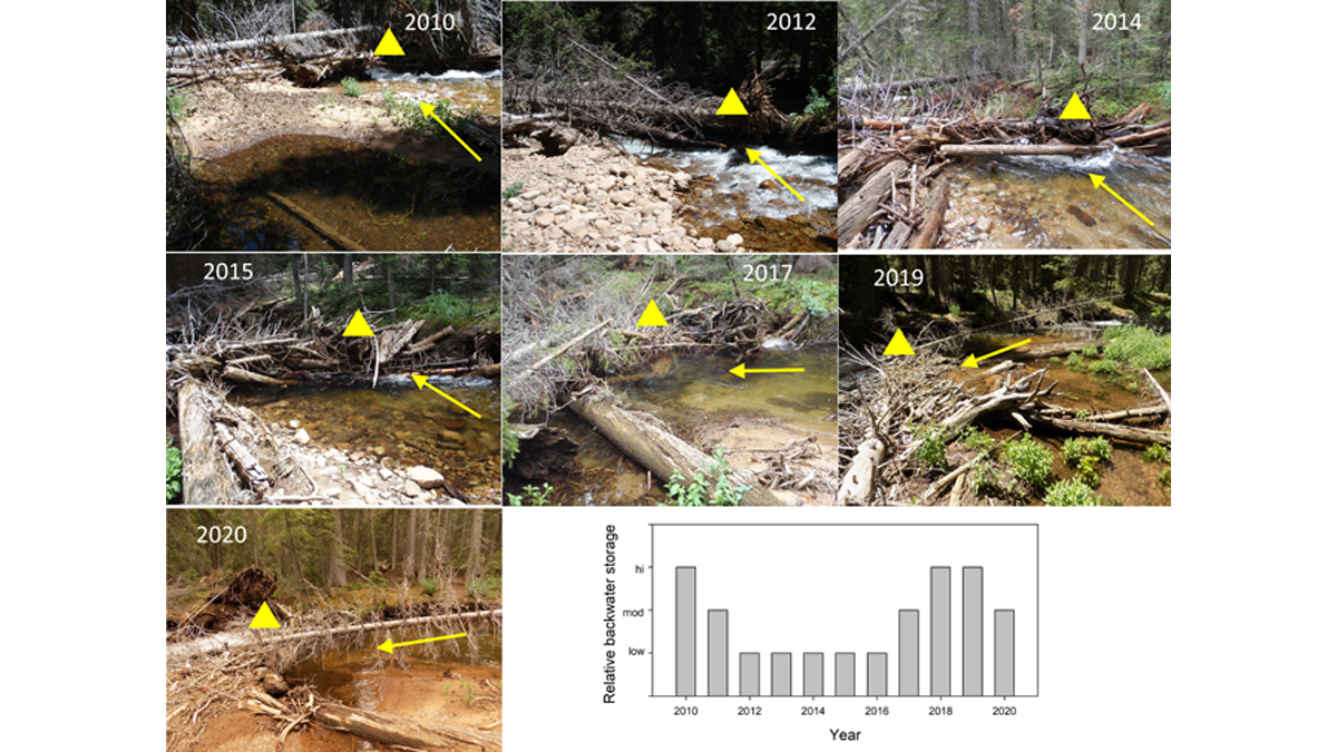
Logjams May Be Transient but Their Effect is Long Lasting
Even though natural logjams in rivers continuously change and maybe short-lived, their effects in terms of geomorphic diversity and habitat can be surprisingly long-lasting.
Posted inResearch Spotlights
A Probabilistic Model for Classifying Temporary Rivers
The model relies on measurable broad-scale attributes, increasing its flexibility for use in diverse environments.
![A 3-D image of the study area of Liu et al. [2022] in Kuuguluk River at Salluit, Nunavik (Quebec), Canada. The image shows the locations of A-A’ and B-B’ and lines C1-5.](https://eos.org/wp-content/uploads/2022/04/2021WR031630-Figure-4.png)
Posted inEditors' Highlights
Why is Permafrost Groundwater Surfacing?
Hydrogeological properties of degrading permafrost come to fruition with a new 3-D modeling study that highlights the increasing role of groundwater in the water cycle of high-latitude areas.