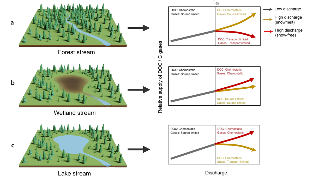
Carbon export in boreal catchments depends on the landscape setting and differs for snowmelt and rainfall events.
Water Resources Research

Posted inEditors' Highlights
New Standards Spur Water Utilities to Improve Compliance
Although American water utility companies take time to modify procedures and technologies in response to new quality requirements, ultimately it reduces the rate at which they violate standards.
Posted inResearch Spotlights
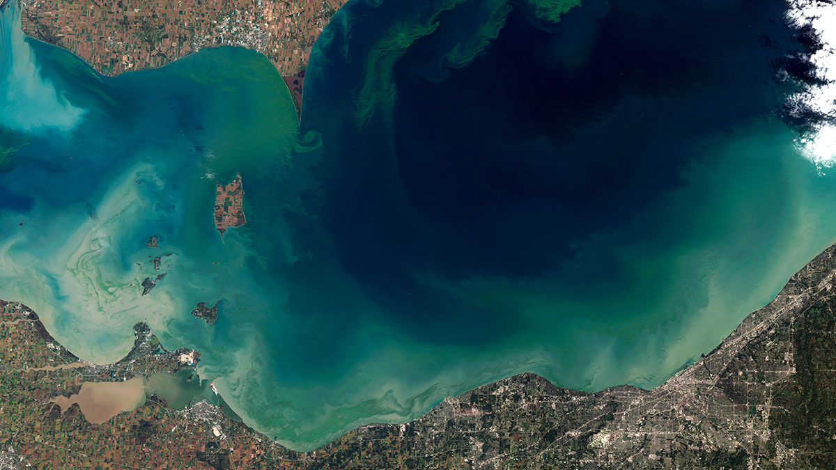
Cyanobacteria Blooms Exceed WHO Thresholds in Midwest Lakes
A study of 369 lakes across the Midwest finds that many of them, especially those close to agriculture, have high concentrations of harmful algal bloom-causing cyanobacteria.

Posted inResearch Spotlights
Improving Weather Simulations Through Increased Generality
By adding support for spatially variable velocity fields and anisotropy, the CoSMoS simulation package can more accurately reproduce physical phenomena.

Posted inEditors' Highlights
Analysis Reveals Patterns of Streamflow Generation Across USA
A new study transforms a classic conceptual framework into a quantitative classification of streamflow generation patterns.
Posted inEditors' Highlights
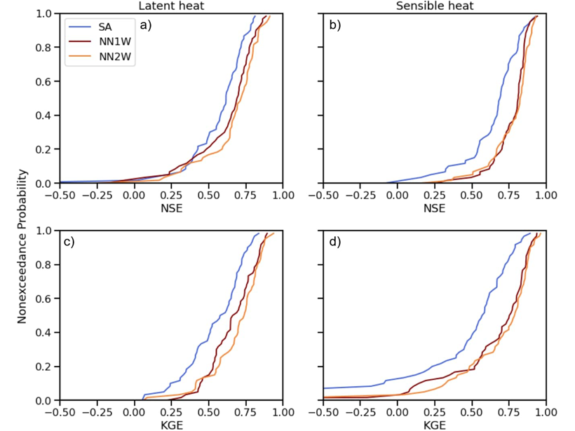
Combining Deep Learning Methods with Process-based Models
Using turbulent heat fluxes as an example, a new study shows that exchange of information between process-based models and deep learning methods may lead to improved predictions.
Posted inEditors' Highlights
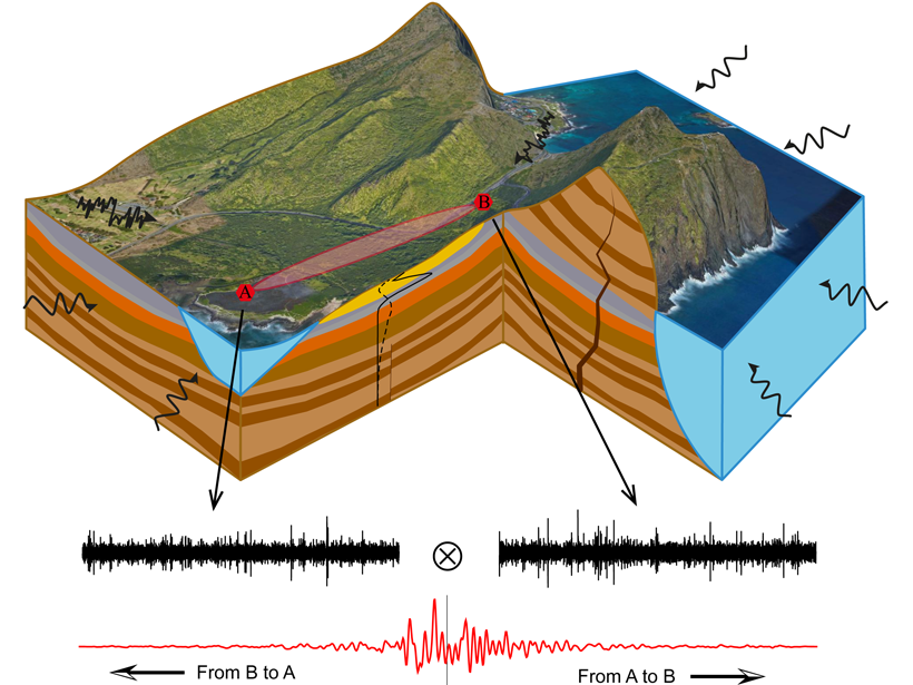
Revealing Complexity of Groundwater Flow with Hydrogeophysics
A combination of passive seismic and electrical measurements are used to unravel the complex hydrogeology structure and associated groundwater flow paths at a coastal site in O’ahu, Hawai`i.
Posted inEditors' Highlights
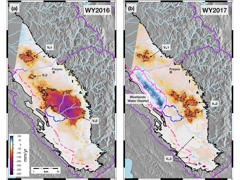
Satellites Detect Groundwater Recharge for San Joaquin Valley
A new study integrates spaceborne InSAR time series and GPS to resolve spatiotemporal patterns of deformation across the San Joaquin Valley indicating recharge areas and pathways for groundwater flow.
Posted inResearch Spotlights
Tracing Water from River to Aquifer
A new technique using dissolved noble gas tracers sheds light on how water moves through an aquifer, with implications for water resources and their vulnerability to climate change.

Posted inEditors' Vox
Introducing the New Editor in Chief of Water Resources Research
Find out about the person taking the helm of Water Resources Research and her vision for the coming years.