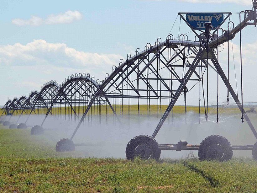
Past studies that have estimated irrigation water usage based on satellite remote sensing have had large uncertainties that could hamper effective water management.
Water Resources Research

Posted inEditors' Highlights
The Ocean-Land Connection of Droughts
Around 16 percent of large-scale droughts over land originate above the ocean and these types of droughts are more extensive and severe than droughts that originate over land.
Posted inEditors' Highlights
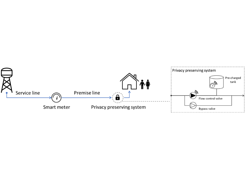
Smart Water Metering Need Not Compromise People’s Privacy
Scientists have devised a way of preserving privacy for smart water metering users while also providing water suppliers with information they can use to improve the efficiency of water services.
Posted inEditors' Highlights
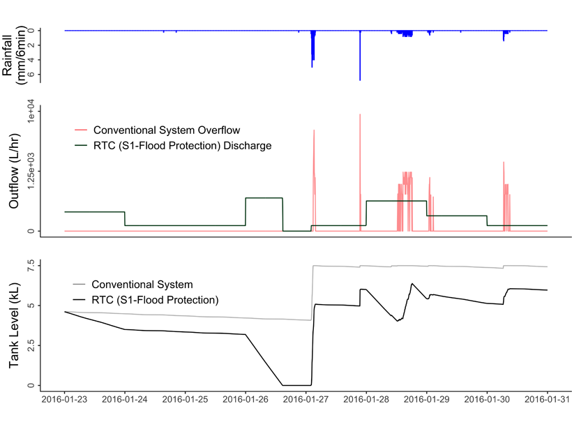
Rainwater Harvesting Can Reduce Flooding as Well as Saving Water
Weather forecasting can greatly improve benefits of rainwater harvesting.

Posted inEditors' Highlights
Environmental Impact Bonds Incentivize Watershed Restoration
Environmental Impact Bonds for financing new water and environmental infrastructure can be properly priced with the help of watershed modelling.
Posted inEditors' Highlights
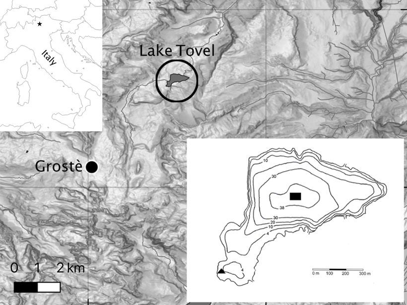
Climate Warming Improves Oxygen Mixing in a High-Altitude Lake
Long term weather and lake data from a high elevation lake in the Alps demonstrate that climate warming may actually improve the ability of high-altitude deep lakes to mix their waters.

Posted inEditors' Highlights
Machine Learning Predicts Subsidence from Groundwater Pumping
Machine learning and data on aquifer type, sediment thickness, and proxies for irrigation water use has been used to produce the most comprehensive map of land subsidence in the western U.S. to date.
Posted inEditors' Highlights
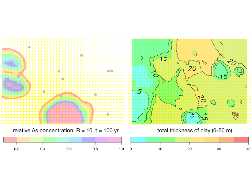
Arsenic Pollution in Bangladesh is Catching Up with Deeper Wells
Inhabitants of Bangladesh have deepened drinking water wells to avoid extracting arsenic-rich groundwater from shallow aquifers, but these may not be free from pollution either.
Posted inEditors' Highlights
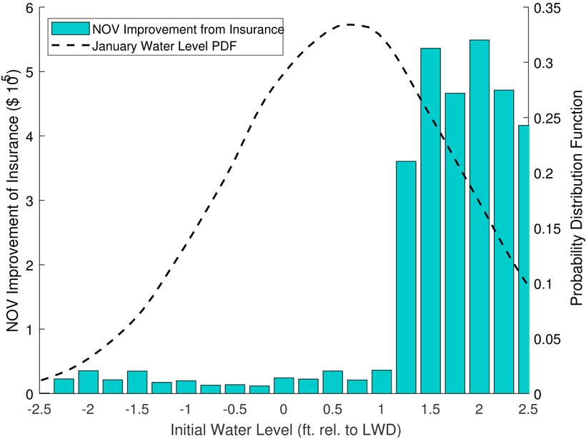
New Analysis Helps Manage Risks to Shipping in the Great Lakes
Modeling of mysteriously fluctuating water levels in the Great Lakes has helped to optimize the prices of shipping insurance contracts along with investments in dredging navigation channels.

Posted inResearch Spotlights
Snowpack Data Sets Put to the Test
A new study compares the accuracy of three observation-based methods of calculating snow water equivalent, a key component in water management.