The outgoing Editor in Chief of Water Resources Research reflects on his tenure and expresses appreciation to all those who contributed to the success of the journal.
Water Resources Research
Posted inEditors' Highlights
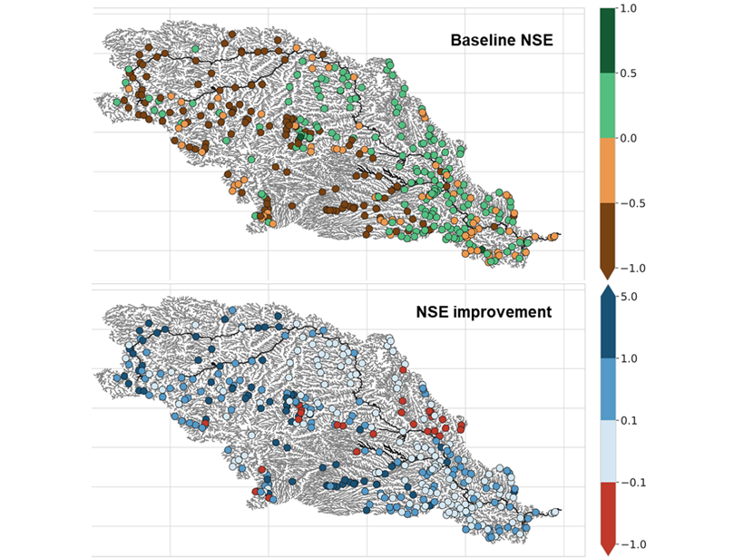
Gauging Ungauged River Basins with Smart Remote Sensing
A clever combination of hydrologic modelling and discharge estimates from the Landsat satellite provides good discharge estimates throughout the Missouri river basin.

Posted inEditors' Highlights
Thawing Permafrost May Cause Streams to Cool
Permafrost thawing associated with climate warming increases contributions to streamflow by deeper, cooler groundwater flow paths, which may result in lower summer stream temperatures.

Posted inResearch Spotlights
Big Benefits from Experimental Watersheds
Scientific insights from the Agricultural Research Service’s long-term study sites underpin dozens of models and research methods that guide global land management and conservation practices.
Posted inResearch Spotlights
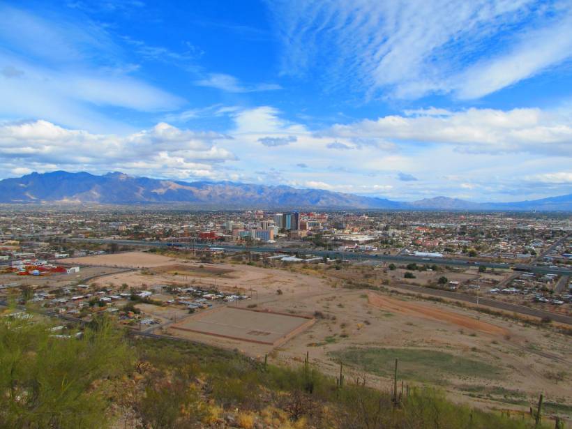
Parsing Routes to Aquifer Recharge Along Mountain Fronts
Research from the Tucson Basin indicates that tracers can be used to distinguish surface and subsurface recharge, providing crucial data to support sustainable water management in arid environments.

Posted inEditors' Highlights
A Smart Solution to Find Leaks in Water Distribution Networks
By systematically turning valves off and on in water distribution networks, researchers can locate pipe leaks, which could help to save huge quantities of drinking water.
Posted inEditors' Highlights
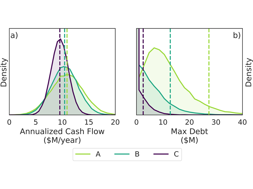
How to Hedge the Risk of Reduced Snowpack for Hydropower
A new index insurance contract – a financial product innovation seeking to cope with climatic variability – could help hydropower operators to manage climate risks.
Posted inEditors' Highlights
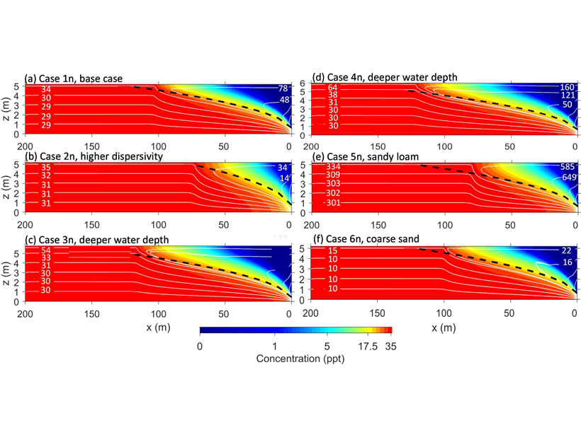
Evaporation Reverses Groundwater Flow and Forms Hyper-Salinity
A numerical model of groundwater-surface water systems shows how floodplain evaporation can reverse stream-groundwater flow and produce strong buoyancy changes associated with salinity.
Posted inResearch Spotlights
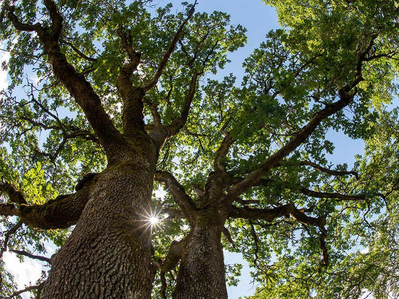
How Some Trees Survive the Summer Dry Season
Oak trees in California seasonally tap moisture in unsaturated soil and weathered bedrock, even when the groundwater table is within reach of their roots.
Posted inResearch Spotlights
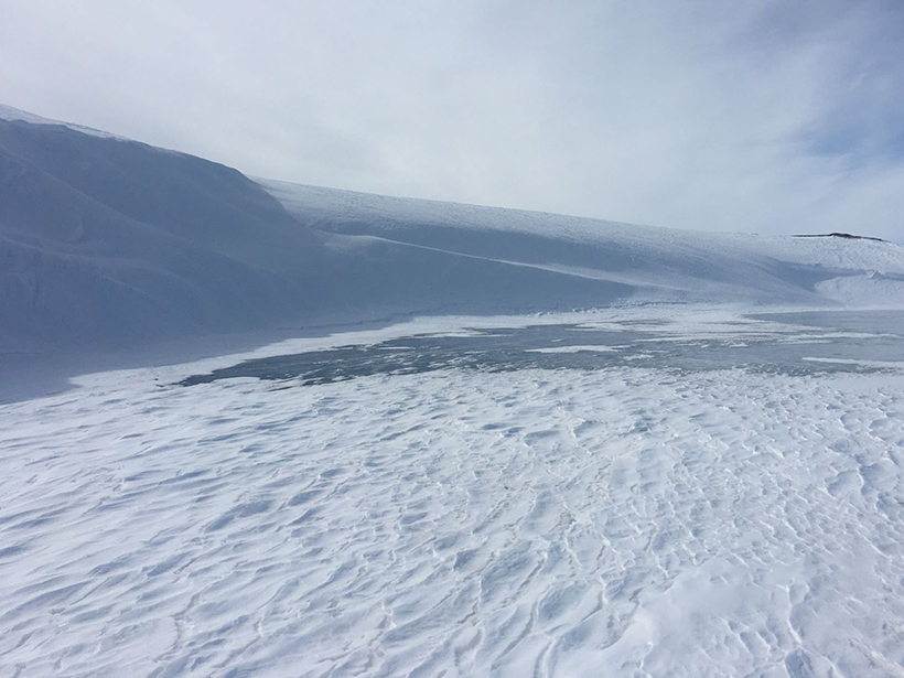
A Census of Snowdrifts in Northern Alaska
Snowdrifts prove less ephemeral than they might seem, occurring in the same places year after year.