
This device allows scientists to measure how much snow is trapped in canopies and predict changes to snowpack—a critical factor in annual water availability.
Water Resources Research
Posted inEditors' Highlights
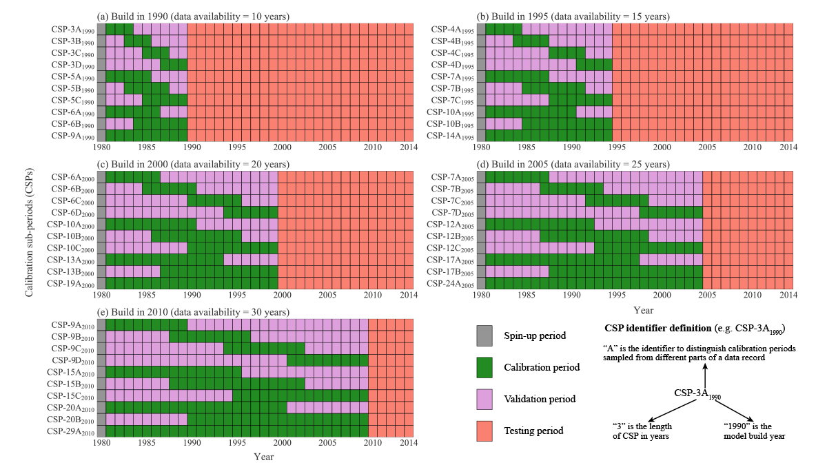
Hydrologists Should Reconsider How They Calibrate Their Models
A new study suggests that the commonly used split sample approach in hydrology, where time series are divided into a part for model calibration and a part for model validation, should be abandoned.
Posted inEditors' Highlights
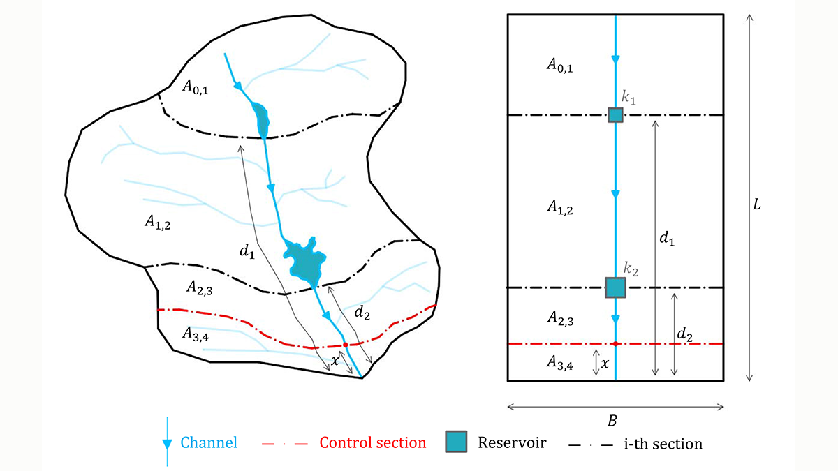
A New Index to Assess Multiple-Reservoir Effects on Peak Floods
A simple, yet quantitative, index is demonstrated to quantify reductions in the peak flood resulting from multiple reservoirs, arranged in series along the same river reach.

Posted inResearch Spotlights
Tree Rings Reveal a Puzzling Trend in Monsoon Intensity
Tree rings confirm that in northern Australia, the past 40 years have experienced more rain than any similar length of time in the past 600 years.

Posted inEditors' Highlights
Predicting Discharge Chemistry in Mine-Waste Rocks
Quantifying integrated hydrological processes, biogeochemical reactions, and mineralogical characteristics can help predict water quality and quantity for mine-waste rock piles.

Posted inEditors' Highlights
Managing Strategic Water Resources in a Changing Climate
Another significant step has been taken in methods for managing water resources in the face of climatic changes and other future uncertainties. Dynamic adaptation is becoming a reality.
Posted inResearch Spotlights
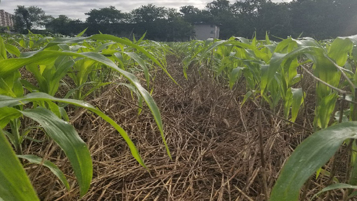
Modeling Mulch to Understand Agricultural Soil
A new model helps shed light on residue mulch, an important regulator of surface soil conditions.

Posted inEditors' Highlights
Plant Root Exudates Mediate Soil Nutrient Transport
Plant roots mediate solute transport through the soil immediately surrounding them by introducing polymers and other binding compounds that disrupt water transport pathways between soil pore spaces.

Posted inEditors' Highlights
Pro-Poor Flood Risk Management Can Reduce Urban Inequality
Rich people’s aversion to flood risk results in poor people living in the most vulnerable locations poverty. Pro-poor flood risk management policies could have a significant impact on inequality.
Posted inEditors' Highlights
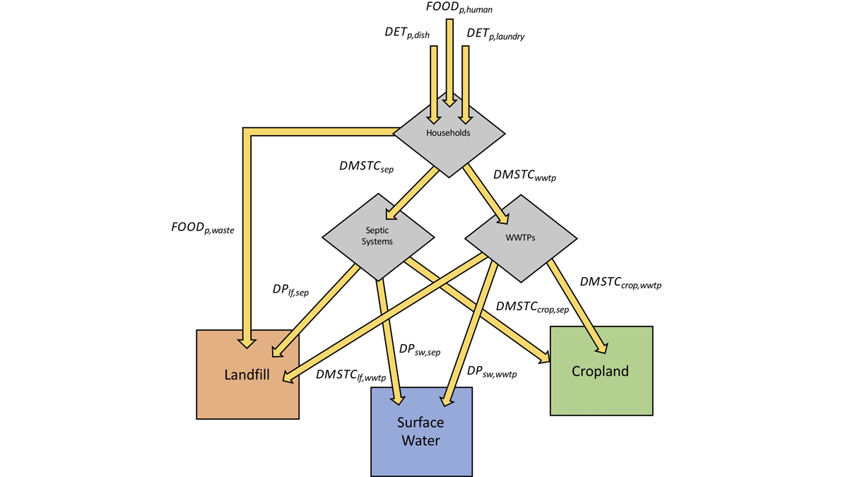
Water Quality Policy Must Consider Stored Watershed Phosphorous
Phosphorous stored in watersheds and affects water quality for decades. A new model predicts phosphorus accumulation and depletion, and the consequences for water quality conservation measures.