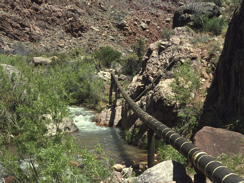
• About
  • Special Reports
  • Topics
    • Climate
    • Earth Science
    • Oceans
    • Space & Planets
    • Health & Ecosystems
    • Culture & Policy
    • Education & Careers
    • Opinions
  • Projects
    • Postcards From the Field
    • ENGAGE
    • Editors’ Highlights
    • Editors’ Vox
    • Eos en Español
    • Eos 简体中文版
    • Print Archive: 2015–2025
  • Policy Tracker
  • Blogs
    • Research & Developments
    • The Landslide Blog
  • Newsletter
  • Submit to Eos
  • AGU.org
  • Career Center
  • Join AGU
  • Give to AGU
  • About
  • Special Reports
  • Topics
    • Climate
    • Earth Science
    • Oceans
    • Space & Planets
    • Health & Ecosystems
    • Culture & Policy
    • Education & Careers
    • Opinions
  • Projects
    • Postcards From the Field
    • ENGAGE
    • Editors’ Highlights
    • Editors’ Vox
    • Eos en Español
    • Eos 简体中文版
    • Print Archive: 2015–2025
  • Policy Tracker
  • Blogs
    • Research & Developments
    • The Landslide Blog
  • Newsletter
  • Submit to Eos
Skip to content
  • AGU.org
  • Career Center
  • Join AGU
  • Give to AGU
Eos

Eos

Science News by AGU

Support Eos
Sign Up for Newsletter
  • About
  • Special Reports
  • Topics
    • Climate
    • Earth Science
    • Oceans
    • Space & Planets
    • Health & Ecosystems
    • Culture & Policy
    • Education & Careers
    • Opinions
  • Projects
    • Postcards From the Field
    • ENGAGE
    • Editors’ Highlights
    • Editors’ Vox
    • Eos en Español
    • Eos 简体中文版
    • Print Archive: 2015–2025
  • Policy Tracker
  • Blogs
    • Research & Developments
    • The Landslide Blog
  • Newsletter
  • Submit to Eos

water supply

A pipeline stretches across a flowing river in a small canyon.
Posted inNews

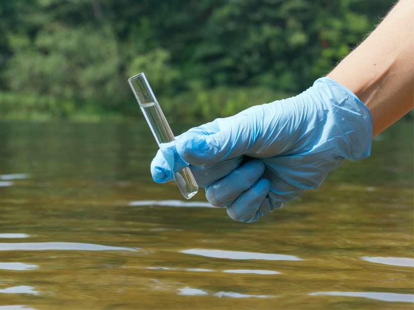
Tracking the Grand Canyon’s Mysterious Springs

Mary Caperton Morton, Science Writer by Mary Caperton Morton 24 February 202016 July 2025

Improved modeling will help protect a crucial drinking water source for both rims of Grand Canyon National Park.

Anthropologists set up a total station to study a Khmer city complex.
Posted inNews

Poor Water Management Implicated in Failure of Ancient Khmer Capital

Rachel Fritts, Science Writer by Rachel Fritts 3 February 20203 November 2022

Researchers used remote sensing technologies to map Koh Ker’s buried reservoir and calculate its capacity to hold water during the rainy season.

Stalks of corn beneath a blue sky
Posted inNews

Some Plans to Reverse Climate Change Could Double Water Use

by J. Kathan 30 January 202018 October 2021

Researchers say full-scale deployment of negative emissions technologies would lead to major changes in global usage of water, land, and energy.

Irrigation machinery sprays water on the green vegetation of a mango farm in South Africa.
Posted inNews

Minireservoirs Could Save Farmers with Sandy Soils

Kate Wheeling, freelance science writer by Kate Wheeling 29 January 202031 October 2022

A recently revived subsurface water retention technology could conserve water and drastically increase crop yields in arid landscapes with sandy soils like sub-Saharan Africa.

An image of villagers from Huamantanga constructing a shallow stone canal to divert water down a hillside
Posted inNews

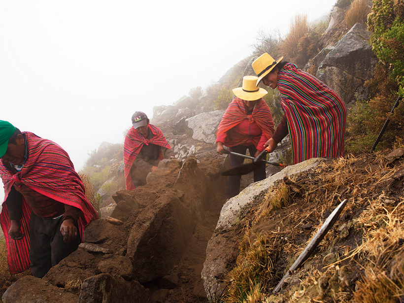
Pre-Inca Canal System Uses Hillsides as Sponges to Store Water

Rachel Fritts, Science Writer by Rachel Fritts 30 December 201915 October 2021

To prepare for a drier future on Peru’s western coast, researchers are turning to techniques of the past.

A gloved hand holds a test tube of water above a flowing river.
Posted inNews

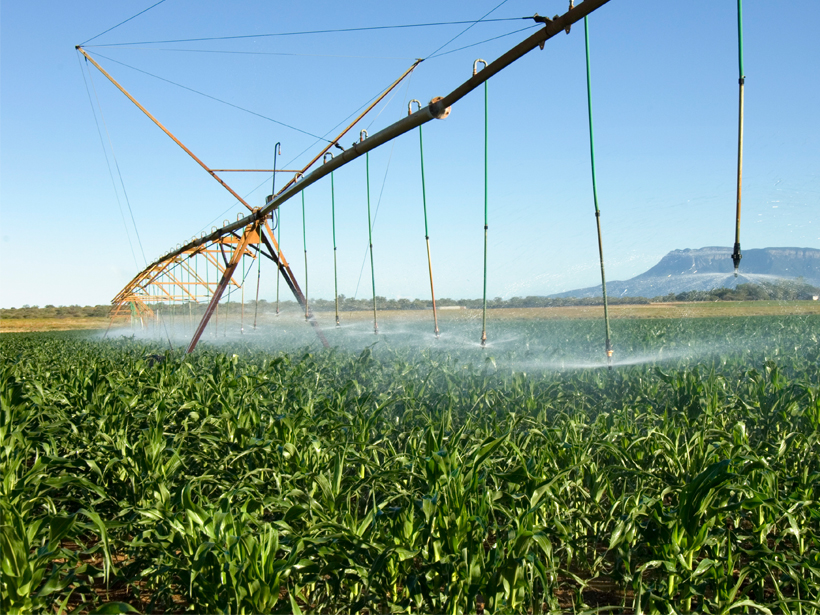
Modeling How Groundwater Pumping Will Affect Aquatic Ecosystems

Adityarup Chakravorty, freelance science writer by Adityarup Chakravorty 15 November 201918 October 2021

Regions with dry climates and heavy agricultural industries may be the most hard-hit.

Water flows from a pipe at an oasis in the Saudi desert.
Posted inNews

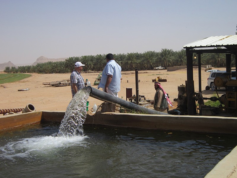
Arid Arabian Peninsula Is Tapping into Vast Groundwater Reserves

Mary Caperton Morton, Science Writer by Mary Caperton Morton 5 November 201925 August 2022

A new, multipronged study sheds light on an ancient aquifer system.

Maps showing flooding near Houston after Hurricane Harvey in 2017
Posted inEditors' Highlights

Future Remote Sensing Mission Holds Promise for Flood Monitoring

by Valeriy Ivanov 28 October 20191 December 2022

The 2021 Surface Water and Ocean Topography (SWOT) mission will measure water surface elevation, slopes, and inundations of rivers as narrow as 50 meters.

Schematic showing 4 difference scenarios in which atmospheric rivers affect the surface water budget
Posted inEditors' Highlights

Hydrological Footprint of Atmospheric Rivers on Land

by Minghua Zhang 10 September 201930 January 2024

Atmospheric rivers that make landfall in the western United States have significant impacts on the surface water balance, sharpening the seasonality of water resources in coastal watersheds.

Snow blankets East Gros Ventre Butte, just west of Jackson, Wyo., in the Upper Snake River Basin
Posted inResearch Spotlights

Capturing Snowmelt Patterns from Cloudy Satellite Images

Sarah Stanley, Science Writer by Sarah Stanley 2 August 201925 October 2022

A new modeling strategy could improve streamflow predictions in places where mountain snow is a critical source of water.

Posts pagination

Newer posts 1 … 12 13 14 15 16 … 21 Older posts
Over a dark blue-green square appear the words Special Report: The State of the Science 1 Year On.

Features from AGU Publications

Research Spotlights

The Surprising Link Between a Cold Blob and the Indian Monsoon

1 June 20261 June 2026
Editors' Highlights

Model of Complex Blanket Bog Improves Prediction of Peat Expansion

1 June 20261 June 2026
Editors' Vox

The Editorial Board Marks the Latest Chapter in AGU Books

1 June 202626 May 2026
Eos logo at left; AGU logo at right

About Eos
ENGAGE
Awards
Contact

Advertise
Submit
Career Center
Sitemap

© 2026 American Geophysical Union. All rights reserved Powered by Newspack