
The Landslide Blog is written by Dave Petley, who is widely recognized as a world leader in the study and management of landslides.

The 4 October 2023 Glacial Outburst Flood (GLOF) in Sikkim was triggered by a landslide into a glacial lake, that in turn triggered an overtopping event that generated the appalling debris flow and flood. I have previously highlighted the amazing work that Praful Rao of the Save the Hills blog has undertaken to document the impact of the flood between Teesta Bazar and NHPC’s Teesta Low Dam Project. He has now posted a further three fascinating articles that document damage along other sections of the Teesta River, first, at Chunthang and its vicinity; second, at Singtam; and third, along the NH10 road. All three are remarkable records of the high level of damage – I strongly recommend that you take a look.
The first documents damage along the line of the Teesta River, but it is especially interesting in that it was the site of the 60 metre high Teesta III dam, which collapsed during the flood. Praful has posted an image of the remains of the dam:-
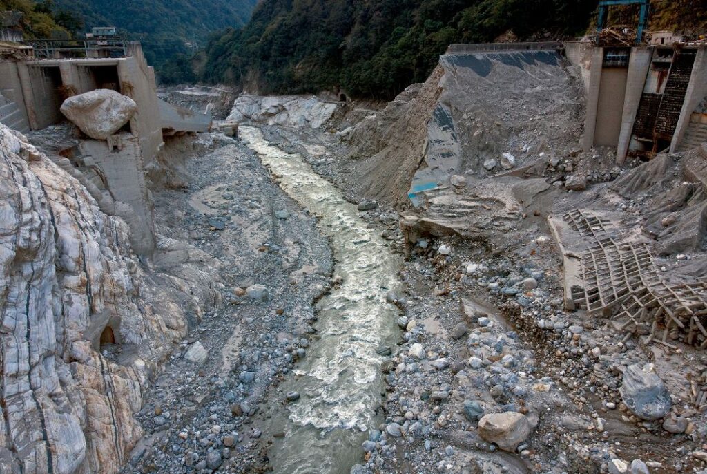
Clearly the dam has been completely destroyed, but note also the size of the boulder lodged on the left side of the structure.
The view in the other direction is equally as remarkable:-
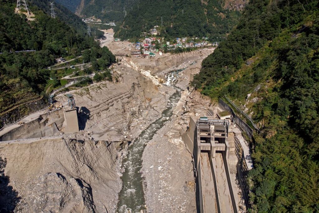
The scale of the destruction portrayed in the image is clear. There are many more of this area on the Save the Hills site.
Meanwhile, the Teesta stage VI dam at Sirwani, Singtam in Sikkim has also suffered huge amounts of damage. The image below appears to show severe damage to the infrastructure of the dam and a large amount of timber debris having been deposited:-

Praful also highlights damage to the NH10 highway, a key arterial route for Sikkim, and the issues that this has caused. The image below shows damage to just one section of the road:-

The scale of the challenges that this area now faces is very stark.
Finally, as Praful has pointed out in his most recent post, the next monsoon season is starting to hove into view. There is much to be done to be ready for another long period of heavy rainfall.