
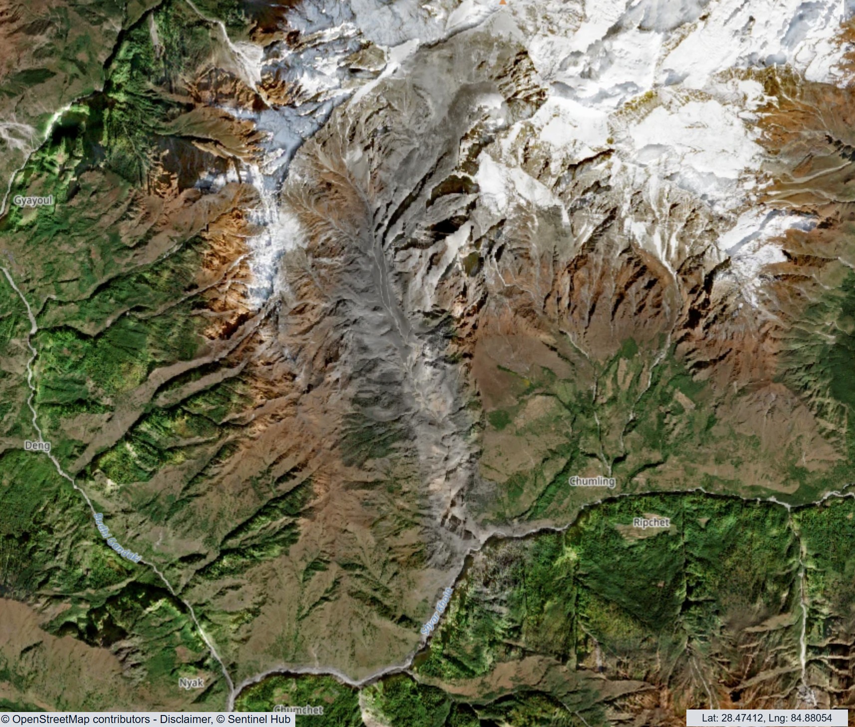
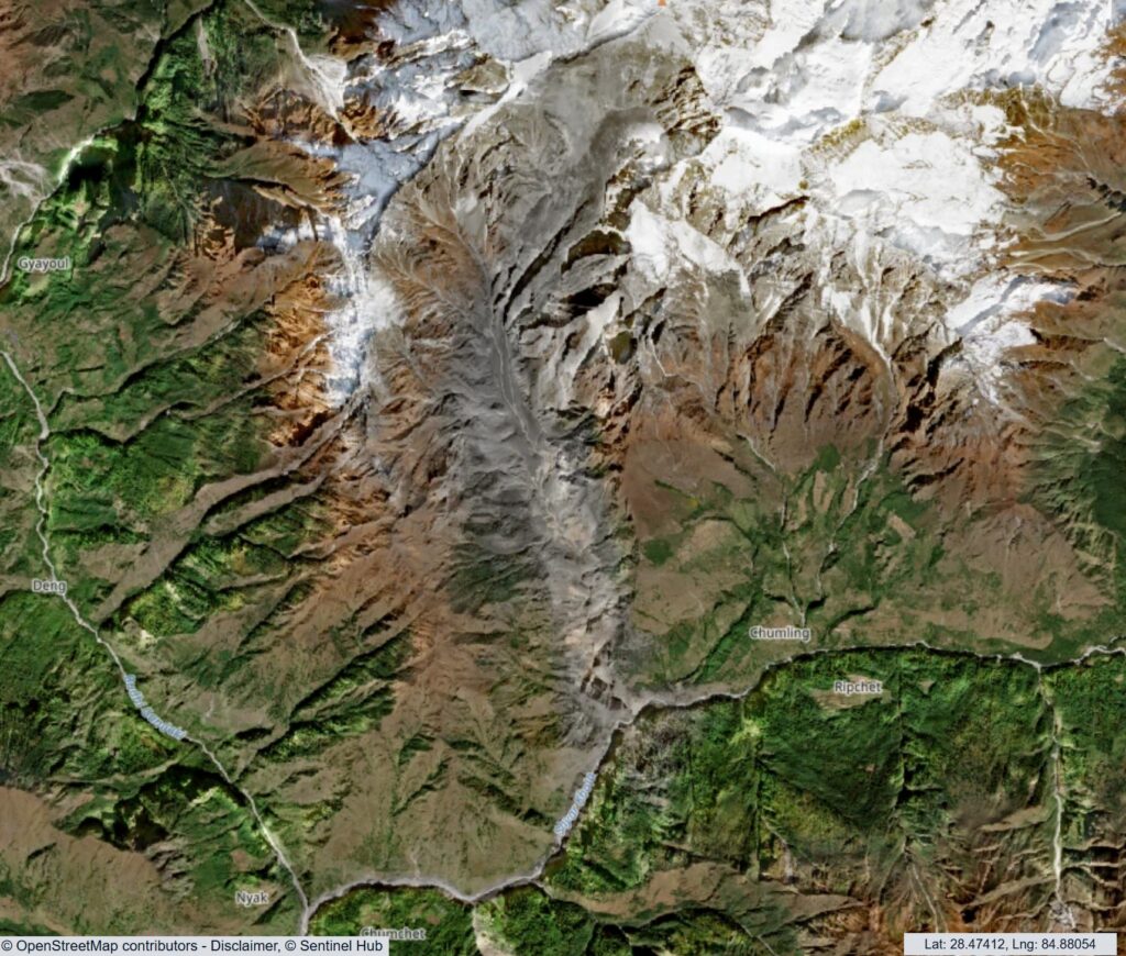
Sentinel satellite imagery shows that the Budhi Gandaki event was another example of the failure of a steep rock slope that transitioned into a rock avalanche and then a debris flow.

Almost a month ago, a less well reported but significant debris flow swept down the Budhi Gandaki river in Nepal, causing extensive damage. I described on this blog helicopter footage that seemed to show the aftermath of a rock avalanche, but noted that at that point we had no satellite imagery to clarify what had occurred.
As the monsoon has drawn to a close, the skies in the area are now clear, which has allowed the ESA Sentinel 2 satellite to capture high quality imagery of the area. This image was collected on 21 October 2026:-
I have annotated a more detailed view of the first part of the path of the landslide below:-
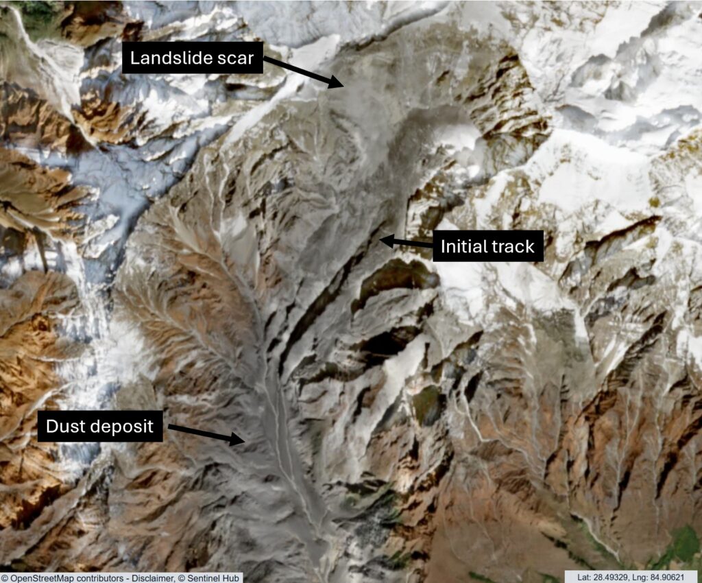
The landslide scar appears to be located on [28.5336, 84.9345]. This appears to be on the southern side of Chamar, on the western side of the valley. The landslide source area is about 500 m wide and 850 m long on plan view. But this is extremely steep terrain – the crown may be at about 6,600 metres and the toe of the initial failure at about 5,400 metres. The Google Earth image of the site (from January 2026) shows a glacier at the toe of the slope and a very steep slope down to the main valley at an elevation of about 3,200 metres. It is this very steep topography that probably accounts for the very dynamic nature of this landslide.
So, the Budhi Gandaki event was another example of the failure of a steep rock slope that transitioned into a rock avalanche and then a debris flow. It did not involve the collapse of a landslide dam, as others have suggested.