The Landslide Blog is written by Dave Petley, who is widely recognized as a world leader in the study and management of landslides.

Rainfall induced landslide disasters just keep on occurring in this extraordinary year. October usually sees a dramatic reduction in events globally as the northern hemisphere summer rainfall ebbs away. However, this year continues to buck the trend.
The latest event occurred on Friday 4 October 2024 around the village of Donja Jablanica in Bosnia and Herzegovina. Voice of America has tweeted some images of the aftermath of the disaster:-
Several communities were hit by similar events across the region, although the debris flow at Donja Jablanica appears to be the worst by far. To date the confirmed loss of life is 16 people, of which fifteen were killed in Jablinica. A further five people are reported to be missing.
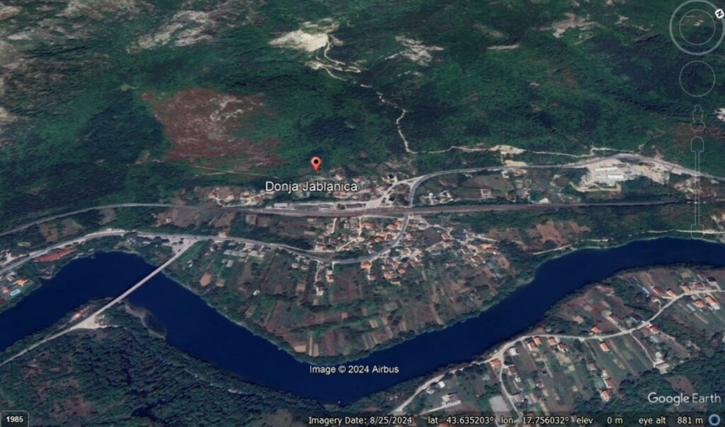
Donja Jablanica is located at [43.6359, 17.7564]. This is a Google Earth perspective view of the village, which includes the valley down which the debris flow travelled:-
In the media, there has been a suggestion that a factor on the landslide may have been the quarry that is located about a kilometre upstream of the community, which can be seen in the Google Earth image below:-
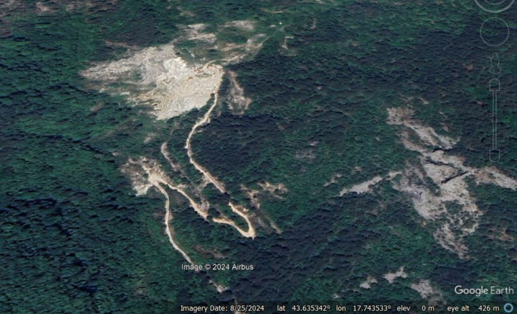
There is certainly a great of waste rock in this image, and note that it covers the track on the other side of the valley.
This is a Planet Labs image of the area around this debris flow, captured on 4 October 2024 (i.e. immediately after the landslide):-
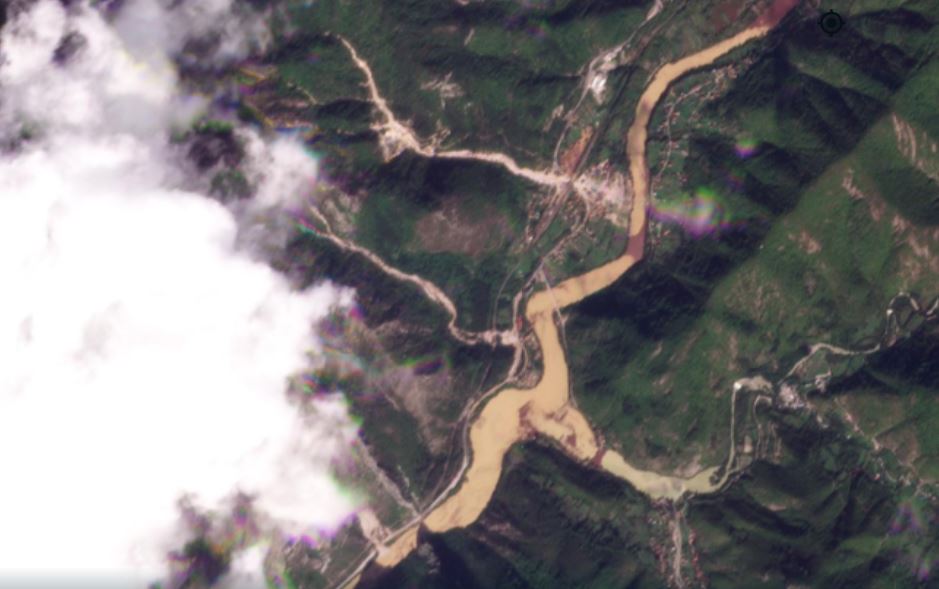
The debris flow that struck Donja Jablanica is the one to the north in this image. There is a similar event further south (in the centre of the image), and possibly two more obscured by cloud. Interestingly, the debris flow that struck Donja Jablanica appears to have started about 600 metres upstream of the quarry, so the excavation was probably not the primary cause of the event. However, it is possible that the quarry debris initially blocked the flow, and then collapsed catastrophically, intensifying the impact downstream, and / or that it added rock and debris to the landslide. Better aerial imagery will be needed to determine this. Either way, the quarry waste posed a severe threat to Donja Jablanica.
This is yet another event in which exceptional rainfall has triggered terrifying debris flows. I am struggling to keep up with them all at the moment, so please accept my apologies if a landslide in which you are interested has not appeared on this site.
Reference and acknowledgement
Planet Team 2024 Planet Application Program Interface: In Space for Life on Earth. San Francisco, CA. https://www.planet.com/
Thanks to loyal reader Karlo for highlghting the landslide.