
A large landslide has destroyed a 662 m long highway viaduct in China.

Over the last two days there has been considerable media coverage of a large, highly destructive rockslide that occurred at Hongqi Bridge in Sichuan Province, China. There is a very interesting set of images of the bridge during construction on the Highest Bridges site – the bridge was 662 metres long with pillars 172 m high, constructed to divert the G317 road as a result of the construction of the 312 m high Shuangjiangkou Dam.
The location of Hongqi Bridge is [31.82084, 101.90537]. The road exits a tunnel on a steep slope on the east side of the river, crossing via the bridge, and then enters another tunnel on the west side.
This is a video of the landslide:-
This is clearly a rockslide that has destroyed the pillars on the west side of the channel. It is interesting to see the amount of dust being generated. Note that there is a lot of false information circulating about this collapse, including AI generated videos and footage from other sites.
Reports suggest that cracks were noted in the slope and in the structures on 9 November 2025, with the road being closed the following day. The rockslide occurred on 11 November 2025.
This Google Earth image shows the site before construction of the bridge started:-
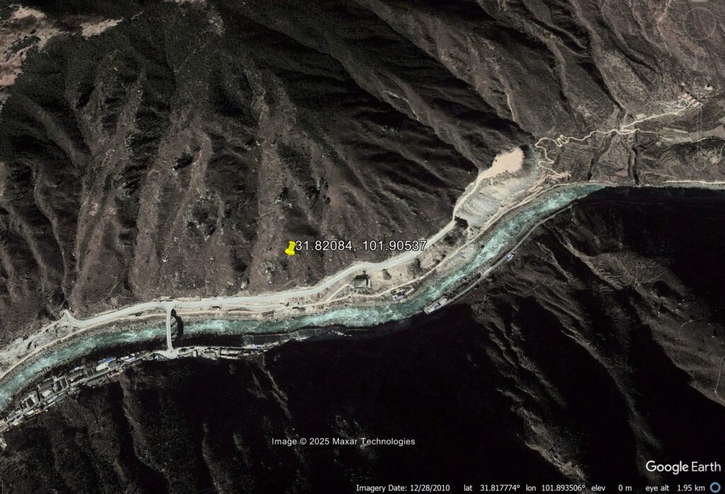
First inspection of that site suggests that it is immensely challenging from an engineering geomorphological perspective. There are hints of palaeo-landslides, fractured rock masses and loose deposits in a very steep, active topography.
Impoundment of water started on 1 May 2025, and satellite images suggest that the water level has been rising rapidly. Landslides during first impoundment are common – Three Gorges for example suffered many examples. The video suggests that the initial large scale failure might have occurred just above the road level, where the slopes have been excavated to create the road platform. This then propagated both downslope and upslope.
At this stage, the failure might be attributed to some combination of increased groundwater levels and poor engineering design / construction, especially with respect to the cut slopes.
The engineers now face two problems. First, reinstating this key road is going to be extremely challenging and time consuming. The highway has to cross this gorge, which of course will have been flooded. This will be a long and very expensive operation.
Second, as impounding continues, are there other potentially unstable slopes? An abundance of caution is needed given the height of the dam.