The Landslide Blog is written by Dave Petley, who is widely recognized as a world leader in the study and management of landslides.

An interesting aspect of the 8 February 2025 Jinping landslide in Sichuan Province is the timing. Yibin has a strongly seasonal rainfall pattern – annual average rainfall is reportedly about 1,195 mm, but on average only c.35 mm of this occurs in January, whilst each of July and August receive >220 mm on average. This does not preclude intense rainfall events occurring at any point in the year, of course, but it is unusual for them to trigger large landslides. An additional factor could be freeze-thaw conditions, but the images do not suggest that the conditions were especially cold at the time of the failure.
Under these scenarios, it is sensible to go back to look again at the conditions leading up to the failure. For this, we have the wonderful Planet Labs archive of imagery.
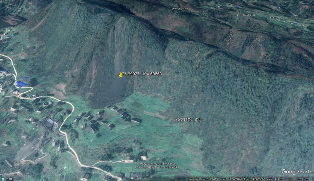
The location of the failure is [27.99927, 104.60863]. As I highlighted yesterday, there are clear signs that this slope has failed previously, albeit on a much lower scale. I used this Google Earth image yesterday to highlight these earlier failure events:-
So let’s take a look at Planet Labs imagery of the site, noting that it is of a lower resolution (so is less clear, although it’s clear enough for our purposes). This is a PlanetScope image from 29 September 2024:-

I would highlight two really interesting things about this image. First, the slope is clearly showing signs of distress, with a fresh scar that differs from that shown in the Google Earth. Second, the houses located at the tow of the slope in 2019 have now disappeared. This is a good thing – they would have been inundated in the landslide, so well done to whoever arranged this (although where the people went is unclear). I can only think that this was in response to the threat from the slope, so it’s likely that the hazards of this site were on someone’s radar.
Now let’s jump forward to 30 November 2024:-
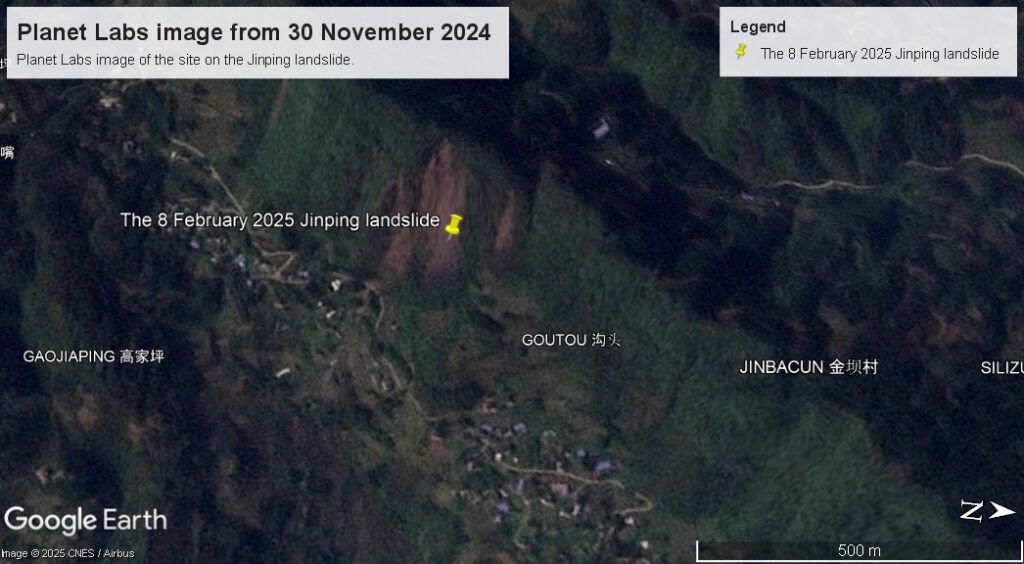
The slope has changed considerably. The area of active failure (i.e. bare rock / soil) has increased very notably. Now areas have opened up on the flanks of the main area of instability. Is there a hint of a tension crack linking them? Possibly. Even though this was a drier period of the year, this slope was evolving markedly.
I have prepared an image compare below to highlight this:-


The slide highlights that this slope had evolved considerably in two months.
The last really good Planet Labs image that is available was captured on 5 January 2025 (unfortunately this is a cloudy area, so capturing good imagery is hard):-

Again, an image compare is helpful:-

We have to be careful here as there is some seasonal change in the vegetation across the whole of the image (this is winter after all), but close examination shows that the slope has evolved further, especially on the right side (as we look at the landslide).
So, I would hypothesise that this was a progressive landslide that was evolving towards collapse in the months leading up to the final failure. The rainfall on 8 February may have pushed it over the edge, or it could be that it was simply at the failure point.
The question now will be whether this evolving behaviour could have meant that the Jinping landslide could have been anticipated. This is really hard, so is not intended to be a criticism. The slope appears to have caused concern previously; it would be interesting to know whether it was being monitored, and if so whether the changes observed in the satellite images had been noted and analysed.
The other element to this is whether it could have been anticipated that the Jinping landslide would transition into a rock and debris avalanche. This is also very difficult, but on first inspection a runout of 1,200 metres for a vertical change of about 450 metres does not seem particularly unusual.

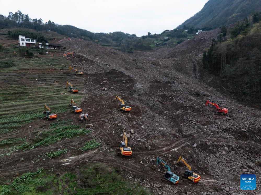
The aftermath of the 8 February 2025 Jinping landslide in Sichuan, China. Image by Xinhua/Jiang Hongjing
This image captures really well the scale of the landslide, the super-elevation on the left side of the image, and the magnitude of the challenge of the recovery operation.
This site is going to need attention after the recovery operation has been completed as the debris may not be stable under heavy rainfall.
Reference
Planet Team (2025). Planet Application Program Interface: In Space for Life on Earth. San Francisco, CA. https://www.planet.com/