
The Landslide Blog is written by Dave Petley, who is widely recognized as a world leader in the study and management of landslides.

Yesterday, I posted about a new paper (Shi et al. 2024) that describes the liquefaction landslide damage caused to villages in Gansu Province, triggered by the 18 December 2023 Ms=6.2 Jishishan earthquake. The paper is in effect in two parts, with the second component hypothesising that the same hazard was the likely cause of the destruction of the Bronze Age settlement at Lajia, a few kilometres away. I thought it would be interesting to examine this aspect of the work in more detail.
Lajia is a critically important archaeological site dating from 4000 years BP. For example, in 2005 the world’s oldest known noodles were discovered at this site.
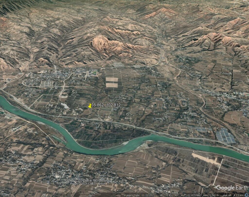
It is well established that Lajia was buried (and thus preserved) by a natural hazard, but there has been much debate about the nature of the cause of this event. The site is located at [35.862, 102.812] (note that the location given on the Wikipedia page is incorrect) – this is a Google Earth view of the area:-
The site is characterised by layers of red clay interbedded with palaeosols (ancient soil layers). Explanations for the destruction of Lajia have included a simultaneous seismic and flooding event; mudflows from the the slopes and gullies located upstream; and (controversially) a catastrophic outburst flood (i.e. the collapse of a landslide dam) on the Yellow River.
In the recent paper, Shi et al. (2024) propose a subtly different mechanism, drawing parallels with the December 2023 earthquake. They interpret the red clay layer as being similar in characteristics to the deposit seen from the “earthquake ripple hazard”, perhaps more conventionally termed a coseismic liquefaction flowslide, seen at Jintian and Caotan after the recent event.
My interpretation is that the key difference with other landslide hypotheses at this site would be the location of the source area of the failure. Under the conventional mudslide explanation, the source would be the steeper slopes at the back of the terrace – and there are certainly landslide scars in this area, as shown in the Google Earth image. In the ripple hazard hypothesis, the source would be liquefaction of the terrace deposits themselves, as per the 2023 event.
It would be very interesting to see high resolution airborne LIDAR imagery of the site, as this should be able to delineate the landslide scar (noting that the terrace has been modified by agriculture). At the level of the Google Earth imagery, one could speculate that a scar is visible on the terrace, but better quality data is needed.
In some ways, this argument could be seen to be of academic interest, but Shi et al. (2024) correctly argue that it is more than this. Gansu Province has a high level of seismic hazard, and loess landslides are a terrible component of large earthquake disasters. Thus, understanding the likelihood of liquefaction induced landslides has key implications for the management of risk in this area.
Reference
Shi, P. et al. 2024. Recent Jishishan earthquake ripple hazard provides a new explanation for the destruction of the prehistoric Lajia Settlement 4000a B.P. Scientific Reports 14, 11630. https://doi.org/10.1038/s41598-024-60433-8