
The 2026-27 El Niño has reached record levels. However, evidence suggests that the impacts on landslides may differ from the popular narrative.

Earlier this week, the Australian Bureau of Meteorology provided an update on the development of the 2026-27 El Niño event. The headline is stark:-
“El Niño is at near-record levels. Both oceanic and atmospheric indices reflect values consistent with a strong El Niño, with further intensification forecast during the rest of spring” [NB spring in Australia is autumn/fall in the northern hemisphere].
Their long term monitoring graph for the Relative Niño3.4 index (a measure of the intensity of El Niño conditions) makes sombre viewing:-
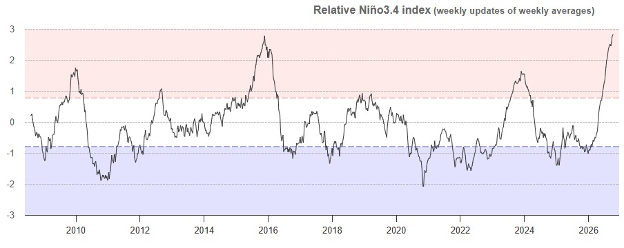
Generally, El Niño peaks in December, so this may intensify further. It is also worth noting that global sea surface temperatures are at a record high level.
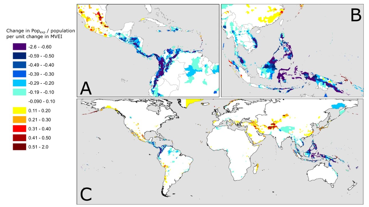
El Niño is associated with significant landslide impacts. There is a really good, open access paper (Emberson et al. 2021) in Nature Communications that used satellite rainfall data (using the NASA IMERG dataset) with a global landslide exposure model to constrain those areas in which the greatest impact occur. This map, from Emberson et al. (2021) the paper is published under a Creative Commons license), shows those area in which there is the greatest change in population exposure to landslide hazards as a result of El Niño conditions:-
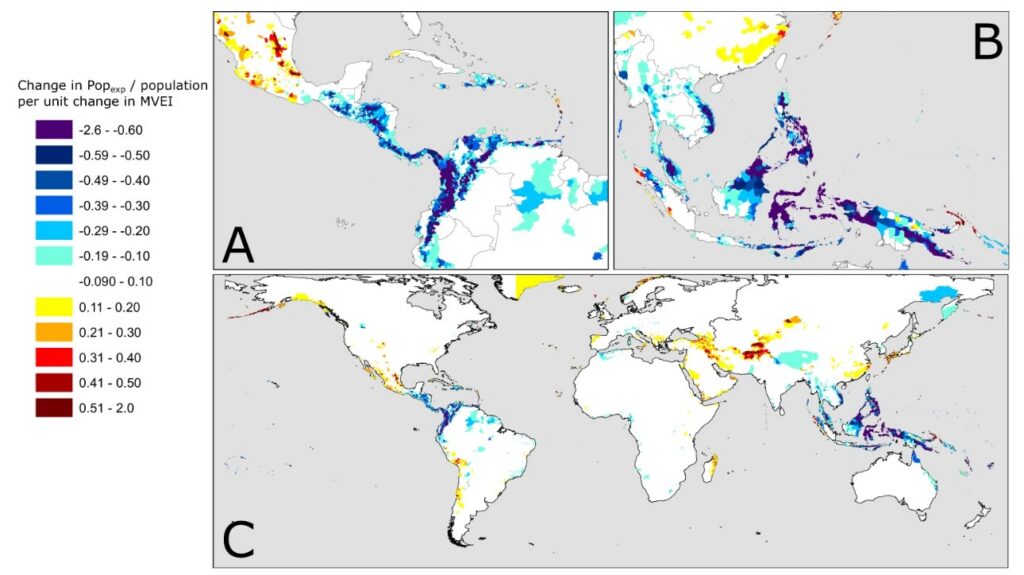
The results are quite surprising – and challenge some dominant narratives about landslides. As the map above shows, exposure to landslides decreases substantially in El Niño years in Colombia, the Philippines, and Indonesia. Areas that see an increase include Mexico, parts of South America and Central Asia. Note also that no effect is seen in California, a state in which there is a common perception that El Niño has a large impact on landslides.
Indeed, Emberson et al. (2021) conclude that it is not El Niño that drives increased landslide impacts globally, it is La Niña (the opposite set of conditions).
Now, there are two caveats to this that are important. The first is that the developing 2026-27 El Niño event is not typical, so the rainfall response may look rather different to that from previous events. Unfortunately, the dataset used by Emberson et al. (2021) does not capture the very intense 1997-98 El Niño event, which may have been a more useful proxy. And second, there are different types of El Niño events (“Warm Pool” and “Cold Tongue”). I believe that the current El Niño may be a “Cold Tongue” event (?), but it is not clear as to the differences in landslide patterns between these two types of El Niños.
So, whilst there is likely to be much discussion in the coming weeks of the implications of the 2026-27 El Niño event on landslides globally, there are many myths that are not supported by the empirical data. But, with an event on this scale, we are venturing somewhat into the unknown.
Reference
Emberson, R., Kirschbaum, D. & Stanley, T. 2021. Global connections between El Nino and landslide impacts. Nature Communications 12, 2262 (2021). https://doi.org/10.1038/s41467-021-22398-4