36 people were killed when a fill slope failed at 2:10 am, leaving cars to plunge into the landslide scar.
The Landslide Blog is written by Dave Petley, who is widely recognized as a world leader in the study and management of landslides.

Those readers who follow me on Twitter (@davepetley) will have seen posts that I made yesterday about the 1 May 2024 Meilong Expressway landslide in China. This failure, in a slope below a highway in Guangdong Province, killed 36 people and injured a further 30 individuals.
The Chinese news agency Xinhua has released this image of the aftermath of the landslide:-
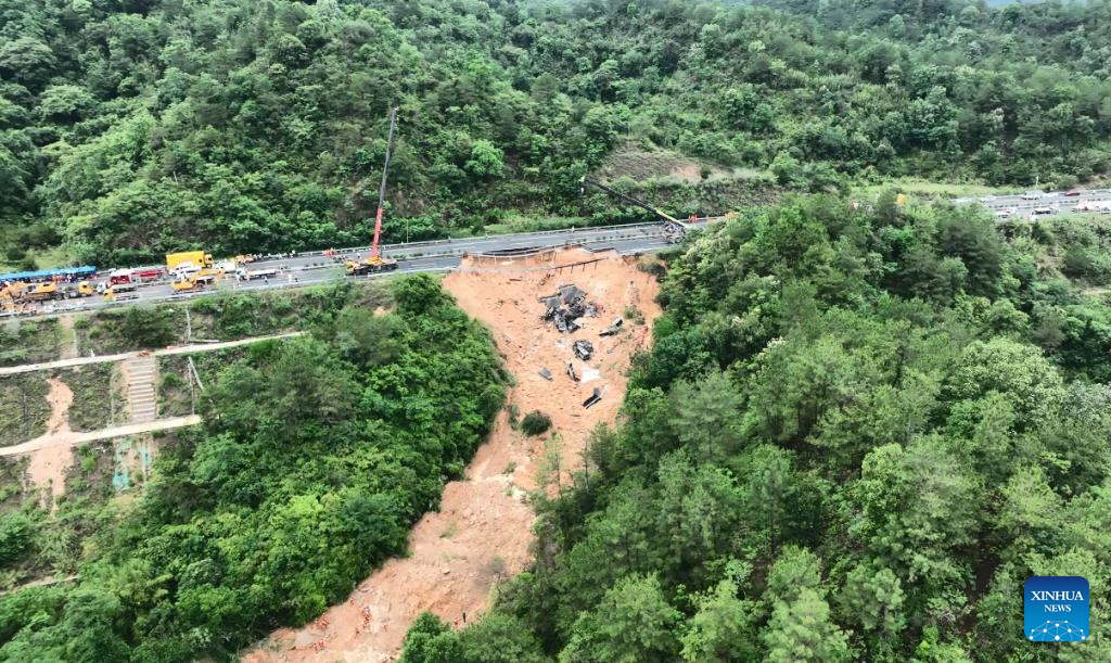
Whilst the media is variously describing this as a collapse or subsidence, it is very clearly a landslide. The failure occurred at about 2:10 am, when it was dark. The road is unlit. The fatalities resulted from 20 cars that plunged into the landslide scar, presumably travelling at high speed along the road. Some of the cars caught fire. The scenario is truly horrific – the drivers would have had almost no time to react to the hazard.
I believe that location of the landslide is [24.490, 116.673], but there is no cloud-free satellite imagery at this time to confirm. If I’m right, this is a Google Earth image from November 2021:
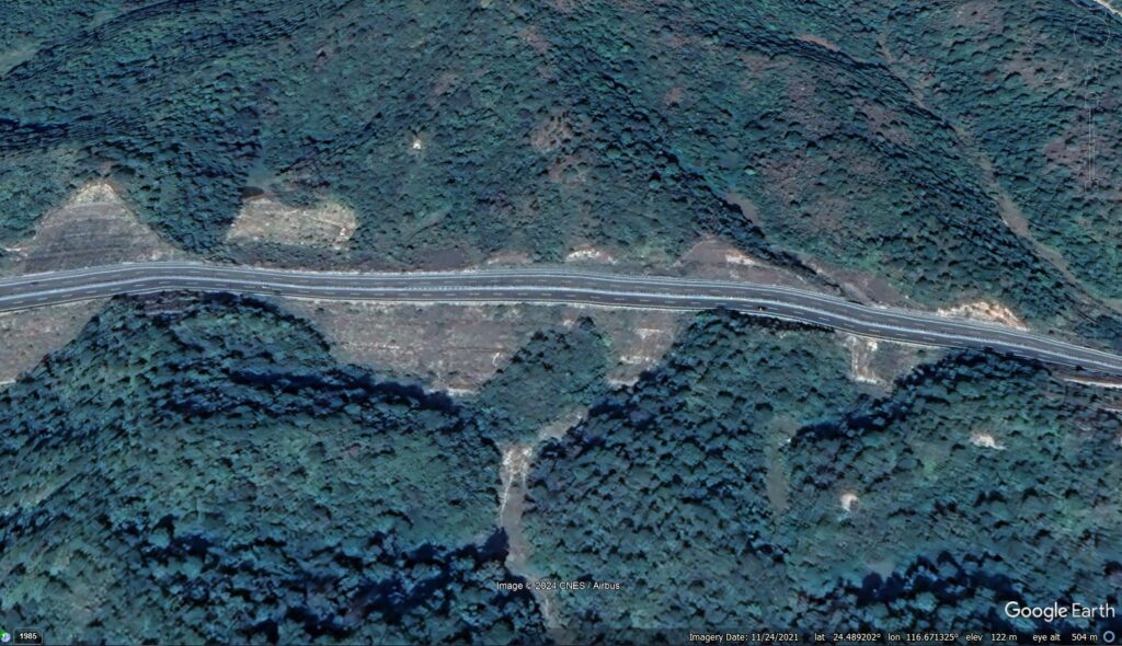
The slope that failed is in the centre right of the image, with the gully extending down through the lower centre area.
At first glance, this appears to be a fill slope, possibly with some soil nails for reinforcement? The Google Earth image below shows the same site in February 2013, when the road was under construction. Slopes on the upslope side were being cut, and fill was being emplaced in the gullies to create the road bench. It appears that it is one of these fill slopes that failed so catastrophically.

Guangdong has been suffering from extreme rainfall in recent weeks, so the most likely trigger was high pore water pressure. It will be interesting to see whether there was a drainage issue at this location.
A key question will now be the stability of the many other fill slopes along this section of road. Urgent checks will be needed to see if this was a design and/or maintenance issue that might be replicated elsewhere along the road. There are possible signs of a much smaller failure on the adjacent slope – see the first image in this post.