A significant “quake lake” has developed in a remote area of the Philippines, threatening four communities located downstream.

In the aftermath of the 8 June 2026 M=7.8 earthquake in the Philippines, a major challenge has developed in the Jose Abad Santos region of Mindanao. Here, a landslide has blocked the valley between barangays (villages) San Isidro and Nuing, and a lake is developing. Minda News has a good article from yesterday describing the situation, which is threatening a number of communities – Sitio Nara, Sitio BMBB, Sitio Lambayong, and the Sitio Proper.
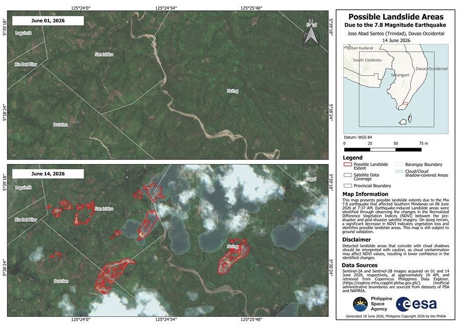
The Philippine Space Agency has released some maps of landslides triggered by the earthquake, which includes this map of the landslide in question:-
The ESA Sentinel-2 image shows the landslide in question, and the early stages of the “quake lake” that is developing:-
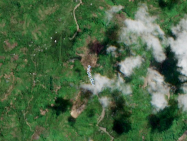
The landslide in question appears to be the one the is under the first two letters of the Butulan River caption. The lake can be seen as the dark blue black area just to the northwest of the letter “B”. This lake is undoubtedly larger now given the age of the image.
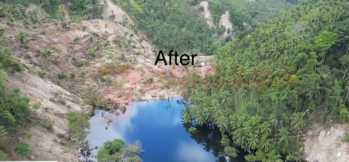
On Facebook, Marina Barlizo Taping appears to be posting videos and images of the lake as it builds. This is interesting in terms of the nature of the landslides, the growth of the lake and the apparently small scale of the mitigation works currently under way. This unverified image, from his feed, gives an impression of the scale of the issue:-

Careful management of this landslide dam is essential.