
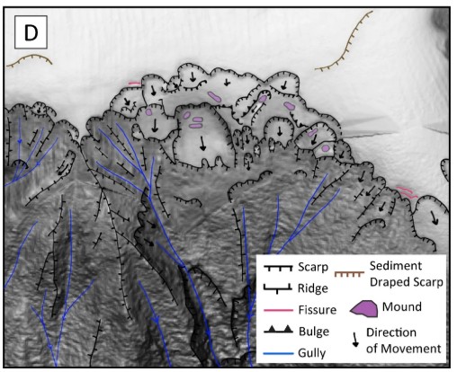
High resolution bathymetric data has allowed submarine landslides triggered by the 2016 Kaikōura earthquake in New Zealand to be mapped (Gnesko et al. 2026). In total 853 slope failures were identified.

I rarely feature submarine landslides in this blog – they are beyond my area of expertise – but I came across a really cool paper this morning that is worth a post. The paper (Gnesko et al. 2026), which is both open access and published under a CC licence, reports on the construction of an inventory of coseismic landslides triggered by the 2016 Kaikōura earthquake in New Zealand.
The inventory is for the upper Kaikōura Canyon, which lies just offshore the area affected by the earthquake. One of the faults that ruptured, the Hundalee Fault, is thought to run along the upper slopes of the canyon as shown in the image below from the paper:-
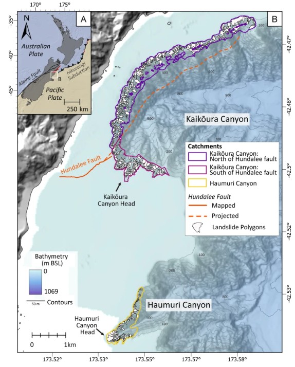
The cool thing about this study is that a high resolution bathymetric survey had been completed in 2015 (before the Kaikōura earthquake), and this was then repeated in 2017. This allowed landslides that had been triggered by the earthquake to be detected and mapped. I find this particularly interesting as, on the whole, work on submarine landslides after earthquakes tends to focus on the large, long runout events rather than these multiple, smaller landslides.
In total, Gnesko et al. (2026) mapped 853 coseismic submarine landslides triggered by the Kaikōura earthquake. These were mostly comparatively small (the mean volume is about 9,900 m3) and shallow (median failure depth is 4 metres). Less than 4% were deep-seated. The majority (74%) were classified as slides. The map above shows the landslides mapped by the team.
We know that large earthquakes trigger large populations of landslides in terrestrial environments, so it is fascinating to see that this also occurs in submarine environments too where the topography and availability of sediments permit.
Reference
Gnesko, L., Stahl, T., Mountjoy, J.J., Carey, J.M. and Shulmeister, J. 2026. Submarine landslide inventory for coseismic landslides triggered by the 2016 Kaikōura earthquake in the upper Kaikōura Canyon, New Zealand. Landslides. https://doi.org/10.1007/s10346-026-02825-7.