• About
  • Special Reports
  • Topics
    • Climate
    • Earth Science
    • Oceans
    • Space & Planets
    • Health & Ecosystems
    • Culture & Policy
    • Education & Careers
    • Opinions
  • Projects
    • Postcards From the Field
    • ENGAGE
    • Editors’ Highlights
    • Editors’ Vox
    • Eos en Español
    • Eos 简体中文版
    • Print Archive: 2015–2025
  • Policy Tracker
  • Blogs
    • Research & Developments
    • The Landslide Blog
  • Newsletter
  • Submit to Eos
  • AGU.org
  • Career Center
  • Join AGU
  • Give to AGU
  • About
  • Special Reports
  • Topics
    • Climate
    • Earth Science
    • Oceans
    • Space & Planets
    • Health & Ecosystems
    • Culture & Policy
    • Education & Careers
    • Opinions
  • Projects
    • Postcards From the Field
    • ENGAGE
    • Editors’ Highlights
    • Editors’ Vox
    • Eos en Español
    • Eos 简体中文版
    • Print Archive: 2015–2025
  • Policy Tracker
  • Blogs
    • Research & Developments
    • The Landslide Blog
  • Newsletter
  • Submit to Eos
Skip to content
  • AGU.org
  • Career Center
  • Join AGU
  • Give to AGU
Eos

Eos

Science News by AGU

Support Eos
Sign Up for Newsletter
  • About
  • Special Reports
  • Topics
    • Climate
    • Earth Science
    • Oceans
    • Space & Planets
    • Health & Ecosystems
    • Culture & Policy
    • Education & Careers
    • Opinions
  • Projects
    • Postcards From the Field
    • ENGAGE
    • Editors’ Highlights
    • Editors’ Vox
    • Eos en Español
    • Eos 简体中文版
    • Print Archive: 2015–2025
  • Policy Tracker
  • Blogs
    • Research & Developments
    • The Landslide Blog
  • Newsletter
  • Submit to Eos

New Zealand

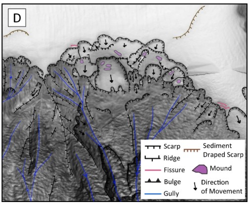
Canyon headwall landslides after the Kaikōura earthquake at 2 m grid with mapped morphology and arrows showing movement direction, illustrating loss of diagnostic detail at coarse resolution and improved delineation at high resolution.
Posted inThe Landslide Blog

Submarine landslide inventory for the 2016 Kaikōura earthquake

by Dave Petley 3 August 20263 August 2026

High resolution bathymetric data has allowed submarine landslides triggered by the 2016 Kaikōura earthquake in New Zealand to be mapped (Gnesko et al. 2026). In total 853 slope failures were identified. I rarely feature submarine landslides in this blog – they are beyond my area of expertise – but I came across a really cool […]
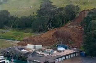
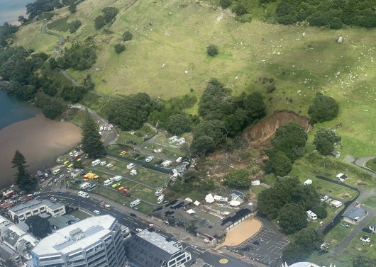
The aftermath of the reactivation of the Mauao landslide in New Zealand.
Posted inThe Landslide Blog

Reactivation of the Mauao landslide in Mount Maunganui, New Zealand

by Dave Petley 27 July 202627 July 2026

A significant reactivation occurred over the weekend of the 22 January 2026 Mauao landslide in Tauranga. Loyal readers will remember my posts on the Mauao landslide in Mount Maunganui in New Zealand on 22 January 2026, which killed six people. Over the weekend, heavy rainfall caused the landslide to reactivate. Fortunately, in this case there […]
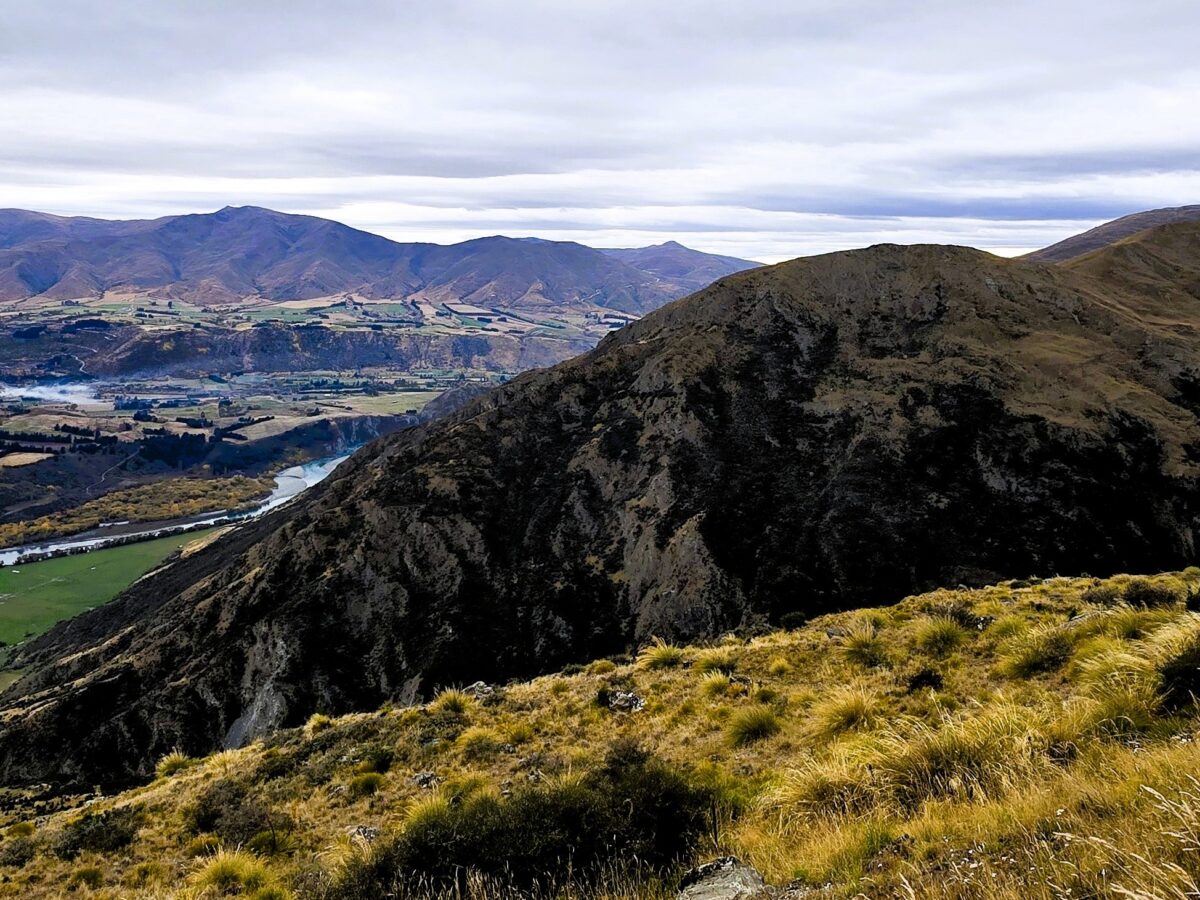
Here be landslides - typical landslide-prone terrain in New Zealand.
Posted inThe Landslide Blog

Landslides are New Zealand’s most expensive natural hazard, and the costs are rising quickly

by Dave Petley 14 May 202614 May 2026

New evidence from the Natural Hazards Commission – Toka Tū Ake (NHC) shows that landslides are now New Zealand’s most costly natural hazard. New Zealand is a country that is prone to a range of natural hazards. Located on a series of major fault systems, earthquakes cause high levels of loss. The country is also […]
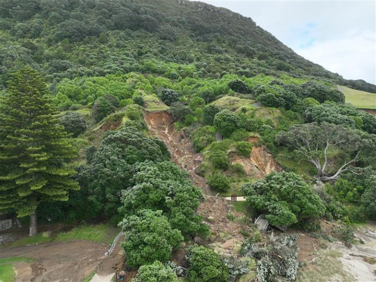
Landslides on Mauao following the 22 January 2026 rainfall event.
Posted inThe Landslide Blog

Landslides on Mauao in New Zealand following the 22 January 2026 rainfall event

by Dave Petley 19 February 202619 February 2026

To date, 42 landslides have been identified on Mauao (Mount Manganui) in New Zealand following the 22 January 2026 rainfall event. The extreme rainfall event that affected parts of the North Island of New Zealand triggered two fatal landslides, of which the major failure at the Mount Maunganui Beachside Holiday Park on the flanks of […]
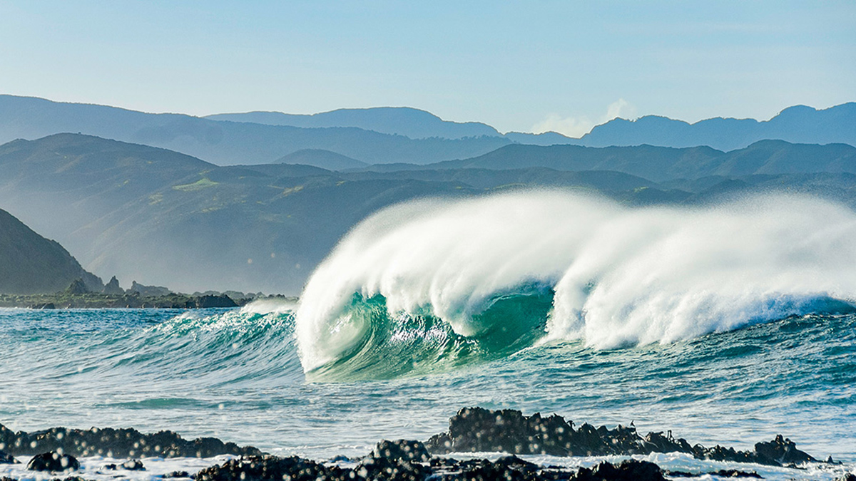
A wave crashes onto a dark, rocky shore. Green rolling hills are in the distance.
Posted inResearch Spotlights

Our Ocean’s “Natural Antacids” Act Faster Than We Thought

Sarah Stanley, Science Writer by Sarah Stanley 30 January 202630 January 2026

New evidence from New Zealand suggests that calcium carbonate dissolution occurs not just over millennial timescales, but over annual and decadal ones too.
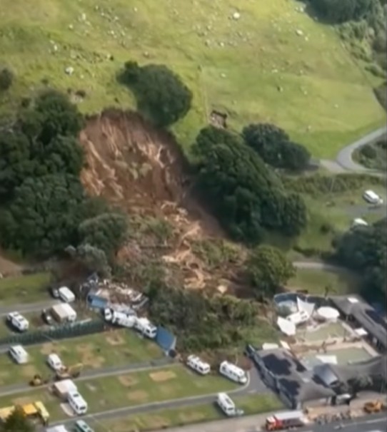
The aftermath of the 22 January 2026 landslide at Mount Maunganui.
Posted inThe Landslide Blog

Early news about the 22 January 2026 landslide at Mount Maunganui in New Zealand

by Dave Petley 22 January 202622 January 2026

Eight people have been killed or are missing in two landslides triggered by heavy rainfall in New Zealand Substantial parts of New Zeealand have been suffering extreme rainfall – yet again – causing floods and landslides. The most serious event to date occurred at a camp site at Mount Maunganui on the Bay of Plenty in […]
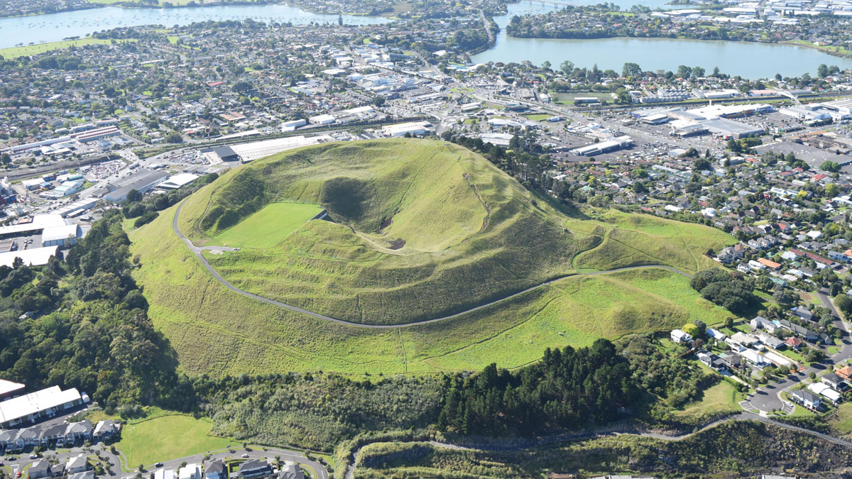
A view across Auckland’s suburbs and harbors with the volcanic cone of Mount Wellington in the foreground.
Posted inNews

“Passion Project” Reveals Auckland’s Hidden Urban Faults

by Kate Evans 23 September 202523 September 2025

An innovative analysis has identified 10 likely and 25 possible faults in the region.
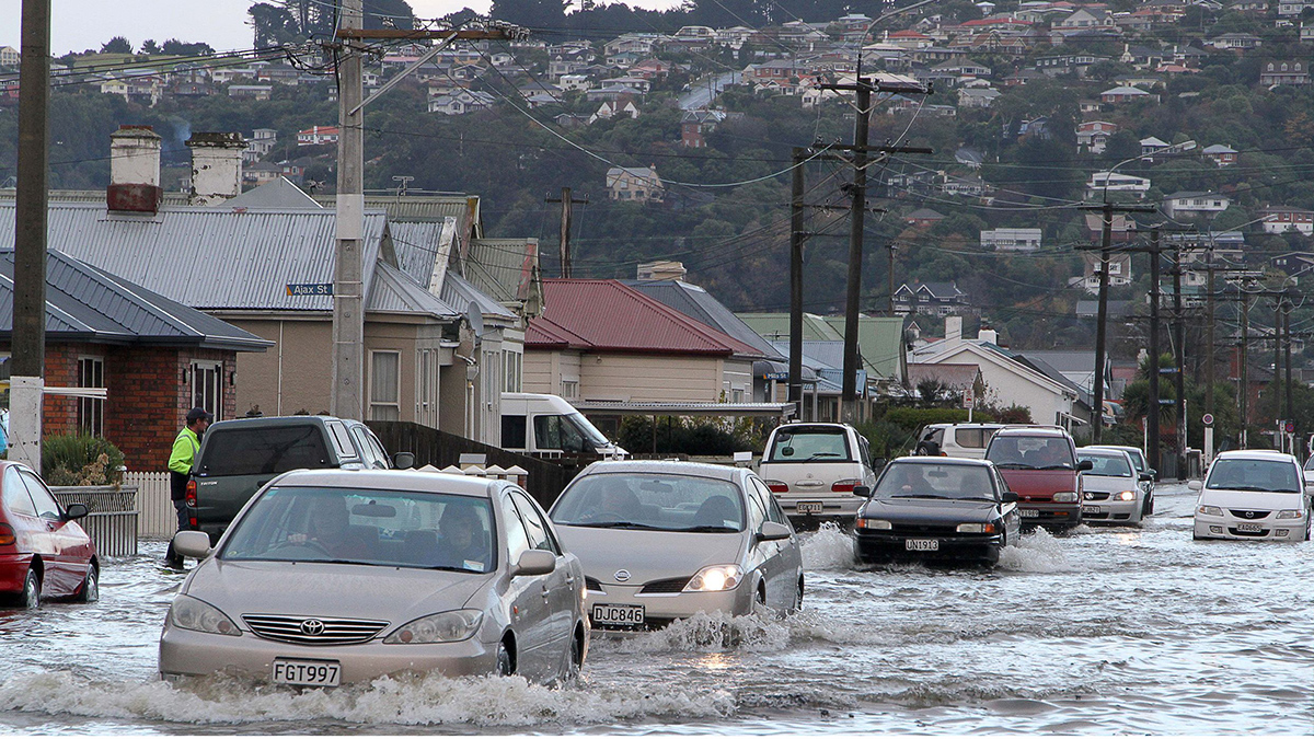
2015年6月洪水期间,汽车在新西兰达尼丁南部的街道上前行。图片来源:John Cosgrove
Posted inResearch Spotlights

地下洪水:海平面上升的隐形风险

Sarah Stanley, Science Writer by Sarah Stanley 20 May 202520 May 2025

研究人员展示了一种方法来评估海平面上升如何提高地下水位,从而可能将洪水灾害传播到遥远的内陆地区。

Photo of the snowy Southern Alps covered in red dust.
Posted inEditors' Highlights

Why the Southern Alps Turned Red During the Summer of 2019-2020

by Bin Zhao 23 April 202522 April 2025

Snow on the Southern Alps turned from white to red in 2019-2020. New geochemical evidence points to the color change resulting from red Australian desert dust carried across the Tasman Sea.

Aerial image of glaciers in the Southern Alps in New Zealand, taken during the annual snowline survey
Posted inNews

First Global Comparison of Glacier Mass Change: They’re All Melting, and Fast

by Veronika Meduna 15 April 202515 April 2025

By systematically assessing data gathered by different methods, researchers refined estimates of global glacier melt and its contribution to sea level rise.

Posts pagination

1 2 3 … 7 Older posts
Over a dark blue-green square appear the words Special Report: The State of the Science 1 Year On.

Features from AGU Publications

Research Spotlights

Extreme Heat May Drive Asthma Risk in Baltimore, Especially at Night

12 August 202612 August 2026
Editors' Highlights

How Fluid Mixing due to Kelvin-Helmholtz Instabilities Really Works

13 August 202613 August 2026
Editors' Vox

Introducing Research Letters in Paleoceanography and Paleoclimatology

12 August 202610 August 2026
Eos logo at left; AGU logo at right

About Eos
ENGAGE
Awards
Contact

Advertise
Submit
Career Center
Sitemap

© 2026 American Geophysical Union. All rights reserved Powered by Newspack