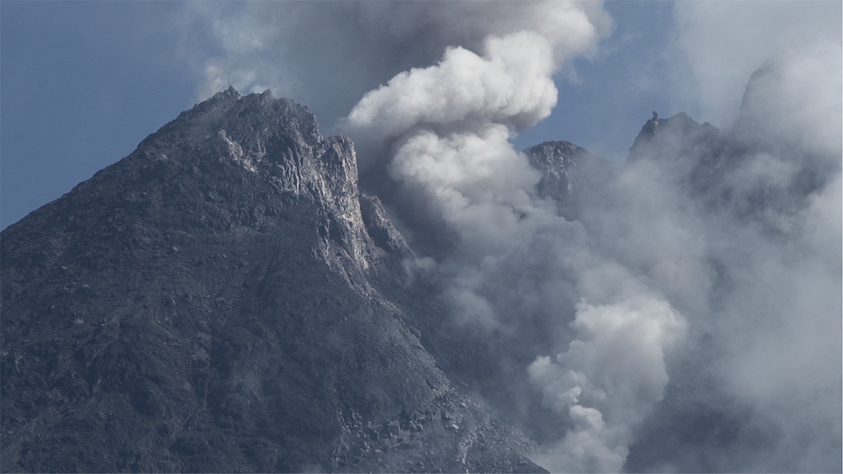

When viscous lava erupts, lava domes can form at the top of many volcanoes. If these domes become unstable, their collapse can be extremely hazardous, as was seen when Mount St. Helens in Washington collapsed in 1980, leading to the largest landslide in recorded history. Although potentially catastrophic, the cause of these events has not been fully understood, in part because of the difficulty and danger of reaching summits by foot. But finding the cause can help experts better predict and prepare for volcano dome collapses, potentially saving many lives and infrastructure.
So how can scientists reach great and treacherous heights to study volcanoes’ lava domes and their destabilization? One answer: drones.
In a new study published in Scientific Reports, a team of international researchers set their sights on the summit dome atop Indonesia’s most active volcano—Mount Merapi—where hazardous pyroclastic flows have occurred. By using drones, the researchers not only accessed Merapi’s summit but also monitored its new lava dome, which had been forming since 2018 and was collapsing along a hidden zone of fractures.
Mixed Methods Pinpoint Weak Areas
The team flew a drone about 500 meters above the lava domes, capturing more than 1,000 high-resolution images over a span of 10 years. According to Valentin Troll, a petrologist from Uppsala University in Sweden and a coauthor of the study, getting usable images was challenging. “Gas emissions or clouds can obscure the view into the crater and onto the dome at times,” he said.
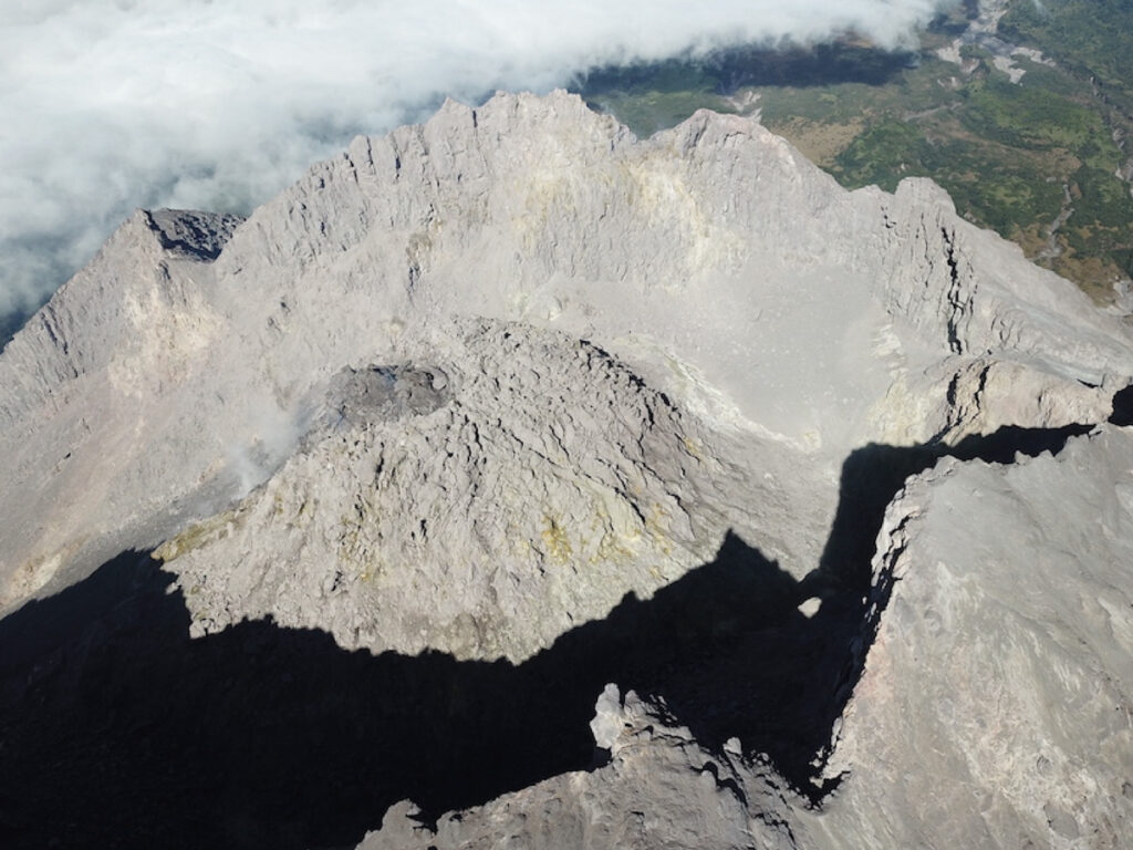
Once enough images were collected, 3D information was extracted from them using software. The collection of aerial drone surveys was also combined with mineralogical, geochemical, and mechanical rock strength measurements that reflected areas of weakness resulting from hydrothermal alteration. The tests were conducted on samples of hydrothermally altered dome rocks that the team collected from the flanks of the dome area. These samples were assumed to represent the typical alteration sequence of Merapi’s lava dome.
The decadelong process led the researchers to unearth the processes that contributed to the weakening and collapse of Merapi’s lava dome. A horseshoe-shaped fracture system—a zone that’s a mechanically weakened part of the dome rock—that formed in 2012 was buried under younger lava in 2018. The rock’s fractures and pores made space for migrating fluids (brines and gases) to initiate hydrothermal alteration, in which primary minerals were replaced with mechanically weaker secondary minerals, reducing rock strength further. By 2019, the new lava dome that had formed in 2018 collapsed along this older fracture system, covering the earlier dome structures. New, weaker minerals replacing older minerals in the rock gaps caused more weakening and collapse.
Understanding lava domes’ yearlong changes “is hugely significant in more accurately understanding locations of lava dome collapses, as well as for application in numerical models of collapse processes.”
The new research showed the importance of understanding yearlong changes to more accurately monitor volcanic hazards. According to Claire Harnett, a volcanologist at University College Dublin in Ireland, doing so “is hugely significant in more accurately understanding locations of lava dome collapses, as well as for application in numerical models of collapse processes.”
Beyond Merapi and farther afield, drones could be a useful way to achieve long-term monitoring of hidden structural changes at other volcanic domes. “Continued drone recordings will likely allow [us] to identify areas of weakness that later become integrated into the volcano edifice by burial with new lava, for instance,” said Troll. These data, from drones and other monitoring methods, could provide an indication of where internal structural weaknesses may be expected in the future.
—Clarissa Wright (@ClarissaWrights), Science Writer