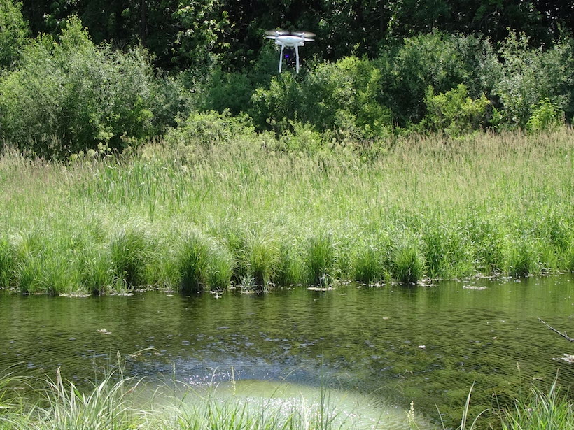
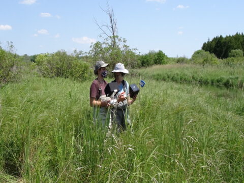
On an early spring day before crops had begun to sprout and cover the ground, two geologists focused their eyes not on the landscape below them but, instead, upward, on a flying drone, beaming images back to an iPad. The researchers, from the Wisconsin Geological and Natural History Survey (WGNHS), were testing a new method using airborne drones equipped with infrared cameras to peek below Earth’s surface. Led by hydrogeologist Dave Hart, they believe this new technique may prove to be a more efficient way to gather data that will be instrumental in protecting local groundwater supplies from contamination.
Here’s how it works: As the quadcopter drone soars overhead, steered expertly via remote control by WGNHS geologist and licensed drone operator Grace Graham, the infrared camera records temperature data from the ground surface and produces colorful images showing where the temperature changes, which it transmits to an iPad in real time. Thicker soils can absorb more heat, so they tend to be cooler than the surrounding air, whereas their neighboring thin soils, which reach their maximum heat capacity more quickly, tend to read as being warmer when measured during the day.
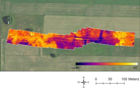
Although this may sound fairly straightforward on paper, in practice it becomes more complicated. It’s not just soil depth that influences temperature—differences in soil moisture levels also produce temperature changes, among many other factors, explained Hart. “There may be better times of year to do temperature measurements, there may be better times of day,” he continued. “It could be that if you fly at the exact wrong time, you don’t see anything.” So although their results thus far look promising, Hart said that more work is needed to refine the method.
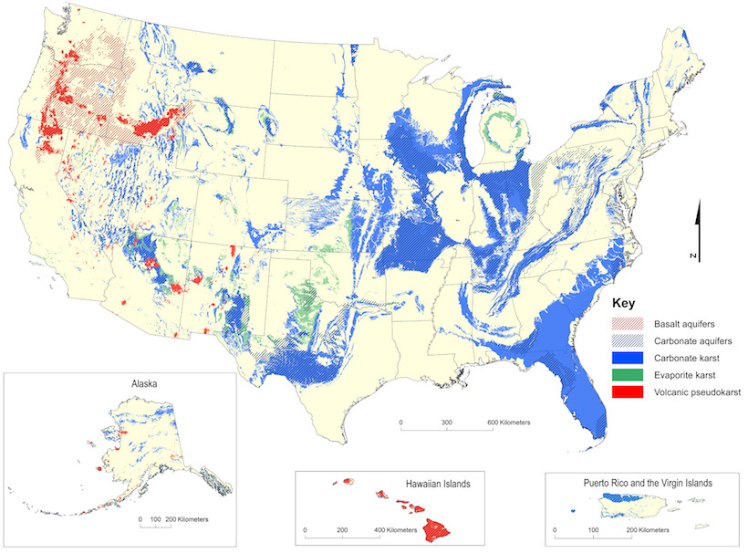
Hart and Graham’s study area includes northeastern Wisconsin’s Kewaunee County, which has been in the news for several years regarding its ongoing struggles with groundwater contamination. These problems are due in part to the county’s high number of concentrated animal feeding operations. The other major factor contributing to contamination is the region’s karst geology, which features thin soils with fractured bedrock underneath. This type of landscape often contains aquifers that area residents depend on for water. The combination of shallow soils and fractured bedrock makes it easy for fecal bacteria and nitrates to make their way into those aquifers, making the groundwater unsafe for human use.
Innovation with Widespread Potential
This issue is far from unique to Wisconsin—similar karst geology makes up approximately 20% of land surface in the United States, according to the nonprofit Karst Waters Institute.
Many karst-dominated areas are also heavily agricultural, and groundwater concerns are not uncommon. For example, when discussing water issues in the karst areas of southwestern Minnesota, people tend to think about nitrate contamination, said Steven Schmidt, a Rochester-based unit supervisor of the Minnesota Pollution Control Agency’s County Feedlot Program. “But then there’s also bacterial contamination and [other] emerging concerns,” he continued, “so it kind of spans the whole gamut.”
Concerns like these have led some areas to enact programs aimed at limiting runoff. Whether these efforts succeed depends on knowing how deep the soil is, as soil depth determines how much manure or excess nutrients the land can safely absorb without impacting groundwater.
Although many such initiatives are led by state governments, some community-led endeavors have also sprung up. One example is Peninsula Pride Farms, a farmer-led nonprofit in northeastern Wisconsin that focuses on environmental stewardship. Their soil depth program “offers its members the opportunity to evaluate the depth of soil over bedrock” through the services of a crop consultant, who creates custom maps of the interested farmer’s land. To do this, the consultant manually measures the soil thickness using a GPS unit and a push probe, a laborious method that Hart describes as “poking a stick into the ground.”
Hoping to make this arduous process easier, Hart and Graham are working to develop a drone-based method that nonscientists would be able to use. Once the geologists are finished, farmers and consultants in karst areas could use aerial infrared cameras to measure shallow soil depths with a higher degree of precision and greater efficiency than current labor-intensive methods can provide. These improved measurements would enable them to comply more effectively with rules designed to prevent groundwater contamination. Hart credited the idea for this new technique to former WGNHS geophysicist Carolyn Streiff.
This research project is actually one of three drone-based studies that the WGNHS recently worked on, all funded by a grant from Wisconsin’s Department of Agriculture, Trade and Consumer Protection. It’s also the one that Hart and the grant reviewers initially had the most doubts about. “More than one reviewer identified the depth to bedrock piece as the weakest,” Hart said with a laugh before adding, “And we knew that. The fact that it worked at all was a surprise.”
—Jady Carmichael (@jadycarmichael), Science Writer
This piece was produced with support from the National Association of Science Writers’ David Perlman Virtual Mentoring Program.
Citation:
Carmichael, J. (2020), Taking an aerial view underground, Eos, 101, https://doi.org/10.1029/2020EO150060. Published on 06 October 2020.
Text © 2020. The authors. CC BY-NC-ND 3.0
Except where otherwise noted, images are subject to copyright. Any reuse without express permission from the copyright owner is prohibited.