

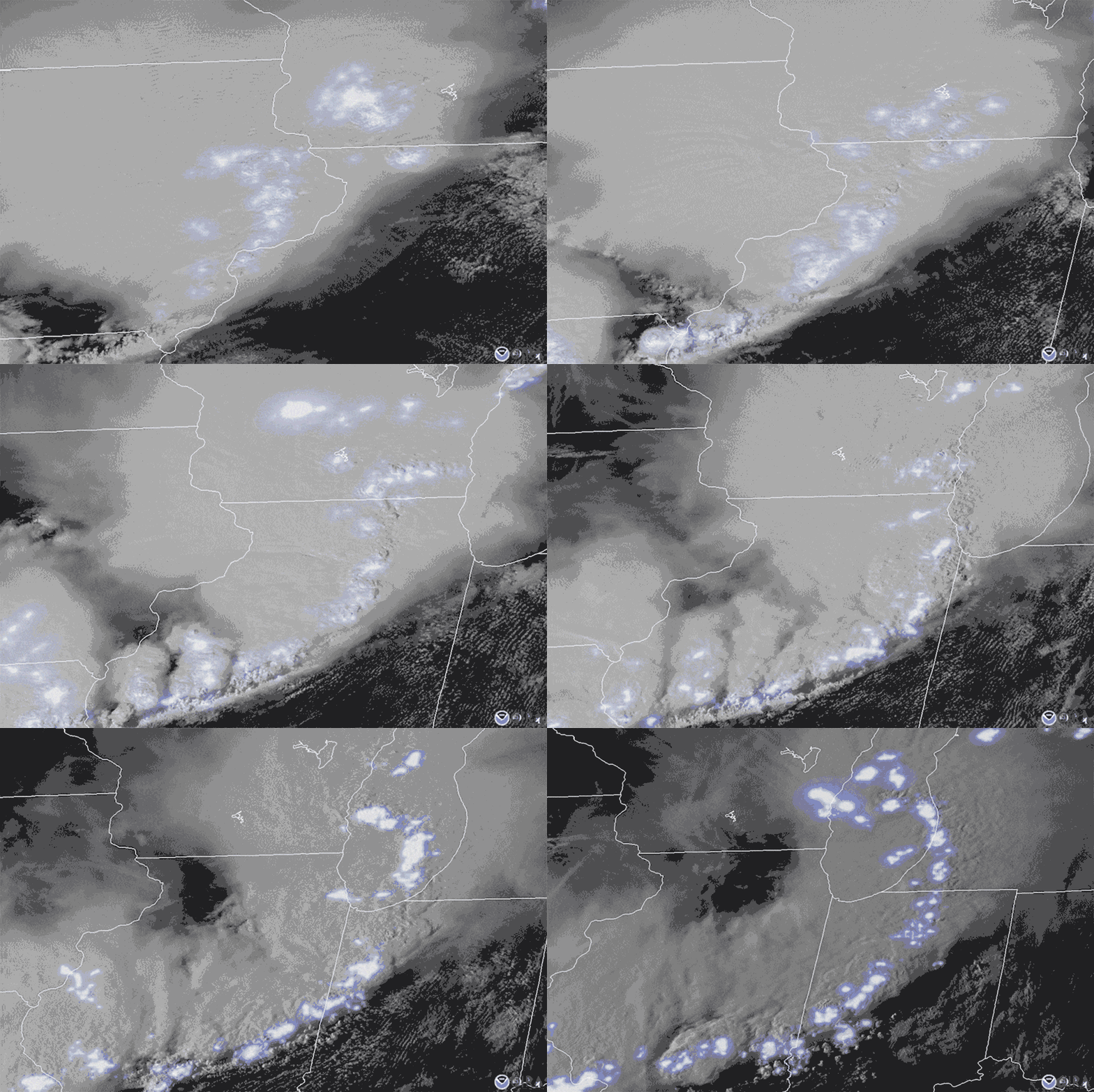
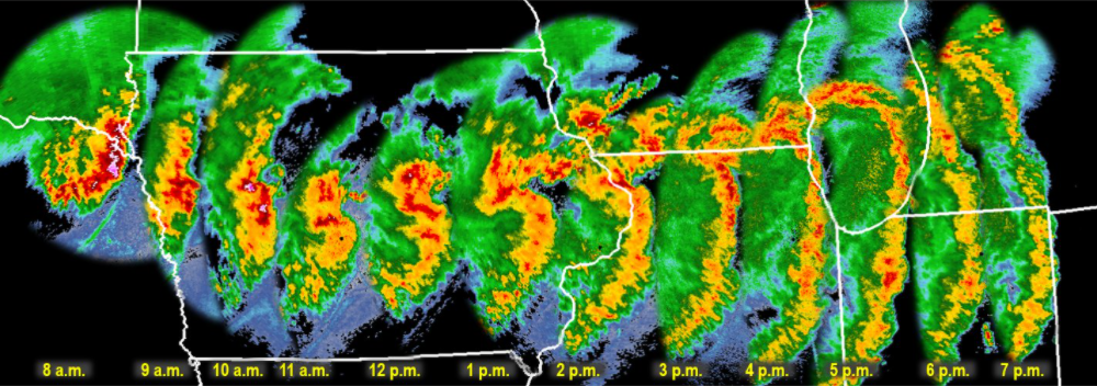
In August of 2020, intense winds accompanied a severe thunderstorm that ripped through the Great Plains. Gusts up to 100 miles (160 kilometers) per hour produced 26 tornadoes, destroyed crops, took roofs off houses, knocked out power, and killed four people.
The storm was a derecho—a fast-moving, destructive windstorm that forms under unique conditions.
Scientists track extreme weather phenomena like tornadoes, hurricanes, and derechos in detail to aid in forecasting and communication to the public. But definitions for derechos have always varied, and a comprehensive inventory of them had never existed, until now. A new study, published in the Bulletin of the American Meteorological Society, presents the country’s first archive of derechos, offering scientists a better opportunity to understand the drivers behind these destructive storms.
“We’re trying to objectively identify these events,” said Brian Squitieri, lead author of the new study and a meteorologist at NOAA’s Storm Prediction Center.
Assembling an Archive
“For a long time, meteorologists have taken the approach of ‘It’s hard to define a derecho, but I know one when I see one.’”
The definition of the term “derecho” has been difficult for scientists to pin down: “For a long time, meteorologists have taken the approach of ‘It’s hard to define a derecho, but I know one when I see one,’” said Michael Coniglio, a meteorologist at NOAA’s National Severe Storms Laboratory who was not involved in the new study.
In a 2025 paper, Squitieri and others put forth a new definition of the term that required a windstorm to meet strict requirements for wind gusts and develop from a “cold pool-driven mesoscale convective system” (MCS)—a specific type of thunderstorm cluster resulting from a collection of cold air.
Creating an archive of derechos required applying this new definition to past events. Squitieri ensured that the criteria focused on the distinct physical atmospheric processes that lead to a derecho, rather than “just any large-scale thunderstorm wind event,” he said.
With their criteria in hand, the research team analyzed 2 decades’ worth of detailed data from the Next Generation Weather Radar (NEXRAD) system, operated by the National Weather Service, the Federal Aviation Administration, and the U.S. Air Force. Within the NEXRAD data (1996–2025), they found 96 definitive derechos and 13 likely derechos.
Prior to the NEXRAD era, NOAA used hand-drawn paper maps to summarize radar data and collected storm reports in various formats. Squitieri and the research team combed through more than 2,000 paper maps and more than 22,500 storm reports to identify likely past derechos dating back to 1955. Still, without NEXRAD data, none of the likely derechos from 1955 to 1995 could fully fulfill the team’s criteria. Instead, they identified 48 likely derechos and 16 possible derechos.
“There have been lots of attempts at this over the years,” Coniglio said. The new study, he said, “is an incredibly detailed and thorough paper that I think is now the definitive piece of research that we have out there to know if something is a derecho or not.”
Derecho Behavior
From the new archive, the researchers were able to distinguish patterns in derecho behavior in the United States. The archive confirmed that derechos typically form in three corridors: the Midwest/Ohio Valley, the Northern Plains, and the Southern Plains.
The team also noticed the impressive impact of derechos in the data. “There are a lot of common factors that seem to stick out in reports [of derechos] that are a little bit more unique than what you see with a lot of other wind events,” Squitieri said.
In particular, the identified derechos had large, long-lasting effects on communities, sometimes being responsible for dozens of deaths or leaving towns without power for days. In many cases, derechos caused the worst power outages in a town’s or region’s history. “That’s quite a title for derechos to compete with, but some have achieved that,” Squitieri said.
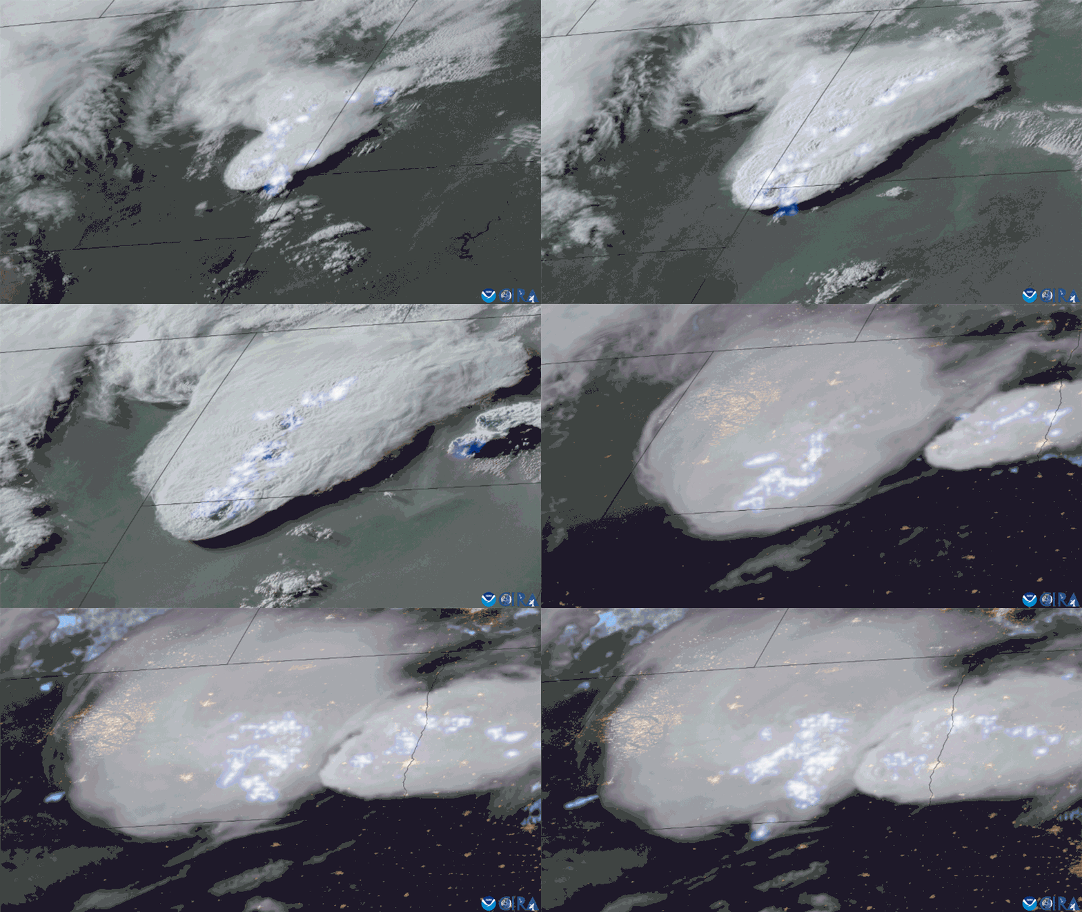
Some written reports of derechos compared the destruction left in their wake to the effects of hurricanes. Squitieri emphasized that just because a certain windstorm doesn’t meet the derecho criteria doesn’t mean it’s not dangerous and that plenty of windstorms that are not derechos still have tremendous impacts.
Future Forecasts
The derecho archive is another step in NOAA’s goals of ultimately being able to better forecast derechos and better communicate derecho risk to the public. Scientists can use the archive to assess what conditions seem to be present for the formation of derechos compared to other wind events.
“We might be able to cue in on a clue for these higher-impact events more cleanly,” Squitieri said.
“Classifying these things ahead of time can help [meteorologists] understand what to look for and what to communicate to the public.”
The Storm Prediction Center has already begun to study the ambient environments that seem to create derechos to parse out signals that forecasters could use, with promising results, he added.
NOAA is also working to develop a MCS wind swath classification system similar to the Saffir-Simpson Hurricane Wind Scale to help forecasters communicate the risk of wind events to the public. This scale would classify all MCS wind swaths into two types: squall-line wind swaths and those driven by cold pools. Squitieri imagines that a 4 or 5 on the cold-pool-driven scale would be a derecho or “super derecho,” respectively, and lower numbers would be used to describe the risks posed by less severe storms. He hopes that such a scale would be operational sometime in 2027 or 2028.
“Classifying these things ahead of time can help [meteorologists] understand what to look for and what to communicate to the public,” Coniglio said.
—Grace van Deelen (@gvd.bsky.social), Staff Writer