• About
  • Sections
  • Topics
    • Climate
    • Earth Science
    • Oceans
    • Space & Planets
    • Health & Ecosystems
    • Culture & Policy
    • Education & Careers
    • Opinions
  • Projects
    • ENGAGE
    • Editors’ Highlights
    • Editors’ Vox
    • Eos en Español
    • Eos 简体中文版
    • Print Archive
  • Blogs
    • Research & Developments
    • The Landslide Blog
  • Newsletter
  • Submit to Eos
  • AGU.org
  • Career Center
  • Join AGU
  • Give to AGU
  • About
  • Sections
  • Topics
    • Climate
    • Earth Science
    • Oceans
    • Space & Planets
    • Health & Ecosystems
    • Culture & Policy
    • Education & Careers
    • Opinions
  • Projects
    • ENGAGE
    • Editors’ Highlights
    • Editors’ Vox
    • Eos en Español
    • Eos 简体中文版
    • Print Archive
  • Blogs
    • Research & Developments
    • The Landslide Blog
  • Newsletter
  • Submit to Eos
Skip to content
  • AGU.org
  • Career Center
  • Join AGU
  • Give to AGU
Eos

Eos

Science News by AGU

Support Eos
Sign Up for Newsletter
  • About
  • Sections
  • Topics
    • Climate
    • Earth Science
    • Oceans
    • Space & Planets
    • Health & Ecosystems
    • Culture & Policy
    • Education & Careers
    • Opinions
  • Projects
    • ENGAGE
    • Editors’ Highlights
    • Editors’ Vox
    • Eos en Español
    • Eos 简体中文版
    • Print Archive
  • Blogs
    • Research & Developments
    • The Landslide Blog
  • Newsletter
  • Submit to Eos

CC BY-NC-ND 2019

Children help salvage and remove debris after the 2015 earthquake in Nepal
Posted inResearch Spotlights

How Do Main Shocks Affect Subsequent Earthquakes?

by Terri Cook 29 March 20192 December 2022

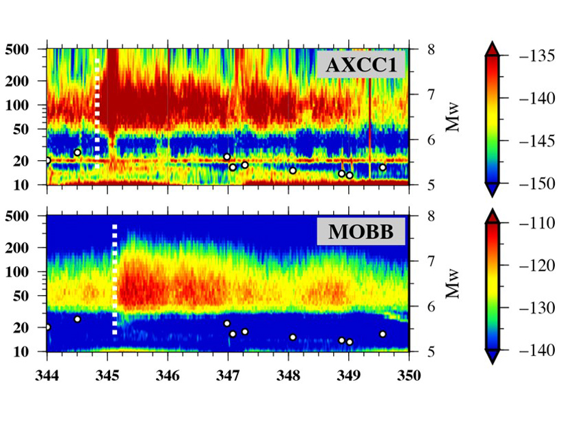
The results of a novel analysis of aftershock size distribution have important implications for more realistically assessing the seismic hazard of earthquake sequences.

The soil in a field near the campus of Wageningen University in the Netherlands clearly shows its layered structure.
Posted inScience Updates

Modeling Digs Beyond Soil Properties and Processes

by M. van der Ploeg, C. Carranza and Roland Baatz 29 March 20199 February 2023

International Soil Modeling Consortium Conference: New Perspectives on Soil Models; Wageningen, Netherlands, 5–7 November 2018

Electric lights illuminate the Nile and its delta in this satellite image captured at night.
Posted inFeatures

The Renaissance of Hydrology

by V. Gabrielle 28 March 201927 October 2022

Hydrology has evolved as a transdisciplinary, data-driven science in a remarkably short period of time.

Satellite image of a meteorite burning over a cloudy sky.
Posted inNews

Fireball over the Bering Sea

Nola Taylor Redd, Science Writer by Nola Taylor Tillman 28 March 20198 March 2022

Powerful meteorite explodes over “a sensitive part of the world.”

Posted inEditors' Highlights

Follow The ‘Hum’: The Seismic Signal of Pacific Ocean Storms

by M. Long 27 March 20198 February 2023

Have you ever noticed that the Earth is humming? Seismologists have! Discover how individual storms in the northern Pacific Ocean generate a long-period seismic signal.

A view of the observatory at Mount Abu
Posted inResearch Spotlights

What Drives Temperature Inversions in the Mesosphere?

by E. Underwood 27 March 201916 March 2023

A study of nightglow over India reveals that gravity waves are less important than previously thought.

Twilight in the Tapajós National Forest, seen from an observation tower
Posted inResearch Spotlights

A Simplified Model of Water Vapor Exchange in the Amazon

Aaron Sidder, freelance science writer by Aaron Sidder 27 March 20195 September 2023

Evapotranspiration is the exchange of water vapor between land and the atmosphere, and it is hard to measure and model. A new study shows promise for its estimation over large, vegetated landscapes.

A satellite image of Hurricane Maria
Posted inResearch Spotlights

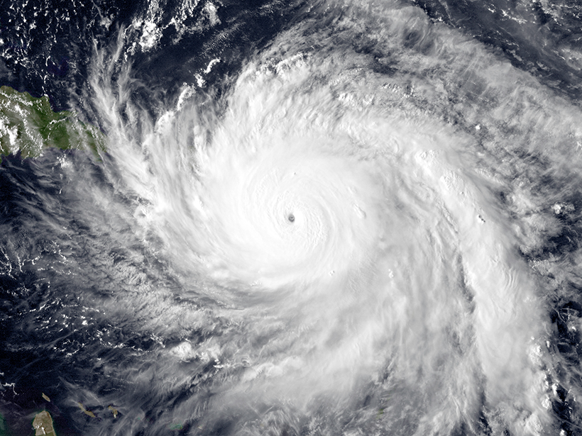
A Better Understanding of Tropical Cyclones

by E. Underwood 26 March 201926 January 2022

A new model of how anvil clouds form could improve short-term hurricane forecasts.

Sunset from the R/V Sikuliaq, July 2018, with broadband ocean-bottom seismometers arranged on deck
Posted inScience Updates

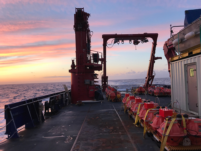
Examining Alaska’s Earthquakes on Land and Sea

by G. A. Abers, A. N. Adams, P. J. Haeussler, Emily Roland, P. J. Shore, D. A. Wiens, S. Y. Schwartz, A. F. Sheehan, D. J. Shillington, S. Webb and Lindsay Lowe Worthington 26 March 20198 November 2021

The Alaska Amphibious Community Seismic Experiment is taking a close look at seismic activity along the Alaska Peninsula to understand earthquakes in this little-studied region.

eastern-mediterranean-map
Posted inNews

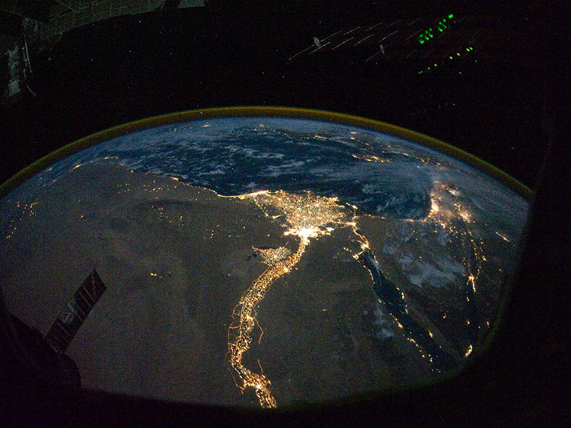
Ancient River Discovery Confirms Mediterranean Nearly Dried Up in the Miocene

Mara Johnson-Groh, Science Writer by Mara Johnson-Groh 25 March 201931 May 2023

Sedimentary deposits reveal a Nile-sized river system flowing from what are today Turkey and Syria.

Posts pagination

Newer posts 1 … 47 48 49 50 51 … 66 Older posts
A view of a Washington, D.C., skyline from the Potomac River at night. The Lincoln Memorial (at left) and the Washington Monument (at right) are lit against a purple sky. Over the water of the Potomac appear the text “#AGU24 coverage from Eos.”

Features from AGU Publications

Research Spotlights

Coherent, Not Chaotic, Migration in the Brahmaputra-Jamuna River

2 July 20252 July 2025
Editors' Highlights

The Mid-20th Century Winter Cooling in the Eastern U.S. Explained

3 July 20253 July 2025
Editors' Vox

Water Tracks: The Veins of Thawing Landscapes

25 June 202525 June 2025
Eos logo at left; AGU logo at right

About Eos
ENGAGE
Awards
Contact

Advertise
Submit
Career Center
Sitemap

© 2025 American Geophysical Union. All rights reserved Powered by Newspack