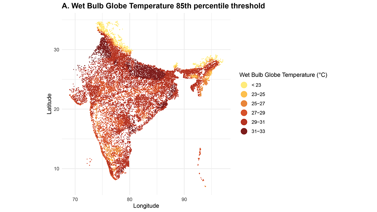
Heatwaves in India are associated with increased home births, with differential susceptibilities across regions and populations, threatening maternal and newborn health.
Editors’ Highlights
Posted inEditors' Highlights
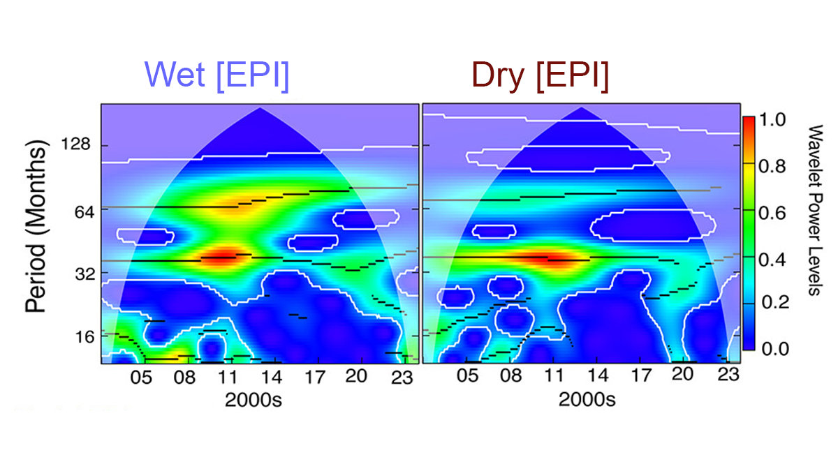
Climate Variations in Tropical Oceans Drive Primarily Extreme Events
Severe droughts and floods are primarily driven by climate variations in tropical oceans, with interannual and decadal patterns playing key roles.
Posted inEditors' Highlights
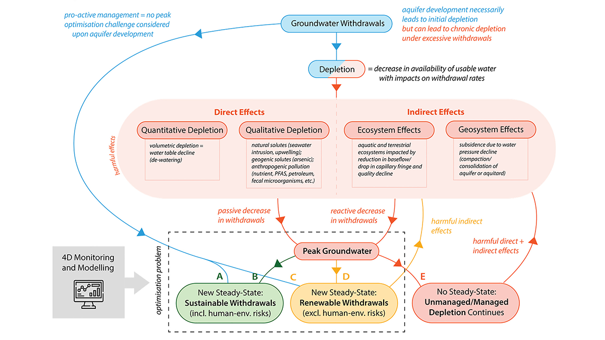
Avoiding and Responding to Peak Groundwater
A new review shows how rising demand, shrinking supplies, and policy decisions together shape when groundwater use peaks and what can be done to avoid long-term depletion.
Posted inEditors' Highlights
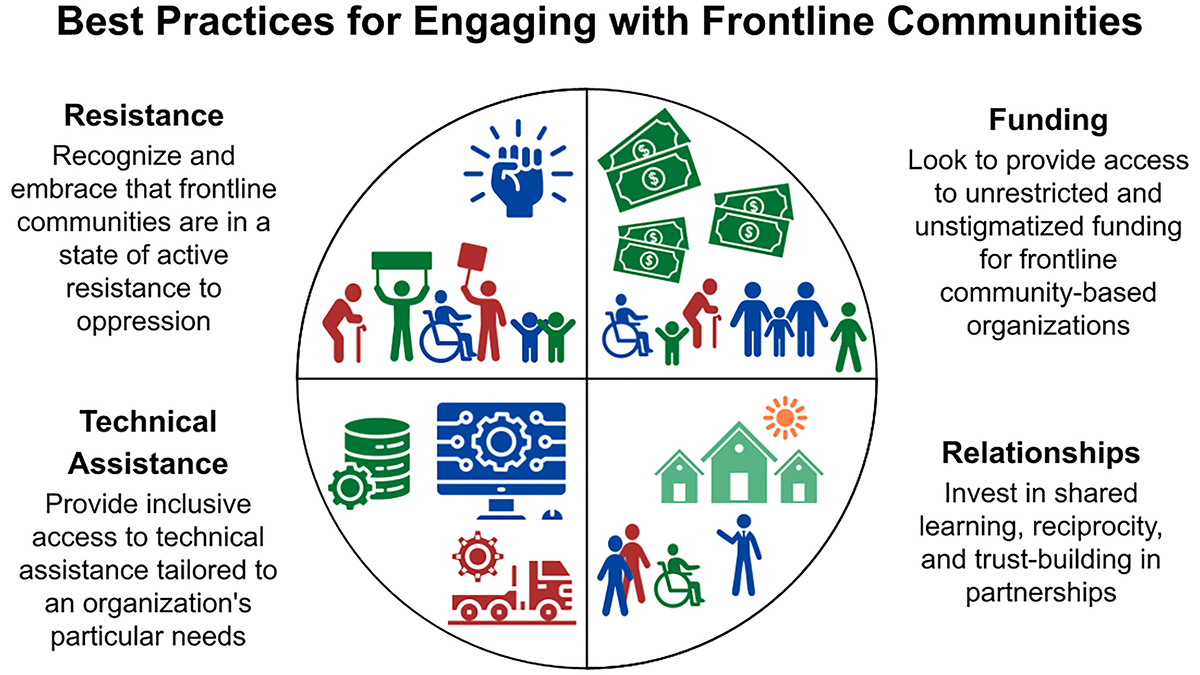
Rethinking Engagement with Frontline Communities
A new perspective from community-based organizations explains how scientists, funders, and other supporters can collaborate ethically and effectively while respecting community identities and priorities.
Posted inEditors' Highlights
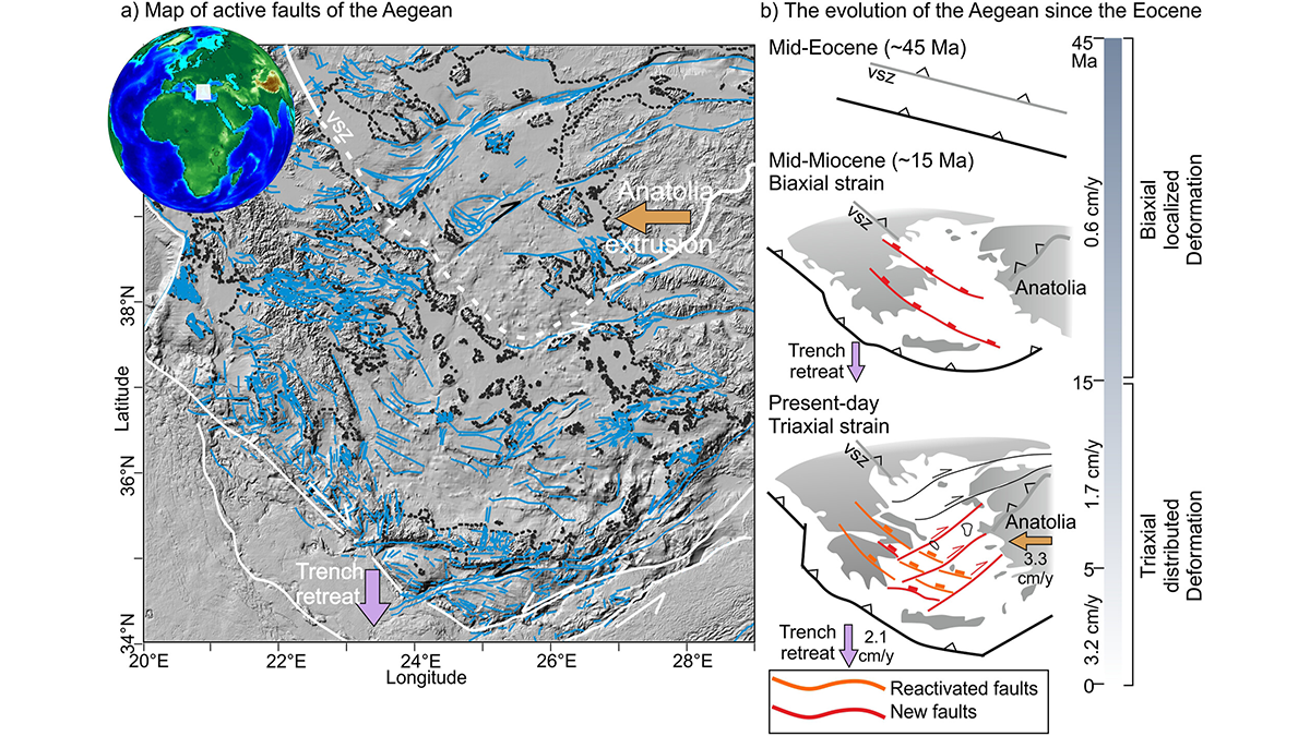
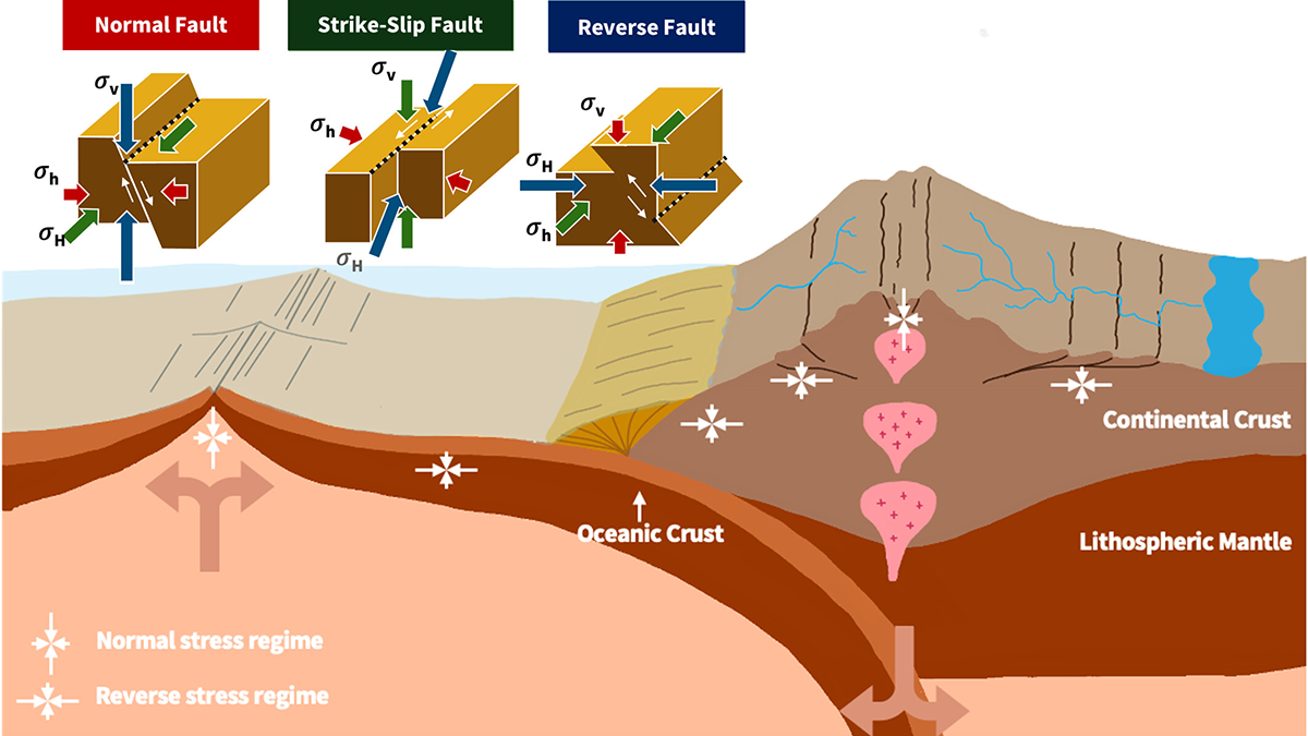
The Language of the Crust: Investigating Fault-to-Fault Interactions
Faults don’t just form—they respond, resist, and reshape the crustal narrative.
Posted inEditors' Highlights
From Mantle Flow to River Flow: Shaping Earth’s Surface from Within
The convection of the Earth’s mantle shapes its surface, carving fault networks into the lithosphere that can guide the course of rivers.
Posted inEditors' Highlights
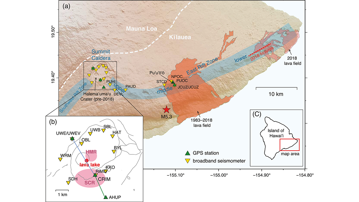
Complex Plumbing Dynamics for Kīlauea Volcano
A new analysis of subtle seismic velocity changes provides insights into the coupling of magma reservoirs of Hawaiian volcanoes.
Posted inEditors' Highlights
The Invisible Brake: Near‑Surface Cooling Stalls Giant Dyke Swarms
Sill-based pressure reconstructions show Mull’s giant dykes had eruption-capable pressures, but near‑surface groundwater cooling increased magma viscosity and stalled lateral propagation.
Posted inEditors' Highlights
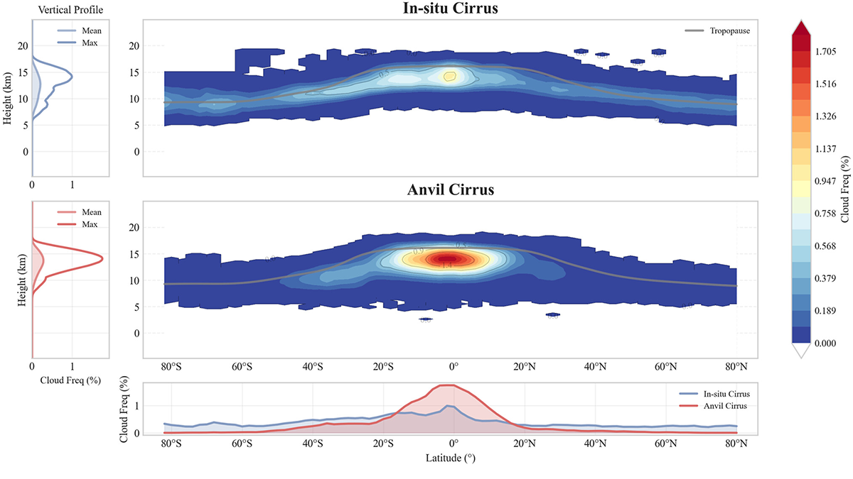
Understanding Relative Atmospheric Roles of Anvil and In-situ Cirrus Clouds
New framework for separating anvil and in-situ cirrus clouds provides a pathway for modeling cirrus and how regional shifts in convection could reshape global cirrus distributions and their radiative impact.
Posted inEditors' Highlights
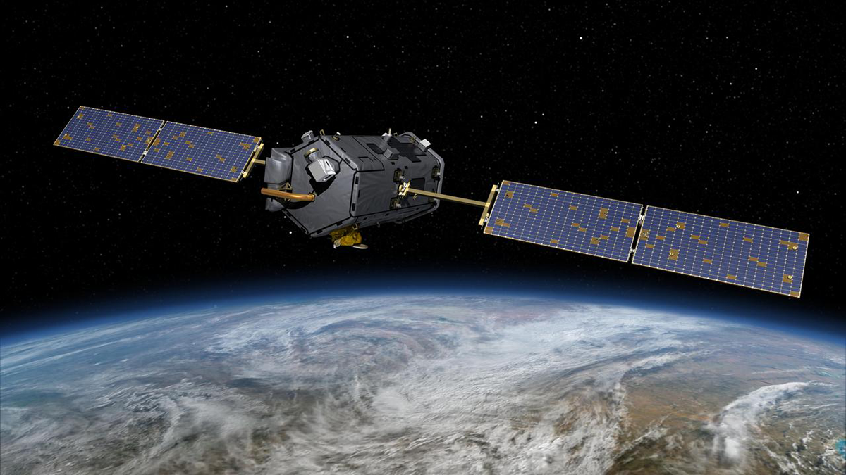
Taking Carbon Science Out of Orbit
NASA’s Orbiting Carbon Observatory-2 satellite reveals an impressively dynamic picture of the Earth’s carbon cycle, yet it may be prematurely decommissioned and destroyed due to budget cuts.