
Editors’ Highlights are summaries of recent papers by AGU’s journal editors.
Source: AGU Advances
The January 2025 Los Angeles wildfires, fueled by prolonged drought and extreme Santa Ana winds, rapidly spread across the region, destroying thousands of structures, causing widespread evacuations and fatalities, and becoming one of the most destructive and costly wildfire disasters in California’s history.
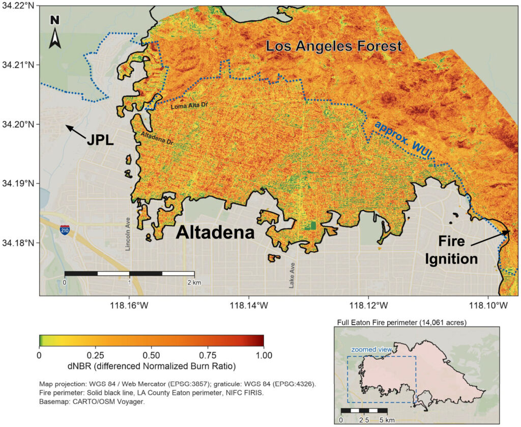
Rolla et al. [2026] highlight how satellite and airborne observations provided by NASA supported situational awareness throughout the disaster, even as the Eaton Fire forced the temporary closure of the Jet Propulsion Laboratory. These observations also proved essential for damage assessment, air quality monitoring, infrastructure evaluation, and debris-flow forecasting. By examining both the value of these remote sensing products and the operational challenges encountered during the Los Angeles wildfires, the study identifies priorities for improving wildfire risk mitigation. It further concludes that upcoming missions, including the NASA-ISRO Synthetic Aperture Radar (NISAR) and Surface Biology and Geology (SBG) missions, will further enhance the ability to transform Earth observations into actionable information for disaster response and management.
Citation: Rolla, J., Miner, K., Elder, C., Howard, E., Milton, J., & Spangler, N. (2026). Remote sensing during the 2025 Los Angeles wildfires. AGU Advances, 7, e2025AV002092. https://doi.org/10.1029/2025AV002092
—Alberto Montanari, Editor-in-Chief, AGU Advances
