Soil degradation threatens food security, water resources, biodiversity, and climate resilience. A new article explores its causes, impacts, monitoring methods, and restoration solutions.
Sustainable Development Goals (SDGs)
Posted inEditors' Highlights
Making Weather and Climate Information Reach the Communities that Need It
Many at-risk communities remain unreached by forecasts due to barriers in language, access, and trust in information systems. A new study looks at how to overcome these.
Posted inEditors' Highlights
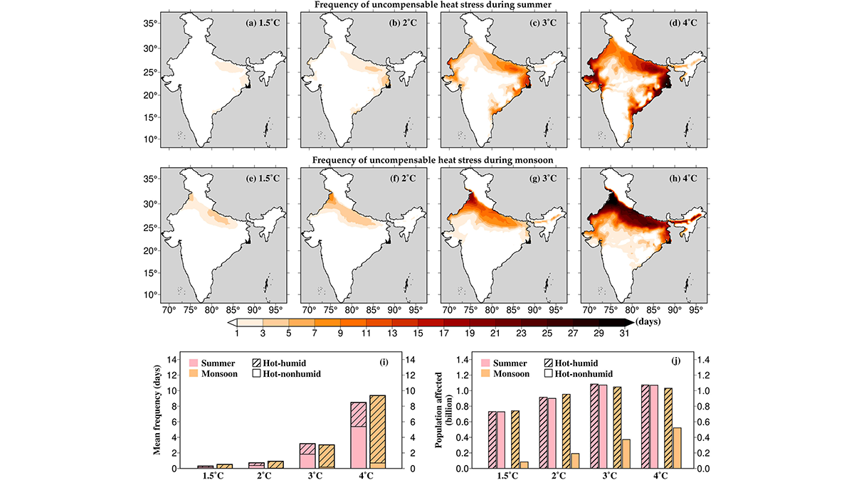
Unbearable Heat for Hundreds of Millions
The Global South, in particular, is suffering from the consequences of global heating. A new study quantifies heat stress in India by projecting it during the critical seasons.

Posted inEditors' Vox
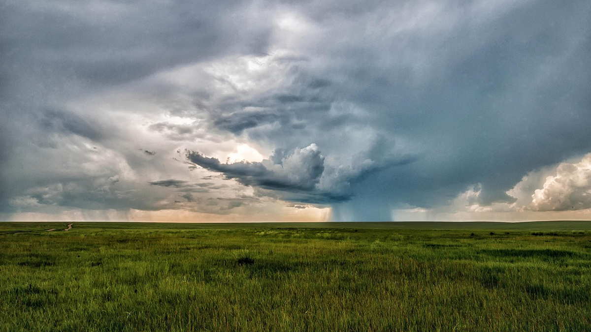
Small-Scale Indian Ocean Dynamics Underpin Marine Ecology and Climate
With unique monsoon, mesoscale and submesoscale processes, the Indian Ocean offers critical insights and new challenges to achieving a full understanding of marine environments and the Earth system.
Posted inEditors' Highlights
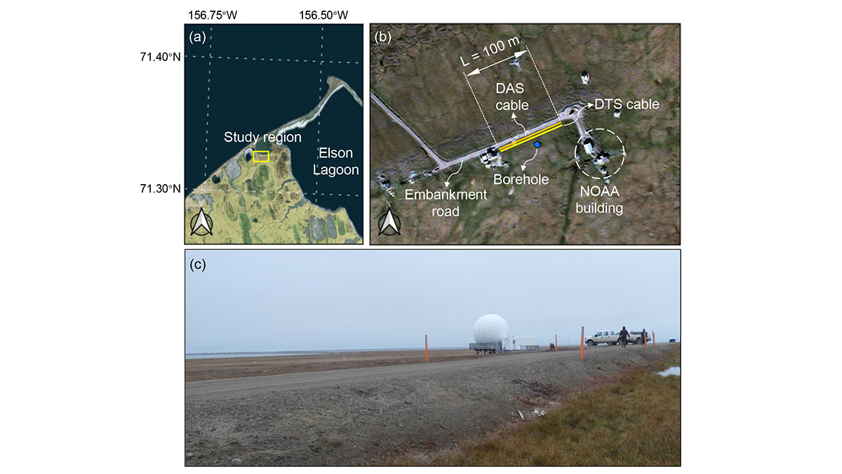
A Digital Twin for Arctic Permafrost Beneath Roads
A physics-informed digital twin uses high-resolution temperature data to track, update, and predict permafrost conditions beneath an Alaskan embankment road.

Posted inEditors' Highlights
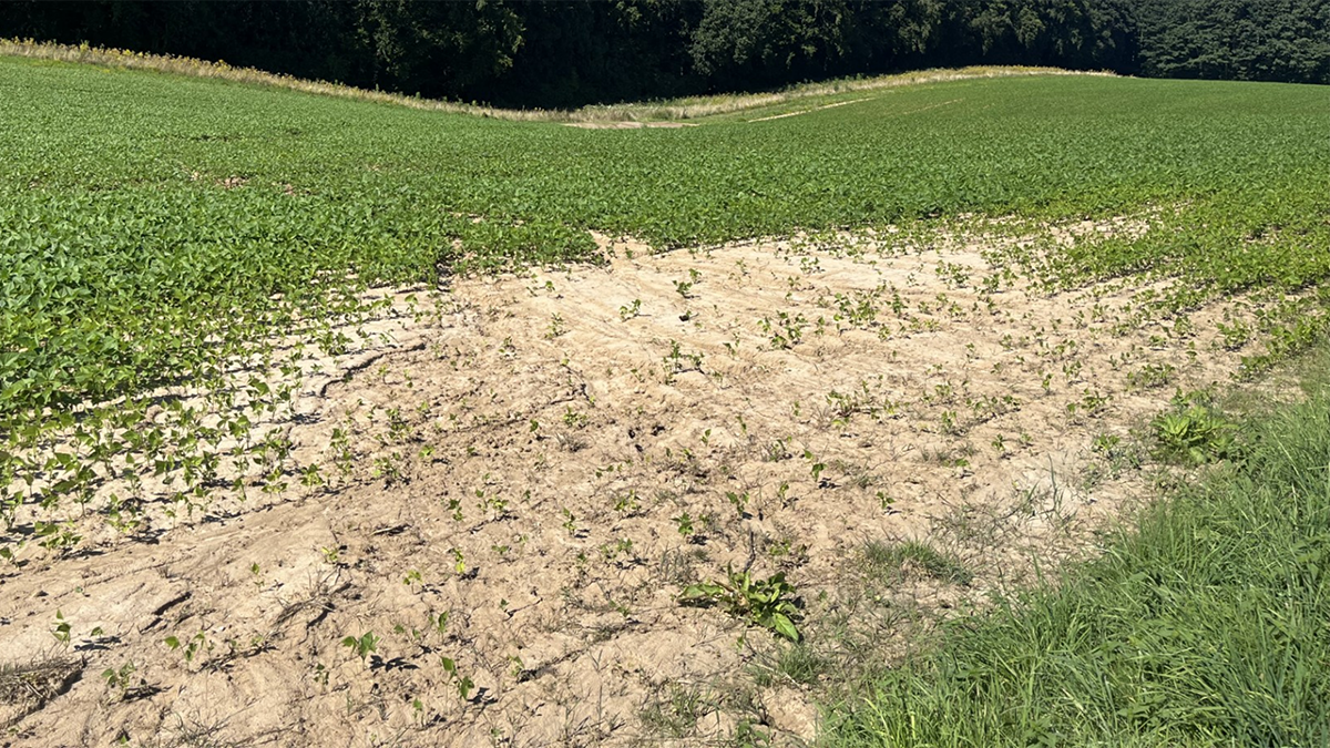
Managed Agriculture Hinders Predictability of Critical Zone Features
Intensively managed agricultural sites show behavioral shifts of the critical zone system and subsystems thus impacting predictability.

Posted inEditors' Highlights
Toward Marine Cloud Brightening at Scale: A Science Agenda
Marine Cloud Brightening (MCB) is a Solar Radiation Management (SRM) solution to cool the planet by changing the albedo of low-altitude marine clouds to increase reflected shortwave radiation.
Posted inEditors' Highlights
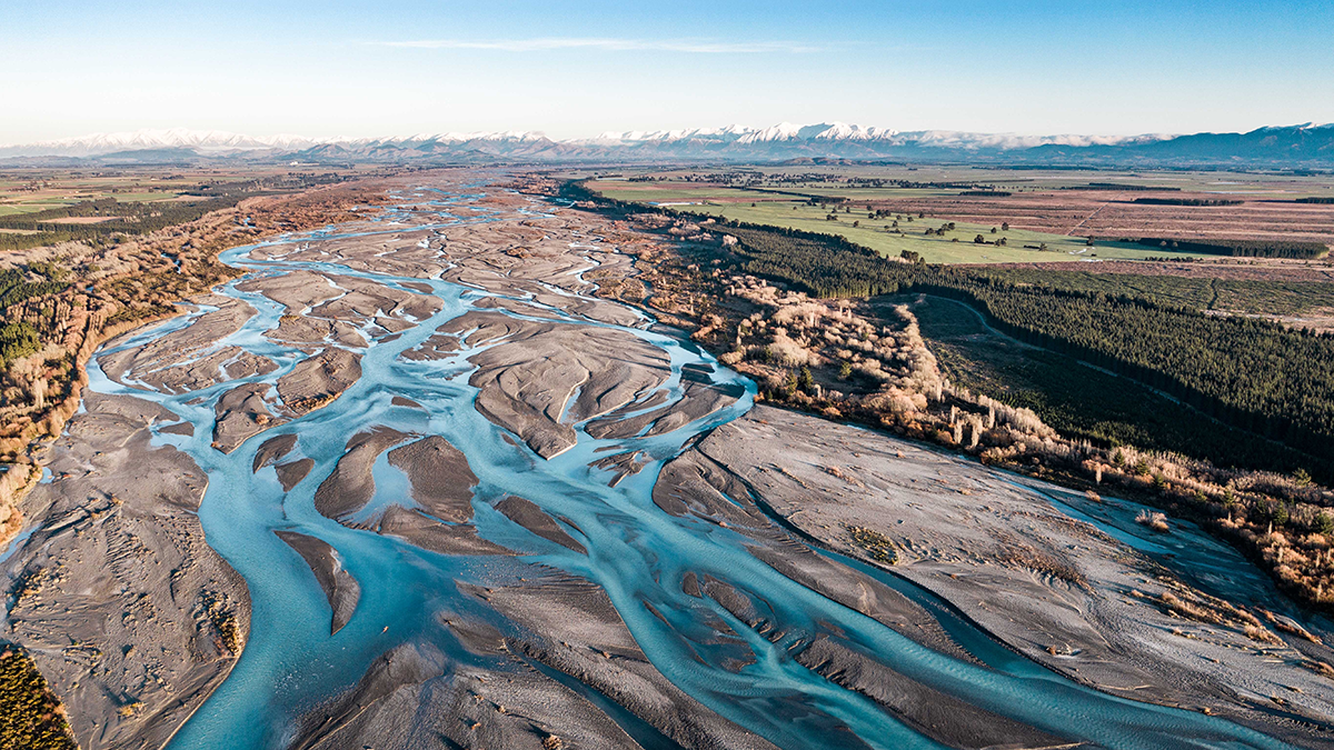
More Braided Rivers from Increasing Flow Variability
Global analysis of satellite data and river flow records show that higher flow intermittency after climate change may lead to an increasing number of threads in braided rivers, thus impacting ecosystems.
Posted inEditors' Highlights
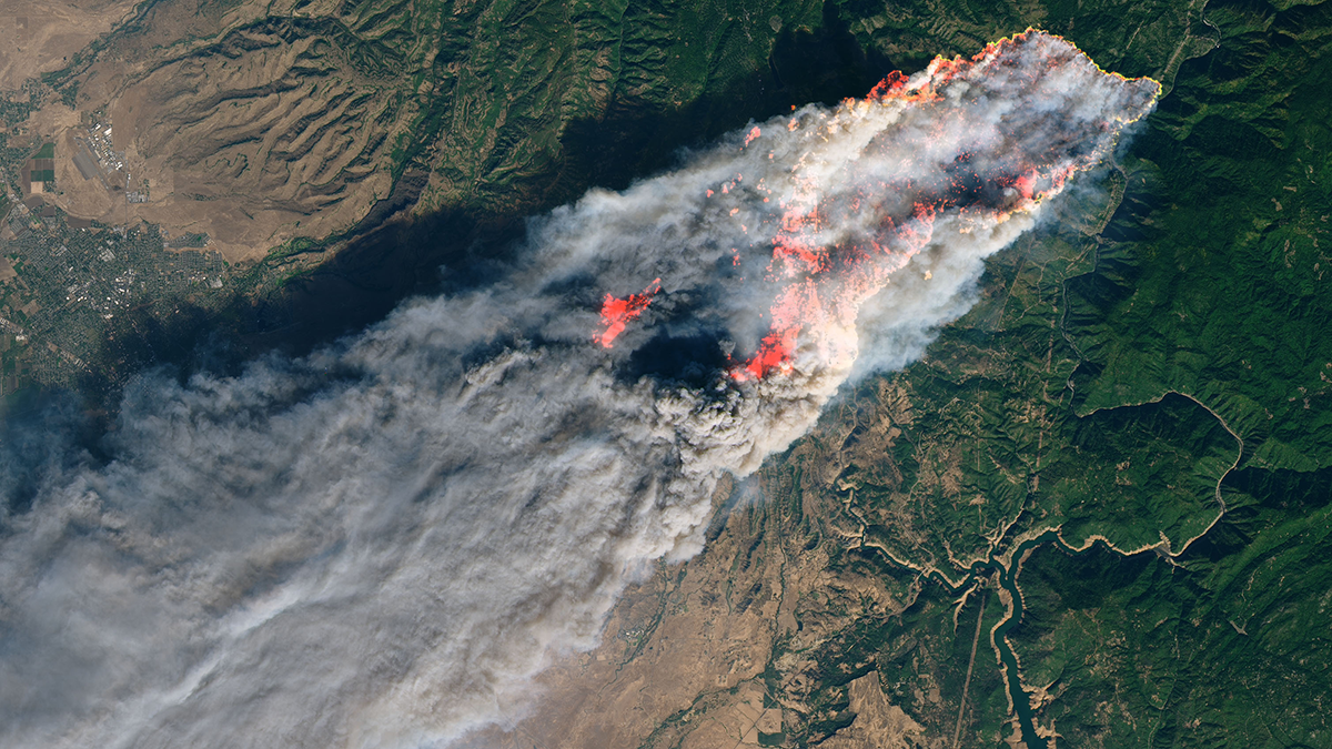
Weather Radar Data Reveal the Dynamics of Rapidly Spreading Wildfires
New research demonstrates the use of operational weather radar measurements to track long-range ember fallout and rapid spread of intense wildfires.
Posted inEditors' Vox
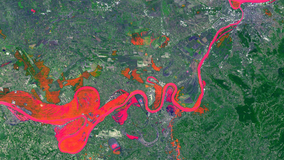
Can Any Single Satellite Keep Up with the World’s Floods?
How well does our current satellite fleet capture the world’s major floods? Scientists turn to the Dartmouth Flood Observatory record for a data-driven answer.