Source: Journal of Geophysical Research: Solid Earth
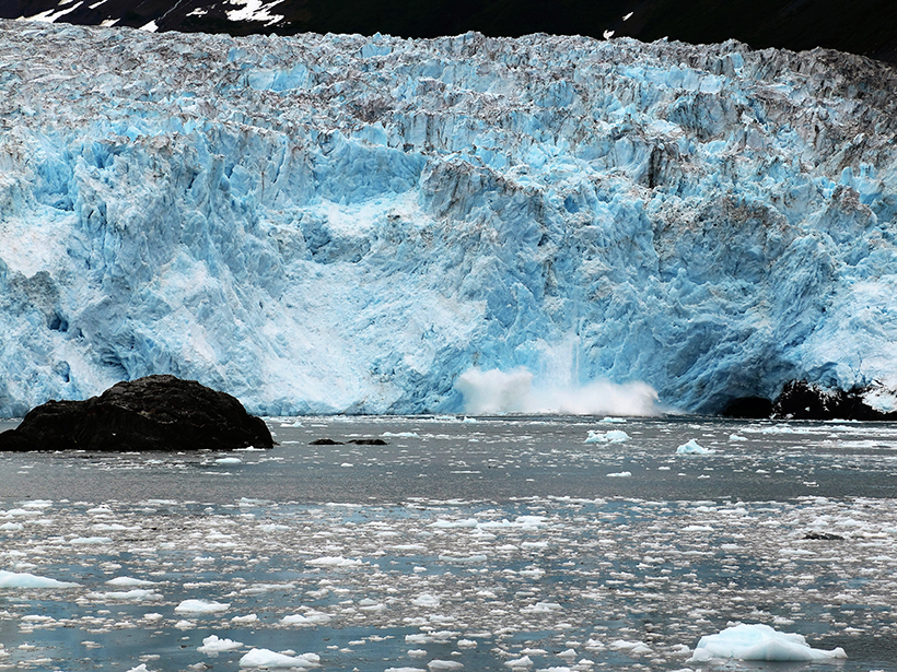
Earth’s gravity is shifting. As new lava flows breach the surface, the polar ice caps melt, and different patterns of drought and rain develop, the distribution of the mass of the planet—and therefore local gravity—is constantly changing. To help scientists better map these changes, NASA and the German Aerospace Center (DLR) launched the Gravity Recovery and Climate Experiment (GRACE) mission in March 2002.
GRACE consists of twin satellites, which orbit Earth at a height of 500 kilometers, in tandem, 16 times a day. The probes fly roughly 200 kilometers apart, but that distance fluctuates as small changes in the planet’s gravity push the two probes closer together or pull them apart. It’s these minute variations that allow scientists to measure changes in the mass of Earth’s surface.
To date, the mission has helped scientists better understand changes in groundwater, polar ice loss, vegetation coverage, atmospheric layers, and ocean dynamics in a warming world. In 2014, for example, the GRACE satellites helped demonstrate the true extent of the California drought. Scientists frequently use spherical harmonics, a set of mathematical functions that account for factors such as Earth’s rotation and equatorial bulge, to create gravity models from GRACE data. However, this technique is prone to several errors. The anomaly maps, for example, show north–south stripes that later have to be removed.
At the Center for Space Research at the University of Texas at Austin, Save et al. created a more accurate gravity model without the need for postprocessing procedures to remove noise. They used a different set of functions called mass concentration (mascon) blocks, which estimate anomalies within targeted grid locations. They divided up Earth into a geodesic grid, which consisted of 40,950 hexagonal tiles and 12 pentagonal tiles, and estimated the mass anomaly—how much the mass of one block deviated from a long-term average mass of that block—for each. This provided them with a 14-year (and counting) time series of mass change for all the tiles over the entire Earth.
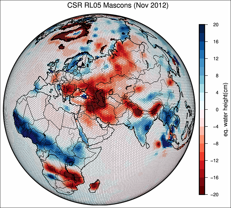
Mascon mass anomalies have been used for a few years now and can be applied at global scales, which means multiple fields of research—the study of water on land, in the world’s oceans, and locked up in ice—can benefit from these models. However, the solutions presented here have an additional advantage: They are derived from GRACE data alone and don’t require input from other geophysical models or data sources.
To test the new model’s accuracy, the team compared it with independent ocean bottom pressure recorder data and estimates of ice mass loss from multiple studies. They found excellent agreement. Furthermore, because of the resolution of the traditional GRACE gravity models, the land hydrology and ice loss signals along the coast used to “leak” into the ocean. The researchers’ new model shows little or no leakage of land signals into the ocean and may help scientists from many Earth science fields to improve their regional and global studies. (Journal of Geophysical Research: Solid Earth, doi:10.1002/2016JB013007, 2016)
—Shannon Hall, Freelance Writer
Citation:
Hall, S. (2016), A new model to improve gravity models, Eos, 97, https://doi.org/10.1029/2016EO062445. Published on 07 November 2016.
Text © 2016. The authors. CC BY-NC-ND 3.0
Except where otherwise noted, images are subject to copyright. Any reuse without express permission from the copyright owner is prohibited.