Source: Geophysical Research Letters
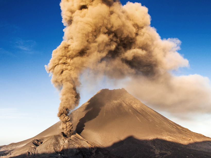
On 23 November 2014, the Pico do Fogo volcano began to erupt, forcing nearby residents to evacuate. By early December, slow-moving lava flows had destroyed two villages, and the eruption continued until early February. Now González et al. have used a new satellite imaging system to model the subsurface path of the magma that fed the eruption.
Pico do Fogo is a 9281-foot composite volcano located on Fogo Island in Cape Verde, an archipelago about 300 miles off the west coast of Senegal. It has erupted at least 26 times in the past 500 years, including in 1995.
The most recent eruption was captured by the European Space Agency’s Sentinel-1 satellite, launched in April 2014. The team used the satellite’s interferometric synthetic aperture radar (InSAR) system to map small movements of the ground over the course of the eruption. This marked the first time a significant ground deformation event was imaged with Sentinel-1’s new InSAR technique—terrain observation by progressive scans (TOPS)—in which the radar beam is carefully steered to improve image quality.
The TOPS InSAR images revealed changes in the volcano’s surface topography, allowing the researchers to model magma flow underneath. They found that the magma likely rose rapidly under the cone and then veered to the southwest flank of the volcano, where it erupted from an elongated crack, or fissure.
The TOPS technique provided the team with better surface coverage than that of the GPS system that is typically used to monitor Pico do Fogo. The researchers also compared the Sentinel-1 data with imagery of the same event captured by Canada’s RADARSAT-2 satellite; the additional data supported their magma flow model.
Following their success with the Pico do Fogo eruption, the scientists believe that Sentinel-1’s TOPS InSAR technique has the potential to be used to study other natural hazards, including earthquakes and landslides. (Geophysical Research Letters, doi:10.1002/2015GL066003, 2015)
—Sarah Stanley, Freelance Writer
Citation: Stanley, S. (2016), Radar technique shows magma flow in 2014 Cape Verde eruption, Eos, 97, doi:10.1029/2016EO044559. Published on 1 February 2016.
Text © 2016. The authors. CC BY-NC 3.0
Except where otherwise noted, images are subject to copyright. Any reuse without express permission from the copyright owner is prohibited.