Source: Journal of Geophysical Research: Atmospheres
When tropical cyclones pass over the land, they can be disastrous to coastal areas. Scientists can paint a fairly accurate picture of cyclones’ trajectories and intensities, but their ability to quantitatively predict the heavy rainfall that accompanies these storms is less advanced. The quantitative forecasts require a more precise understanding of the physics of tropical cyclones, down to the size of a single raindrop.
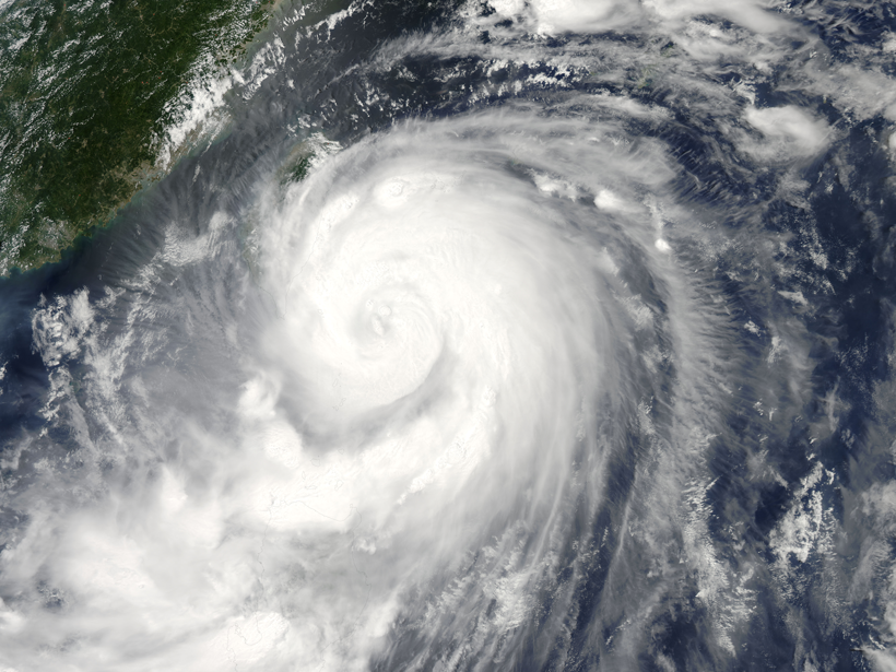
In a new study, Wang et al. used relatively new observational methods to examine microphysical processes in a typhoon’s rainband, the line of heavy showers—generated by temperature differences—that spirals in toward the storm’s center and gives a hurricane its distinctive whorl shape.
Typhoon Matmo made landfall in Fuqing, Fujian Province, China, in July 2014. As it moved inland, the storm passed over an intensive observation area of the Observation, Prediction, and Analysis of Severe Convection of China (OPACC) project, where the microphysical and kinematic structures of its rainband were captured by OPACC’s instruments. The data provided the researchers with insights into the size distribution of raindrops and allowed them to make inferences about the movement of air and water through the storm.
The team found that, generally, the rainband of Typhoon Matmo contained lots of small drops (with radii under 1 millimeter) and only a few larger ones. As the storm progressed, the drops increased in size, and the rainfall intensified; both updrafts and downdrafts of air in the storm built in intensity along with the rain. These updrafts carried water vapor to higher, colder parts of the storm, allowing ice crystals to grow. However, ice accounted for only a small percentage of the storm’s water, suggesting that Matmo’s rainband was dominated by warm rain processes. Eventually, the number of raindrops dwindled as the storm dissipated.
The raindrop distributions that the authors observed in Typhoon Matmo were notably different from those of other storms, including seemingly similar typhoons in Taiwan: Matmo had a higher concentration of smaller raindrops than usual. Some degree of the difference can be accounted for by the environment, but further study will be required to fully probe the microphysical processes involved. A diverse set of data about tropical cyclones will help researchers build and validate numerical models of storms so that they can predict precipitation more precisely and mitigate damage. (Journal of Geophysical Research: Atmospheres, doi:10.1002/2016JD025307, 2016)
—Leah Crane, Freelance Writer
Citation:
Crane, L. (2016), Reading raindrops: Microphysics in Typhoon Matmo, Eos, 97, https://doi.org/10.1029/2016EO063821. Published on 09 December 2016.
Text © 2016. The authors. CC BY-NC-ND 3.0
Except where otherwise noted, images are subject to copyright. Any reuse without express permission from the copyright owner is prohibited.