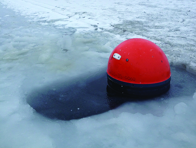
Understanding the fate and influence of glacial meltwater in heavily ice-covered fjord systems has proven difficult because previous measurement platforms were constrained to deeper water to keep instrumentation safe from drifting icebergs. Now, using novel, satellite-tracked devices that can withstand multiple collisions with ice blocks (see Figure 1) without incurring much damage, scientists have obtained new and detailed data about the role of Greenland Ice Sheet meltwater and its trajectories through Godthåbsfjord in western Greenland.

The drifters showed that meltwater led to strong stratification in the fjord, with a fresh and cold surface layer dominating the first few upper meters before changing sharply to much saltier and slightly warmer waters over the next 7 to 15 meters. This strong stratification in the upper 7 to 15 meters of the water column may play a critical role in regulating the fjord circulation, which in turn affects heat, ice, and seawater exchange between the open ocean and the ocean-terminating glaciers.
Knowledge of the role fjords play in ocean-glacier interactions is important because ocean warming is a key driver of the observed acceleration and thinning of ocean-terminating glaciers [Motyka et al., 2011; Rignot et al., 2012; Straneo and Heimbach, 2013]. Thinning reduces the mass of the Greenland Ice Sheet [van den Broeke et al., 2009], thereby contributing to the global mean sea level rise [Moore et al., 2013] and potentially affecting the freshwater balance [Bamber et al., 2012] and circulation in the North Atlantic [Weijer et al., 2012].
Drifter Deployments
Between 2011 and 2013, scientists from the University of Alaska Fairbanks and the Greenland Climate Research Centre deployed 14 drifters from a helicopter and boat into small patches of open water very close to the toe of the ocean-terminating glacier Kangiata Nunaata Sermia (KNS), which is located at the head of Godthåbsfjord (Figure 2, top).

Each year, two of the drifters were equipped with three conductivity-temperature-depth (CTD) sensors positioned at the surface, 7 meters, and 15 meters depth. Each drifter also held a drogue, positioned at 20 meters depth to minimize the influence of wind and wave action on its motion. The CTD sensors communicated with the floating surface of the drifter via an inductive cable. The drifters sent real-time GPS and CTD data via Iridium satellite every hour. A total of eight satellite-tracked surface drifters, consisting of a buoy with a thermistor recording sea surface temperature just below it and a drogue stemming from it to a 1-meter depth, were deployed in 2012 and 2013.
Together, the drifters recorded data for up to 4 months as they drifted along the roughly 190-kilometer-long fjord toward its mouth and sometimes into the Labrador Sea.
Circulation Features and Water Column Stability
Surprisingly, 4 of the 10 drifters that continued into the outer fjord system took a less direct path through an unstudied side fjord, Uummannap Sullua (US; also see animation of all drifter tracks in the supporting information found in the online version of this article). Prior to this study, US had not been viewed as an important exit pathway for glacially modified surface water into the open ocean within the Godthåbsfjord system. Two drifters were allowed to exit the fjord, one of which tracked the glacially modified surface water across the Labrador Sea, providing new insights into the long-term fate of meltwater from the Greenland Ice Sheet.
The drifter observations show a wide range of surface salinities, from as low as 4 in the inner fjord to 33 in the middle and outer fjord region (Figure 2, top; for comparison, average seawater in the region has a salinity of 33), meaning that the middle and outer fjord areas are roughly 8 times more saline than waters near the glacier. In the inner fjord system, the upper 7 meters were heavily stratified into layers of increasing density with depth (Figure 2, bottom). This density gradient was induced by large salinity differences between the melted lower-density icewater floating at the surface and the more saline higher-density water submerged below.
Strong winds, tidal forcing, or abrupt changes in bathymetry are required to mix these heavily stratified waters. Some drifters recorded such distinct mixing events as they passed through the middle fjord system. For example, two drifters located roughly 10 kilometers apart recorded a large simultaneous mixing event, where surface salinities increased from 5 to around 18 in concert with an increase in surface temperatures. Precise drivers of this particular mixing event are still being studied. As the drifters moved toward the open ocean, the upper 15 meters of the ocean changed to a well-mixed structure.
Expansion of Drifter Network
This study points to a very dynamic fjord system with large spatial and temporal gradients in upper ocean properties. To learn more, in February 2014 project scientists drilled a hole through sea ice near the glacier front and deployed one drifter to monitor the annual break-out of the ice melange—a mixture of glacial ice and sea ice—at the glacier’s terminus. Future plans involve expanding this high-resolution upper ocean data set with autonomous vehicles to survey the physical properties of the upper 200 meters of the fjord system and the entrance to the Labrador Sea.
Together, these data will provide a uniquely detailed view of the linkages between the glacier, fjord, and open ocean and may help researchers to better understand how climate change will affect each fjord component and the coupled fjord-ocean system as a whole. In time and through sustained data collection, scientists may be able to map in detail where glacial meltwater from Greenland travels and how the buildup of this freshwater in the North Atlantic may affect global ocean circulation patterns.
References
- Bamber, J., M. van den Broeke, J. Ettema, J. Lenaerts, and E. Rignot (2012), Recent large increases in freshwater fluxes from Greenland into the North Atlantic, Geophys. Res. Lett., 39, L19501, doi:10.1029/2012GL052552.
- Moore, J. C., A. Grinsted, T. Zwinger, and S. Jevrejeva (2013), Semiempirical and process-based global sea level projections, Rev. Geophys., 51(3), 484–522, doi:10.1002/rog.20015.
- Motyka, R. J., M. Truffer, M. Fahnestock, J. Mortensen, S. Rysgaard, and I. Howat (2011), Submarine melting of the 1985 Jakobshavn Isbræ floating tongue and the triggering of the current retreat, J. Geophys. Res., 116, F01007, doi:10.1029/2009JF001632.
- Rignot, E., I. Fenty, D. Menemenlis, and Y. Xu (2012), Spreading of warm ocean waters around Greenland as a possible cause for glacier acceleration, Ann. Glaciol., 53(60), 257–266, doi:10.3189/2012AoG60A136.
- Straneo, F., and P. Heimbach (2013), North Atlantic warming and the retreat of Greenland’s outlet glaciers, Nature, 504(7478), 36–43, doi:10.1038/nature12854.
- van den Broeke, M., J. Bamber, J. Ettema, E. Rignot, E. Schrama, W. J. van de Berg, E. van Meijgaard, I. Velicogna, and B. Wouters (2009), Partitioning recent Greenland mass loss, Science, 326(5955), 984–986, doi:10.1126/science.1178176.
- Weijer, W., M. E. Maltrud, M. W. Hecht, H. A. Dijkstra, and M. A. Kliphuis (2012), Response of the Atlantic Ocean circulation to Greenland Ice Sheet melting in a strongly-eddying ocean model, Geophys. Res. Lett., 39, L09606, doi:10.1029/2012GL051611.
—Claudine Hauri, Institute of Marine Science, University of Alaska Fairbanks; email: [email protected]; Martin Truffer, Geophysical Institute, University of Alaska Fairbanks; Peter Winsor, Institute of Marine Science, University of Alaska Fairbanks; and Kunuk Lennert, Greenland Climate Research Centre, Nuuk, Greenland
© 2014. American Geophysical Union. All rights reserved.
© 2014. American Geophysical Union. All rights reserved.