Ocean color (OC) satellites provide a global, long-term view of the oceans from space and greatly improve our understanding of ocean processes. These processes include the role of phytoplankton in marine ecosystems and the linkage between phytoplankton primary production, carbon fixation, and climate change. The satellite ocean color radiometry (OCR) data stream also supports a range of research and societal applications, including water quality monitoring; harmful algal bloom detection; management of marine resources, including fisheries and aquaculture; and climate and biogeochemical research.
The keynote speaker pointed out the need to begin exploring new questions and enabling new discoveries regarding Earth’s living oceans.
Ocean color scientists and representatives from various space agencies, hosted by the International Ocean Colour Coordinating Group (IOCCG), met earlier this year to improve collaboration and advance OCR research. The IOCS-2017 meeting aimed to inform participants about cutting-edge research and agency mission plans and to get participants to collectively agree on requirements for sustained OC research and operations.
The keynote speaker, Paula Bontempi (NASA), pointed out the need to move the science of OC remote sensing (RS) beyond current capabilities and to begin exploring new questions and enabling new discoveries regarding Earth’s living oceans.
Speakers at the meeting addressed some of these potential new approaches:
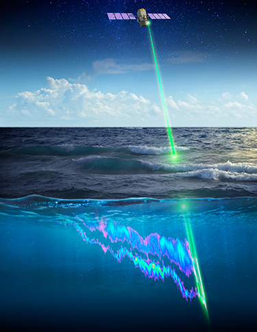
- Active lidar measurements from space present an unprecedented opportunity to complement the passive OC data record and retrieve quantitative phytoplankton properties (Figure 1). Lidar can provide information not available from OCR, including vertical distribution of ocean constituents, data retrievals through clouds, and night and high-latitude sampling.
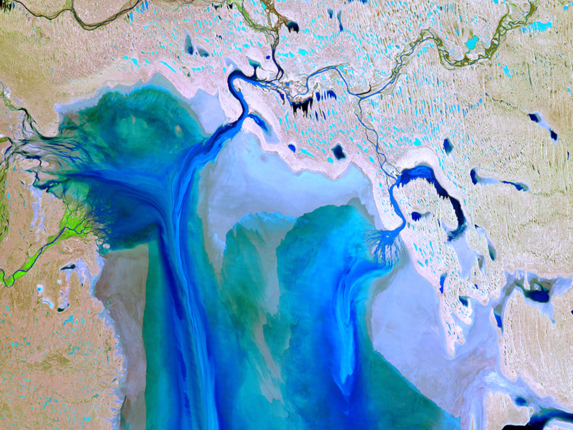
- Data with very high spatial resolution (e.g., from Sentinel-2 and Landsat 8) have led to new applications for observing coastal and inland waters. We can now observe sediment transport and patchy algae distribution, and we can monitor water quality.
- Planned hyperspectral OC remote sensing instruments could shed light on oceanographic processes previously hindered by current limitations in spectral band coverage (e.g., benthic substrate types, improved atmospheric correction, aerosol characterization, phytoplankton functional types, and coral reef health).
- New in situ approaches like the Imaging FlowCytobot can characterize the size and taxa of phytoplankton. This information can be used to validate satellite data.

Breakout groups discussed collective challenges and knowledge gaps. Atmospheric correction (AC) of hyperspectral data is extremely difficult; possible solutions include targeted spectral subsampling, increased parameterization of ocean-atmosphere models, and adopting a decision tree approach as an alternative to full inversions. In situ instrumentation advances for hyperspectral remote sensing (hyperspectral backscatter measurements, compact flow cytometry, and microscopy) can help parameterize radiative transfer models.
Satellite RS offers a unique perspective on inland and coastal waters, and it can help us assess water quality and understand biogeochemical processes. AC is also challenging in these waters because of land adjacency effects, trace gases near cities, and extremely turbid waters. The bio-optical complexity of these waters affects algorithm accuracy and the quality of satellite products that transition across open-ocean, coastal, and inland waters.
The optical water type classification approach offers a promising avenue for improved algorithms in coastal waters, but the fundamental issue impeding the progress of algorithm development is the lack of in situ measurements to describe water types. Community support is essential in making in situ data available for evaluating AC and bio-optical algorithms. Many breakout groups strongly encouraged data sharing and data publication.
Satellite remote sensing offers a unique perspective on inland and coastal waters, and it can help us assess water quality and understand biogeochemical processes.
All presentations, poster abstracts, and a full meeting report that includes recommendations are available at the IOCS-2017 meeting website. IOCS-2017 was sponsored by the European Commission, European Organisation for the Exploitation of Meteorological Satellites (EUMETSAT), the European Space Agency, NASA, Thales Alenia, and Airbus. The next IOCS meeting will take place in May–June 2019 in Busan, South Korea.
—Venetia Stuart (email: [email protected]), International Ocean Colour Coordinating Group, Bedford Institute of Oceanography, Dartmouth, Nova Scotia, Canada
Citation:
Stuart, V. (2017), Observing life near the ocean’s surface with satellites, Eos, 98, https://doi.org/10.1029/2017EO085631. Published on 30 October 2017.
Text © 2017. The authors. CC BY 3.0
Except where otherwise noted, images are subject to copyright. Any reuse without express permission from the copyright owner is prohibited.

