Kick-off Workshop of Indo-Norwegian Project PREPARE; Bergen, Norway, 27–31 March 2017
Science Updates
Posted inScience Updates
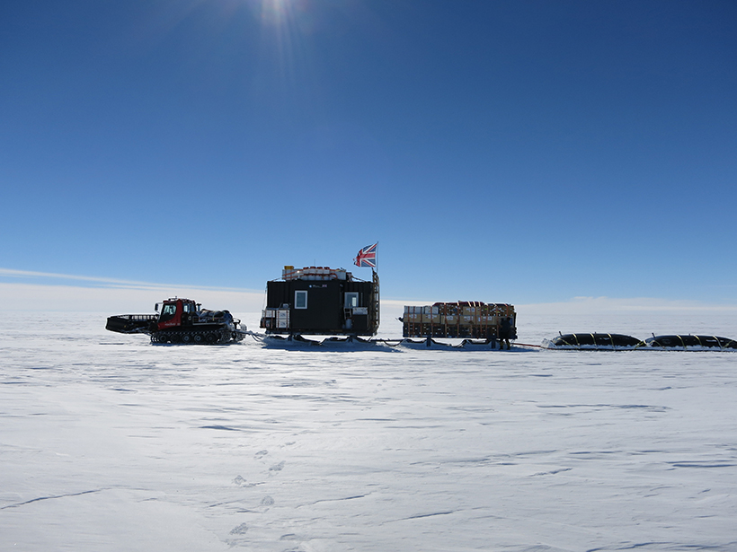
Pine Island Glacier and Ice Sheet Stability in West Antarctica
The iSTAR Programme Science Integration Meeting; Leeds, United Kingdom, 18–19 May 2017

Posted inScience Updates
Sounding the Black Smoker Plumes
Imaging sonar, an emerging technique for monitoring heat from seafloor hydrothermal vents, gives scientists a new look at interacting systems off the coast of Canada.
Posted inScience Updates
Analog Modeling Recreates Millions of Years in a Few Hours
Second Workshop on Analog Modeling of Tectonic Processes; Austin, Texas, 17–19 May 2017

Posted inScience Updates
Driving Convergence in Space and Deep-Sea Science Exploration
ROBEX Sensor Workshop; Vienna, Austria, 27 April 2017
Posted inScience Updates
New Online Tool Teaches Students About the Energy-Water Nexus
Students use real data sets to explore how population changes, power generation, and water-saving strategies affect surface and groundwater use.
Posted inScience Updates
Observing Life near the Ocean’s Surface with Satellites
Third International Ocean Colour Science (IOCS) Meeting; Lisbon, Portugal, 15–19 May 2017
Posted inScience Updates
New Frontiers and Technologies in Submarine Volcanism Research
AGU Chapman Conference on Submarine Volcanism: New Approaches and Research Frontier; Hobart, Tasmania, Australia, 29 January to 3 February 2017

Posted inScience Updates
Understanding a Changing West Antarctic Peninsula
The 1st Workshop of the SOOS WAP Working Group; Cambridge, United Kingdom, 15–16 May 2017
In Icy Waters: The Future of Marine Biogeochemical Research off the West Antarctic Peninsula; Chicheley, United Kingdom, 17–18 May 2017
Posted inScience Updates
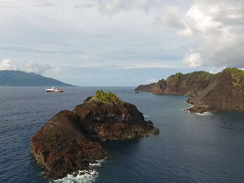
An 1888 Volcanic Collapse Becomes a Benchmark for Tsunami Models
When volcanic mountains slide into the sea, they trigger tsunamis. How big are these waves, and how far away can they do damage? Ritter Island provides some answers.