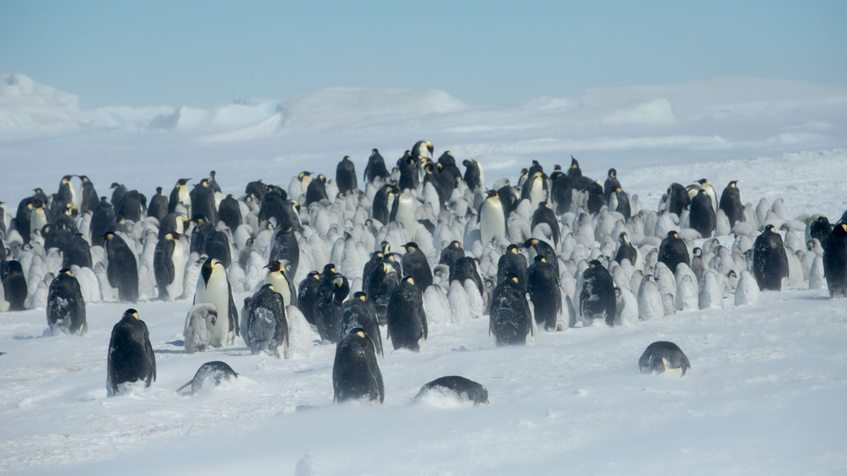
A scientist stumbled upon evidence of penguin molting sites in satellite data, but the sea ice these birds rely on is disappearing.
beaches, coasts, & shorelines
Posted inResearch Spotlights
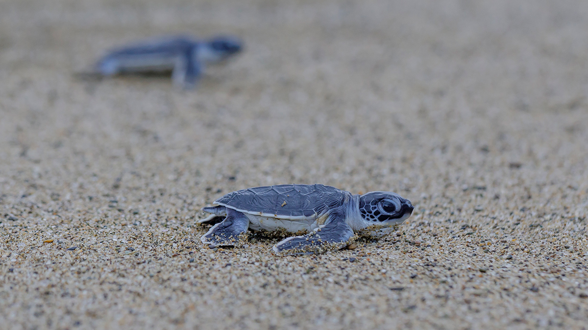
Sea Turtles, Shrinking Beaches, and Rising Seas
A new study looks at how sea turtle nesting sites may be affected as sea levels rise and sandy beaches erode.
Posted inEditors' Highlights
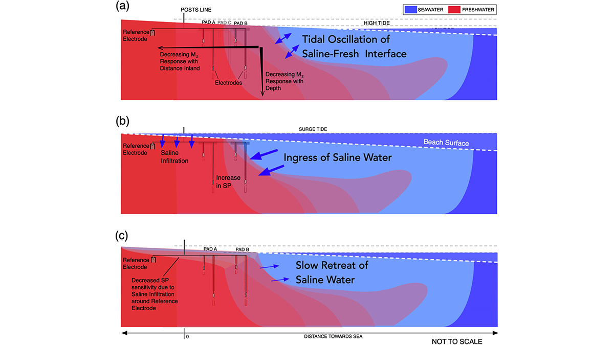
Tides Generate Detectable Electrical Signals in Coastal Aquifers
Spontaneous potentials show possibility for monitoring coastal saltwater intrusion.
Posted inEditors' Highlights
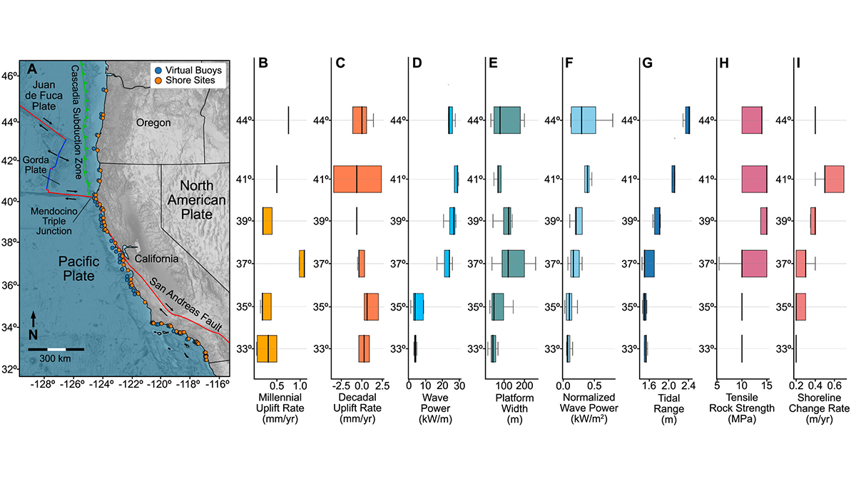
Rocky Shore Erosion Shaped by Multi-Scale Tectonics
Statistical analysis of western United States shore evolution provides hints of long-term tectonic and seismic cycle effects on modulating coastal erosion.
Posted inEditors' Vox
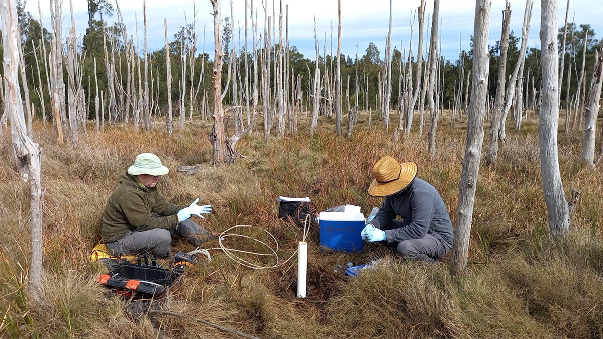
Coastal Wetlands Restoration, Carbon, and the Hidden Role of Groundwater
Coastal wetland restoration offers major carbon benefits, and understanding groundwater processes helps explain how these ecosystems store carbon over the long term.
Posted inNews
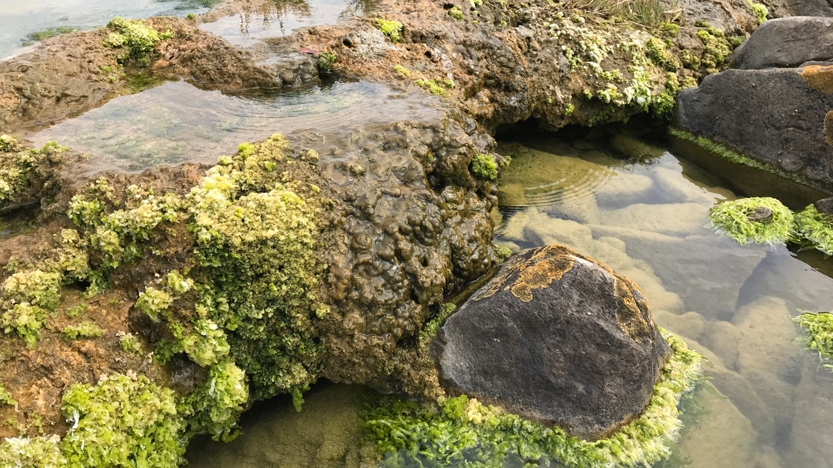
Rocks Formed by Microbes Absorb Carbon Day and Night
Microbialite ecosystems in South Africa stored an “astonishing” amount of carbon, according to new research.
Posted inNews
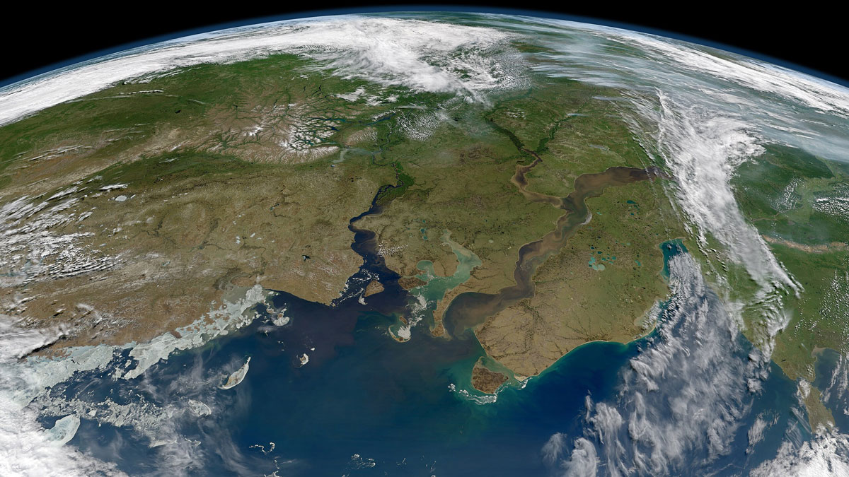
Why Are River Deltas Disappearing? They’re Sinking Faster Than Many People Realize
It’s not just that sea levels are rising. Scientists believe fossil fuel extraction and river engineering are also factors behind coastline disappearance.
Posted inNews
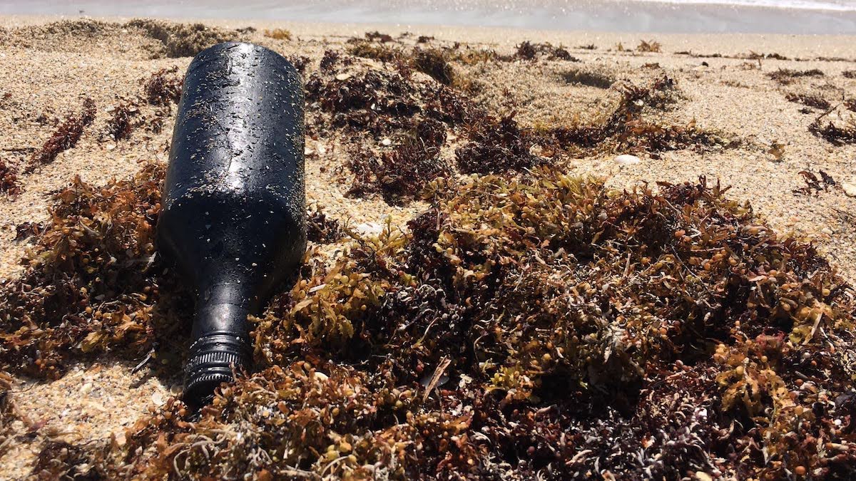
Plastic Debris Helps Oil Residues Reach Farther Across the Ocean
Scientists matched oil residues found in Florida to a Brazilian spill thousands of miles away.
Posted inResearch Spotlights
New River Chemistry Insights May Boost Coastal Ocean Modeling
By more realistically accounting for river inputs, researchers reduced overestimation of the amount of carbon dioxide absorbed by coastal waters.
Posted inOpinions
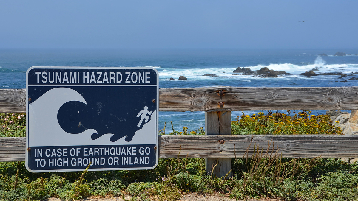
When Should a Tsunami Not Be Called a Tsunami?
It’s time to redefine the term so it more clearly conveys meaningful risks to coastal communities and prompts them to act when needed.