
A new case study investigates causes and effects of California’s 2017 wildfire season.
California
Posted inEditors' Highlights
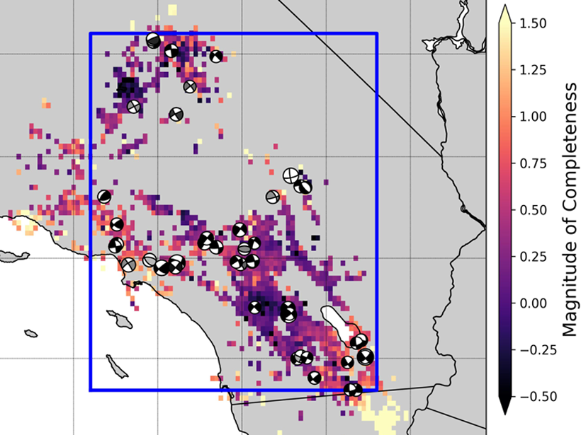
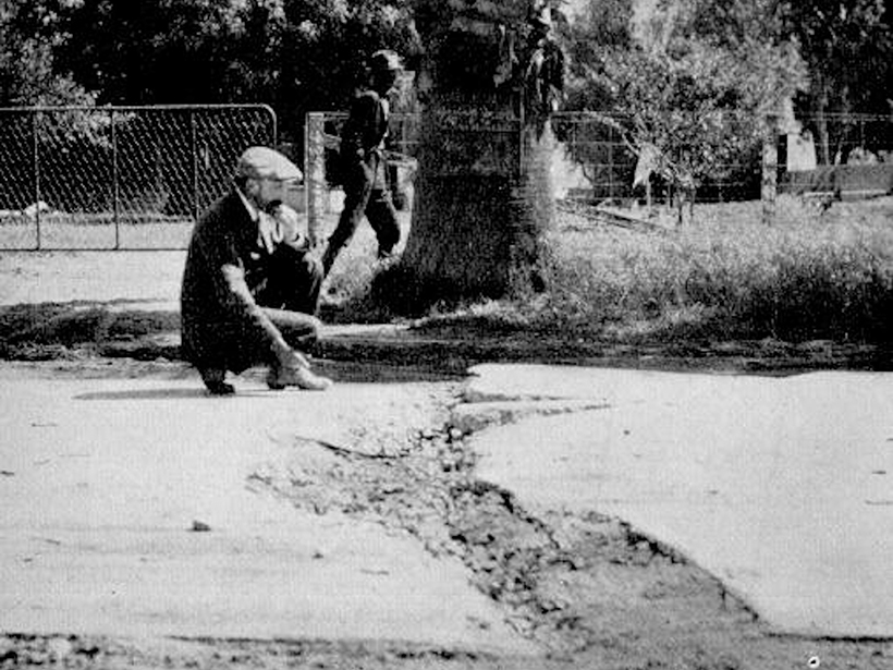
Most Southern California Mainshocks Follow Foreshocks
New research using a highly complete earthquake catalog shows that 72% of M4+ mainshocks are preceded by foreshocks, implying that foreshock activity is much more prevalent than previously thought.
Posted inEditors' Highlights
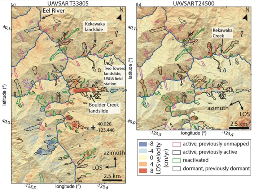
Landslide Activity Ramps Up With Extreme Rainfall
An increase in activity of hundreds of slow-moving landslides during extreme wet conditions in California provides insights into the landscape response to ongoing climate change.
Posted inResearch Spotlights
Fading Air Pollution Reduces Fog in Central Valley
The tule fog in California’s Central Valley is notorious for causing delays and accidents throughout the region; however, a decrease in air pollutants is reducing the fog’s frequency.

Posted inResearch Spotlights
Paleomagnetism Indicators May Be Flawed
A new study finds that magnetism in volcanic ash tuff forms through varied processes, calling into question previously reliable signatures used to study variations in Earth’s magnetic field.
Posted inResearch Spotlights
Answer to California Landscape Riddle Lies Underground
Scientists link vegetation mosaics in California to patterns of weathered bedrock.
Posted inNews
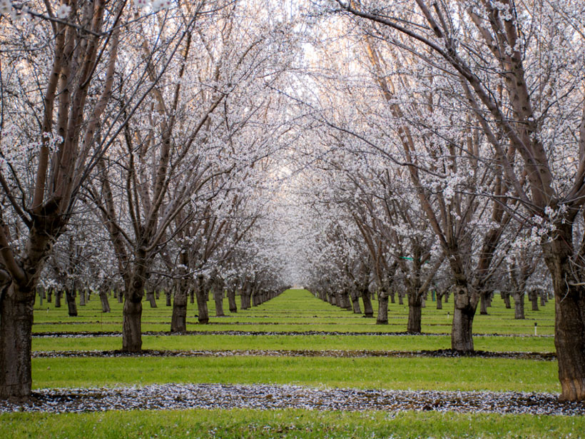
California Heat Waves Triggered by Pacific Thunderstorms
New link may offer 5-week lead time on predicting extreme heat in California’s fruit belt.
Posted inNews
More Than a Million New Earthquakes Spotted in Archival Data
By reanalyzing seismic records, researchers found a plethora of tiny earthquakes in Southern California that trace new fault structures and reveal how earthquakes are triggered.
Posted inNews
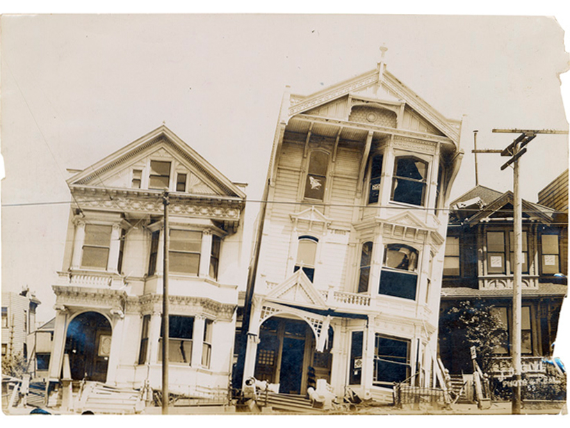
Reassessing California’s Overdue Earthquake Tab
Paleoseismic records show that the current 100-year hiatus since the last major event on the San Andreas, San Jacinto, and Hayward Faults is unprecedented in recent geologic history.
Posted inResearch Spotlights
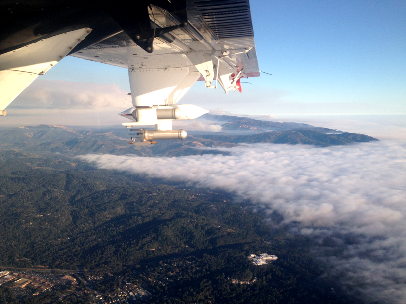
Probing Wildfire Smoke Plumes Up Close
Direct observations from flights over coastal California reveal more about aerosol plumes released by burning biomass.