• About
  • Special Reports
  • Topics
    • Climate
    • Earth Science
    • Oceans
    • Space & Planets
    • Health & Ecosystems
    • Culture & Policy
    • Education & Careers
    • Opinions
  • Projects
    • Postcards From the Field
    • ENGAGE
    • Editors’ Highlights
    • Editors’ Vox
    • Eos en Español
    • Eos 简体中文版
    • Print Archive: 2015–2025
  • Policy Tracker
  • Blogs
    • Research & Developments
    • The Landslide Blog
  • Newsletter
  • Submit to Eos
  • AGU.org
  • Career Center
  • Join AGU
  • Give to AGU
  • About
  • Special Reports
  • Topics
    • Climate
    • Earth Science
    • Oceans
    • Space & Planets
    • Health & Ecosystems
    • Culture & Policy
    • Education & Careers
    • Opinions
  • Projects
    • Postcards From the Field
    • ENGAGE
    • Editors’ Highlights
    • Editors’ Vox
    • Eos en Español
    • Eos 简体中文版
    • Print Archive: 2015–2025
  • Policy Tracker
  • Blogs
    • Research & Developments
    • The Landslide Blog
  • Newsletter
  • Submit to Eos
Skip to content
  • AGU.org
  • Career Center
  • Join AGU
  • Give to AGU
Eos

Eos

Science News by AGU

Support Eos
Sign Up for Newsletter
  • About
  • Special Reports
  • Topics
    • Climate
    • Earth Science
    • Oceans
    • Space & Planets
    • Health & Ecosystems
    • Culture & Policy
    • Education & Careers
    • Opinions
  • Projects
    • Postcards From the Field
    • ENGAGE
    • Editors’ Highlights
    • Editors’ Vox
    • Eos en Español
    • Eos 简体中文版
    • Print Archive: 2015–2025
  • Policy Tracker
  • Blogs
    • Research & Developments
    • The Landslide Blog
  • Newsletter
  • Submit to Eos

continents

两个人,一个穿着黄色背心,一个穿着灰色长袖衬衫,正抬头看着一块岩石表面。
Posted inResearch Spotlights

6.16亿年前波罗的大陆在哪里?

by Saima May Sidik 3 June 20263 June 2026

通过解析古老岩石中的磁信号,我们得以重新认识这块古大陆在埃迪卡拉纪时期的位置。

Photo of a scientists installing equipment in the field.
Posted inEditors' Vox

Mapping the Hidden Electrical Anatomy of a Continent

by Paul A. Bedrosian, Anna Kelbert, Adam Schultz and Gary D. Egbert 26 May 202621 May 2026

After nearly two decades, the first continent-wide magnetotelluric survey reveals the high-resolution electrical architecture of the North American continent.

A mountainous desert on a clear day. Red-orange dirt and rocks dominate the near ground, along with palms and desert plants, with a clear blue sky and gibbous Moon above.
Posted inNews

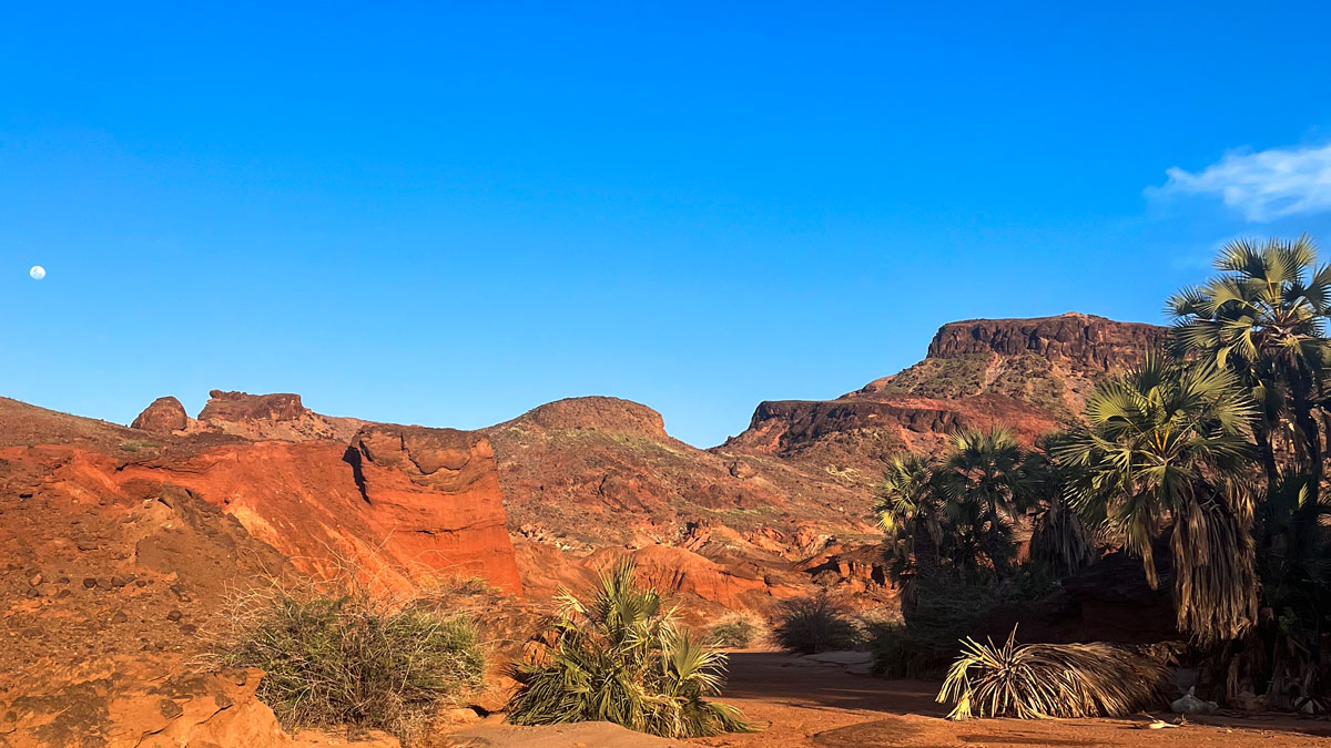
Eastern Africa Is Splitting Apart, but Not Where We Expected

Kimberly M. S. Cartier, News Writing and Production Intern for Eos.org by Kimberly M. S. Cartier 12 May 20261 June 2026

The Turkana Rift Zone in Kenya entered a critical stage in continental breakup about 4 million years ago.

Two people, one wearing a yellow vest and one in a gray long-sleeved shirt, look up at a rock face.
Posted inResearch Spotlights

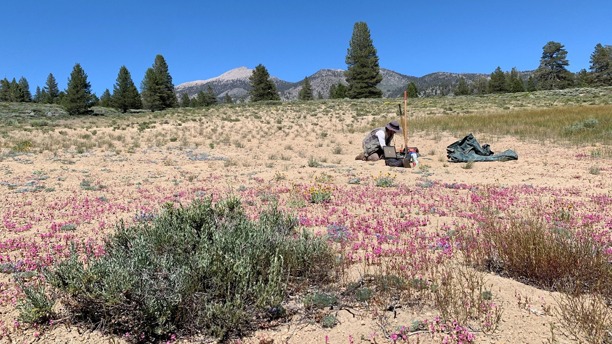
Where Was Baltica 616 Million Years Ago?

by Saima May Sidik 5 May 20263 June 2026

Disentangling magnetic signals in its ancient rocks gives an updated view of the paleocontinent’s position during the Ediacaran period.

Ground-level view looking over a flat expanse of land covered in a crust of crystalline salt, with a group of people standing around a tall drilling rig in the distance.
Posted inFeatures

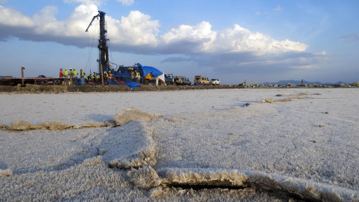
Drilling Down to Open Up New Understanding of Earth’s Continents

by Christopher A. Scholz, Anders Noren, Lisa Park Boush, Brett M. Carpenter and Russell Callahan 27 March 202627 March 2026

Scientists have drilled into Earth’s crust for decades to understand natural hazards, past climates, energy resources, and more. They’ve only scratched the surface of what we can learn.

A map showing continental mantle earthquakes around the world.
Posted inNews

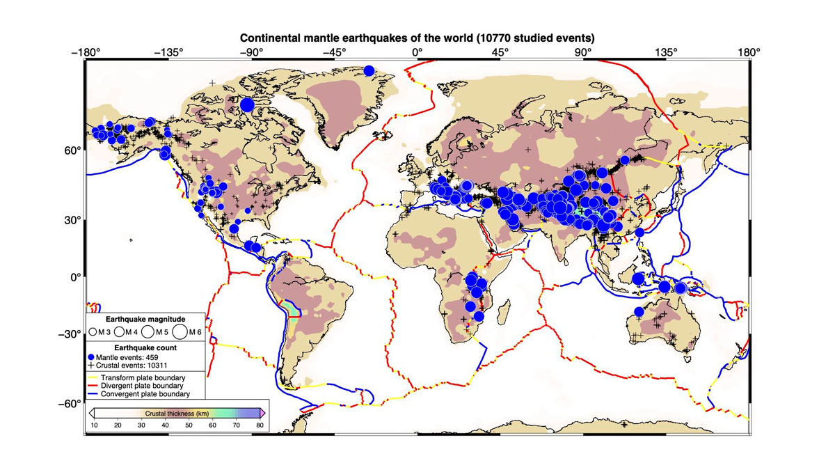
Scientists Create the First Map of Deep Earthquakes Beneath Continents

by Larissa G. Capella 5 March 20265 March 2026

Scientists once thought Earth’s continental mantle was too weak for earthquakes. A new global map of 459 deep tremors suggests otherwise.

Figure from the article.
Posted inEditors' Highlights

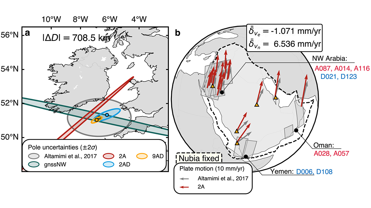
Mapping the Whereabouts of Continents

by Fabio A. Capitanio 24 July 202512 December 2025

A new method integrates Interferometric Synthetic Aperture Radar (InSAR) with conventional ground geodetic networks, taking us closer to high-resolution mapping of plate motions.

Photo of a rock outcrop.
Posted inEditors' Highlights

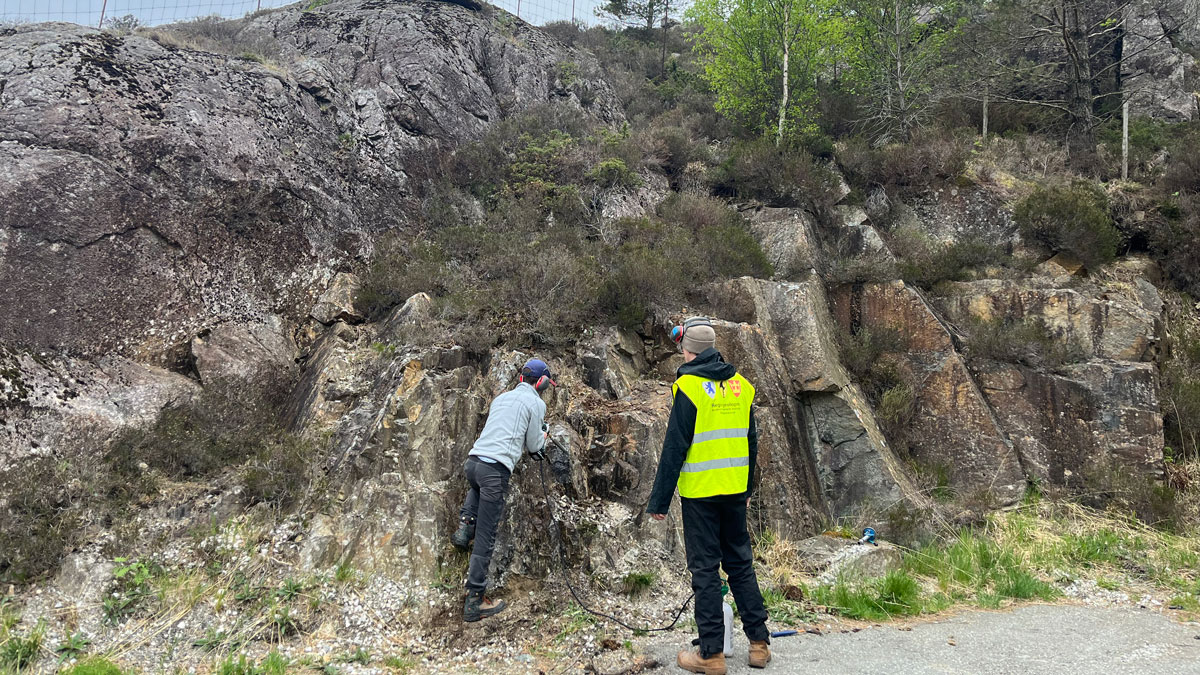
Remagnetization Illuminates Tectonic Consolidation of Megacontinents

by Agnes Kontny 31 March 202527 March 2025

New rock and paleomagnetic research give evidence for prolonged heating during the Cambrian-Ordovician tectonic consolidation of West Gondwanaland.

Field photo of a rock outcrop.
Posted inEditors' Highlights

Structural Inversion of an Intracratonic Rift System in Deep Time

by Alexis Ault 31 October 202431 October 2024

A new study reconstructs how an ancient North American rift system was uplifted in space and time due to subsequent continent-continent collision.

Rocas saliendo del océano en una costa
Posted inNews

Circones de 4,000 millones de años podrían contener nuestras evidencias más antiguas de la existencia de agua dulce

by Nathaniel Scharping 4 September 20244 September 2024

Cristales australianos apuntan a la existencia de agua dulce, así como de continentes que se elevaban sobre el océano Hadeano de la Tierra.

Posts pagination

1 2 3 … 5 Older posts
Over a dark blue-green square appear the words Special Report: The State of the Science 1 Year On.

Features from AGU Publications

Research Spotlights

Rocket Launches and Reentries Harm Earth’s Ozone Layer

8 June 20268 June 2026
Editors' Highlights

Pre-Existing Structure and Stress Shape Geothermal-Induced Seismicity

2 June 20261 June 2026
Editors' Vox

Small-Scale Indian Ocean Dynamics Underpin Marine Ecology and Climate

4 June 20263 June 2026
Eos logo at left; AGU logo at right

About Eos
ENGAGE
Awards
Contact

Advertise
Submit
Career Center
Sitemap

© 2026 American Geophysical Union. All rights reserved Powered by Newspack