• About
  • Special Reports
  • Topics
    • Climate
    • Earth Science
    • Oceans
    • Space & Planets
    • Health & Ecosystems
    • Culture & Policy
    • Education & Careers
    • Opinions
  • Projects
    • Postcards From the Field
    • ENGAGE
    • Editors’ Highlights
    • Editors’ Vox
    • Eos en Español
    • Eos 简体中文版
    • Print Archive: 2015–2025
  • Policy Tracker
  • Blogs
    • Research & Developments
    • The Landslide Blog
  • Newsletter
  • Submit to Eos
  • AGU.org
  • Career Center
  • Join AGU
  • Give to AGU
  • About
  • Special Reports
  • Topics
    • Climate
    • Earth Science
    • Oceans
    • Space & Planets
    • Health & Ecosystems
    • Culture & Policy
    • Education & Careers
    • Opinions
  • Projects
    • Postcards From the Field
    • ENGAGE
    • Editors’ Highlights
    • Editors’ Vox
    • Eos en Español
    • Eos 简体中文版
    • Print Archive: 2015–2025
  • Policy Tracker
  • Blogs
    • Research & Developments
    • The Landslide Blog
  • Newsletter
  • Submit to Eos
Skip to content
  • AGU.org
  • Career Center
  • Join AGU
  • Give to AGU
Eos

Eos

Science News by AGU

Support Eos
Sign Up for Newsletter
  • About
  • Special Reports
  • Topics
    • Climate
    • Earth Science
    • Oceans
    • Space & Planets
    • Health & Ecosystems
    • Culture & Policy
    • Education & Careers
    • Opinions
  • Projects
    • Postcards From the Field
    • ENGAGE
    • Editors’ Highlights
    • Editors’ Vox
    • Eos en Español
    • Eos 简体中文版
    • Print Archive: 2015–2025
  • Policy Tracker
  • Blogs
    • Research & Developments
    • The Landslide Blog
  • Newsletter
  • Submit to Eos

currents

Diagrams of modeled plastic particle concentrations in the ocean after 10 simulated years, starting from an initial uniform distribution over the entire globe
Posted inResearch Spotlights

How Are Microplastics Transported to Polar Regions?

by Terri Cook 26 September 201916 September 2022

New modeling indicates that global subsurface ocean currents distribute submerged microplastics along very different routes than those traveled by floating plastic debris.

Satellite image of a pumice raft floating in the ocean
Posted inNews

Volcanic Eruption Creates Temporary Islands of Pumice

Katherine Kornei, Science Writer by Katherine Kornei 6 September 201918 January 2022

Rafts of pumice, spewed from an undersea volcano, recently appeared in the South Pacific. These transient, movable islands are important toeholds for marine life like barnacles, coral, and macroalgae.

Diagram of oxygen concentrations at 350 meters depth that shows the oxygen deficient zone, or shadow zone, in the eastern tropical North Pacific Ocean
Posted inResearch Spotlights

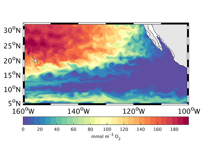
How the Ocean’s “Shadow Zone” Breathes

by E. Underwood 28 August 201922 December 2021

A new study uses Argo floats and an ocean circulation model to track the sources supplying pulses of oxygen to the deep North Pacific.

Color map of sea surface temperatures in the northwest Pacific
Posted inEditors' Vox

The Kuroshio Current: Artery of Life

by Takeyoshi Nagai 27 August 20199 November 2022

The waters of the Kuroshio Current in the northwestern Pacific Ocean transport heat, salt, and organic and inorganic matter from south to north, shaping the ocean ecosystem.

Tabular iceberg in the Weddell Sea
Posted inEditors' Vox

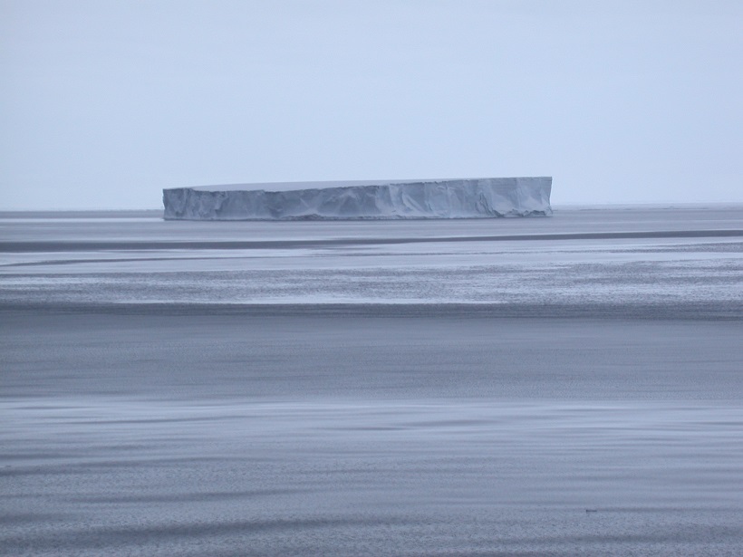
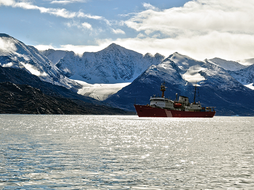
Science in a Frozen Ocean

by M. Vernet, M. Hoppema and W. Geibert 26 July 201912 January 2022

It’s notoriously difficult to access, but new technologies, international collaboration, regional models, and interdisciplinary approaches are improving understanding of the Weddell Gyre.

NASA visualization of dozens of eddies in the Atlantic Ocean
Posted inNews

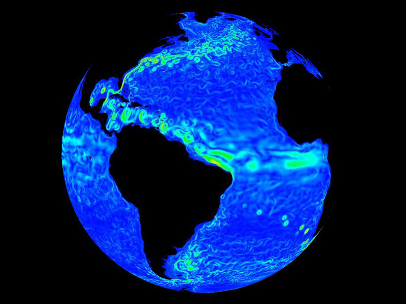
What’s the True Shape of An Ocean Eddy?

Jenessa Duncombe, Staff Writer by Jenessa Duncombe 25 July 201920 July 2022

Ocean eddies spin round and round, but not in a perfect circle.

Satellite image of the East Coast of North America
Posted inResearch Spotlights

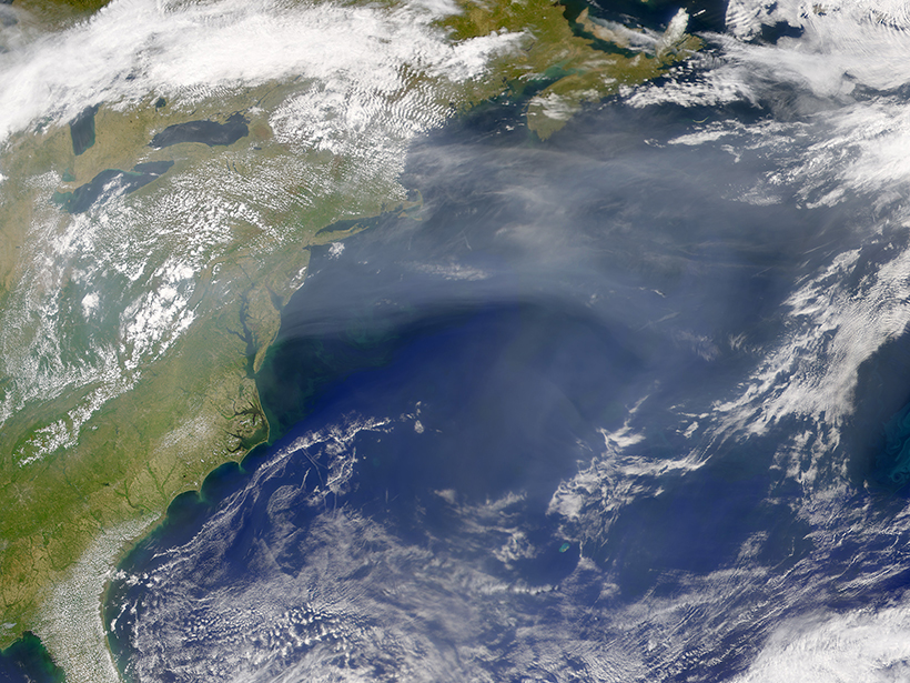
Demystifying Sea Level Changes Along the New England Coast

by Terri Cook 18 June 20192 July 2024

No direct causal connection exists between coastal sea level changes and the strength of the North Atlantic’s overturning circulation, according to new, longer-term observational records.

Photo of a research vessel in front of a tidewater glacier
Posted inResearch Spotlights

Arctic Glacial Retreat Alters Downstream Fjord Currents

Sarah Stanley, Science Writer by Sarah Stanley 14 June 201914 March 2024

High-resolution mapping efforts could improve predictions of coastal changes as glaciers shrink around the world.

Figure showing changes in ocean surface temperature as a large iceberg and several small icebergs break off an ice shelf
Posted inEditors' Highlights

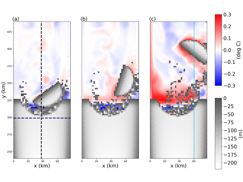
Creating Icebergs in Ocean Models Coupled to Ice Shelves

by L. Padman 6 June 201923 March 2023

Modeling icebergs as Lagrangian elements held together by numerical bonds provides insights into coupled exchanges of heat, freshwater, and momentum between large icebergs and the ocean.

Satellite image of a collapsed storm over atolls
Posted inResearch Spotlights

Pacific Carbon Uptake Accelerating Faster Than Expected

by E. Underwood 29 May 201911 August 2022

A new study suggests that shifting ocean currents drive faster carbon dioxide uptake.

Posts pagination

Newer posts 1 … 8 9 10 11 12 … 18 Older posts
Over a dark blue-green square appear the words Special Report: The State of the Science 1 Year On.

Features from AGU Publications

Research Spotlights

What Makes Mars’s Magnetotail Flap?

20 April 202620 April 2026
Editors' Highlights

How Space Plasma Can Bend the Laser of Gravitational Wave Detectors

24 April 202623 April 2026
Editors' Vox

Can Any Single Satellite Keep Up with the World’s Floods?

20 April 202620 April 2026
Eos logo at left; AGU logo at right

About Eos
ENGAGE
Awards
Contact

Advertise
Submit
Career Center
Sitemap

© 2026 American Geophysical Union. All rights reserved Powered by Newspack