• About
  • Special Reports
  • Topics
    • Climate
    • Earth Science
    • Oceans
    • Space & Planets
    • Health & Ecosystems
    • Culture & Policy
    • Education & Careers
    • Opinions
  • Projects
    • Postcards From the Field
    • ENGAGE
    • Editors’ Highlights
    • Editors’ Vox
    • Eos en Español
    • Eos 简体中文版
    • Print Archive: 2015–2025
  • Policy Tracker
  • Blogs
    • Research & Developments
    • The Landslide Blog
  • Newsletter
  • Submit to Eos
  • AGU.org
  • Career Center
  • Join AGU
  • Give to AGU
  • About
  • Special Reports
  • Topics
    • Climate
    • Earth Science
    • Oceans
    • Space & Planets
    • Health & Ecosystems
    • Culture & Policy
    • Education & Careers
    • Opinions
  • Projects
    • Postcards From the Field
    • ENGAGE
    • Editors’ Highlights
    • Editors’ Vox
    • Eos en Español
    • Eos 简体中文版
    • Print Archive: 2015–2025
  • Policy Tracker
  • Blogs
    • Research & Developments
    • The Landslide Blog
  • Newsletter
  • Submit to Eos
Skip to content
  • AGU.org
  • Career Center
  • Join AGU
  • Give to AGU
Eos

Eos

Science News by AGU

Support Eos
Sign Up for Newsletter
  • About
  • Special Reports
  • Topics
    • Climate
    • Earth Science
    • Oceans
    • Space & Planets
    • Health & Ecosystems
    • Culture & Policy
    • Education & Careers
    • Opinions
  • Projects
    • Postcards From the Field
    • ENGAGE
    • Editors’ Highlights
    • Editors’ Vox
    • Eos en Español
    • Eos 简体中文版
    • Print Archive: 2015–2025
  • Policy Tracker
  • Blogs
    • Research & Developments
    • The Landslide Blog
  • Newsletter
  • Submit to Eos

currents

A seal with an antenna strapped to its head sits in a patch of grass and beams at the camera.
Posted inResearch Spotlights

Seals Help Scientists Make Discoveries in Antarctica’s Bellingshausen Sea

by Nathaniel Scharping 4 June 20242 July 2024

By analyzing hydrographic information gathered by seals and an undersea glider, researchers found new meltwater currents, as well as a new seafloor trough.
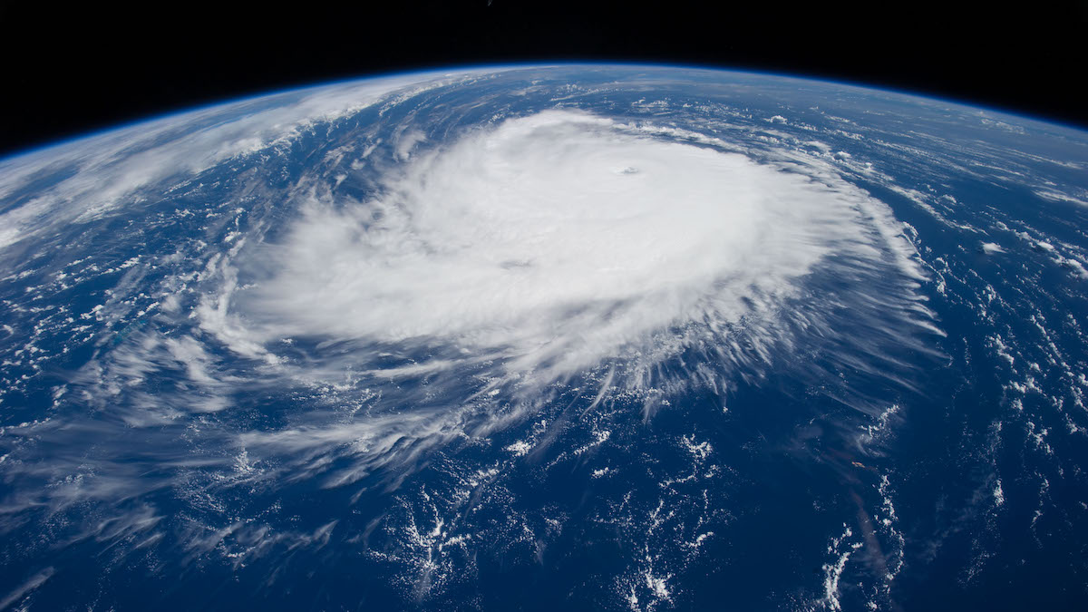
A satellite image of Hurricane Edouard over the Atlantic Ocean
Posted inNews

2024 Could Be Among Most Active Hurricane Seasons Ever

by Grace van Deelen 23 May 202423 May 2024

A new NOAA report predicts an extraordinarily active Atlantic hurricane season spurred by record ocean temperatures and a shift to La Niña conditions.

Tan-colored coral is surrounded by blue water and red, yellow, and blue fish.
Posted inNews

Coral Larvae Journey Far and Wide in the Western Indian Ocean

Katherine Kornei, Science Writer by Katherine Kornei 30 April 202430 April 2024

Researchers mapped coral reef connectivity across the Seychelles archipelago to inform conservation efforts in the face of climate change.

A simulated image of Earth with Antarctica at the center. Swirls and waves in the ocean represent the speed and direction of currents and eddies.
Posted inResearch Spotlights

Verifying the Mathematics Behind Ocean Modeling

by Nathaniel Scharping 11 April 202415 April 2024

A series of test cases designed to confirm the accuracy of ocean models could help improve our understanding of large-scale climate processes.

A beach crowded with people
Posted inNews

Melting Ice in the Polar North Drives Weather in Europe

Katherine Kornei, Science Writer by Katherine Kornei 28 March 202428 March 2024

Influxes of meltwater into the North Atlantic eventually lead to warmer and drier conditions over Europe.

A bed of sand underwater.
Posted inNews

Mars as a Driver of Deep-Sea Erosion

by Grace van Deelen 25 March 202426 March 2024

An analysis of breaks in deep-sea sediment links the geological record to a 2.4-million-year cycle that heats Earth and ventilates our oceans.

Ocean eddies swirl across a coastal stretch in the North Atlantic Ocean.
Posted inNews

Mapping the Ocean’s Motion Energy

by Veronika Meduna 5 March 20245 March 2024

The ocean is a central component of Earth’s climate system. But it is in perpetual motion, and understanding the transfer of kinetic energy is key to better ocean models.

A satellite image of a chain of islands. The ocean looks glossy and mirrorlike, with a large ripple expanding upward from between two of the landmasses.
Posted inResearch Spotlights

Step Aside, Internal Tides: Supercomputer Modeling Improves Satellite Altimetry Precision

by Rebecca Owen 26 February 202426 February 2024

New supercomputer models can provide valuable information about the ocean’s layers and movements, particularly slow moving features such as eddies and currents.

Schematic diagram from the study.
Posted inEditors' Highlights

How Nutrients Get Back Up to the Surface Ocean

by Nicolas Gruber 10 January 20248 January 2024

A new dual isotope tracer technique is used to assess the role of a number of poorly understood nutrient supply mechanisms fueling biological productivity in the ocean.

Visualization of the Kuroshio current.
Posted inEditors' Highlights

Nutrients at Depth Can Be Uplifted by the Kuroshio Large Meander

by Takeyoshi Nagai 8 December 20238 December 2023

Aperiodic, southward deflection of the Kuroshio, a.k.a. the Kuroshio large meander, uplifts the nutrients in deep layers to induce offshore phytoplankton bloom.

Posts pagination

Newer posts 1 2 3 4 5 … 18 Older posts
Over a dark blue-green square appear the words Special Report: The State of the Science 1 Year On.

Features from AGU Publications

Research Spotlights

Making a Map to Make a Difference

11 February 202611 February 2026
Editors' Highlights

Rocky Shore Erosion Shaped by Multi-Scale Tectonics

16 February 202613 February 2026
Editors' Vox

A Double-Edged Sword: The Global Oxychlorine Cycle on Mars

10 February 202610 February 2026
Eos logo at left; AGU logo at right

About Eos
ENGAGE
Awards
Contact

Advertise
Submit
Career Center
Sitemap

© 2026 American Geophysical Union. All rights reserved Powered by Newspack