
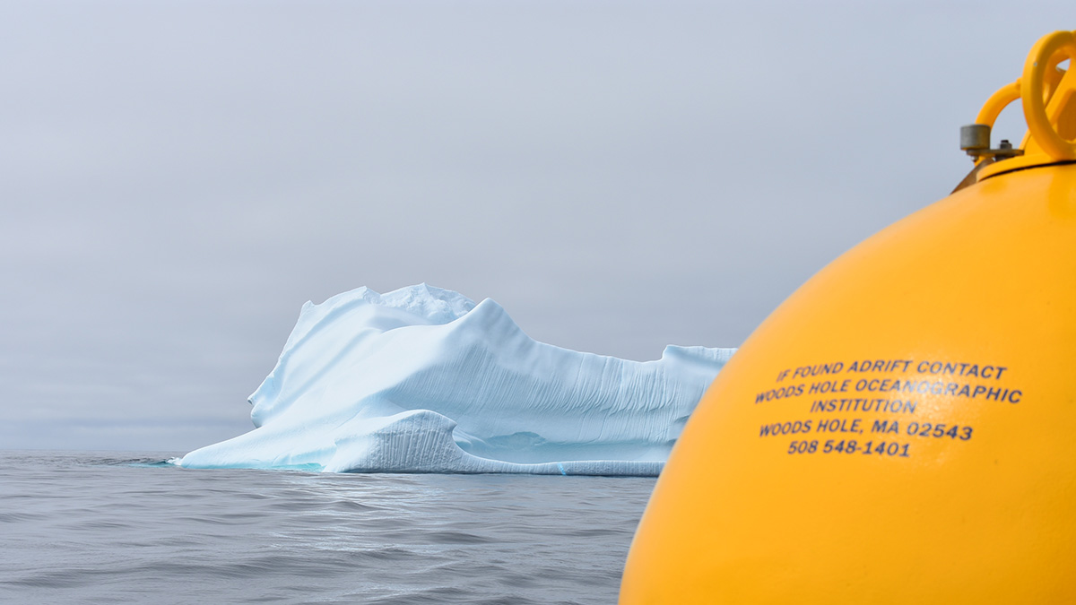
Virtual particles released in the Labrador Current revealed that the westward penetration of the current into the shelf seas is inhibited by warm core rings emanating from the Gulf Stream.
currents
Posted inEditors' Highlights
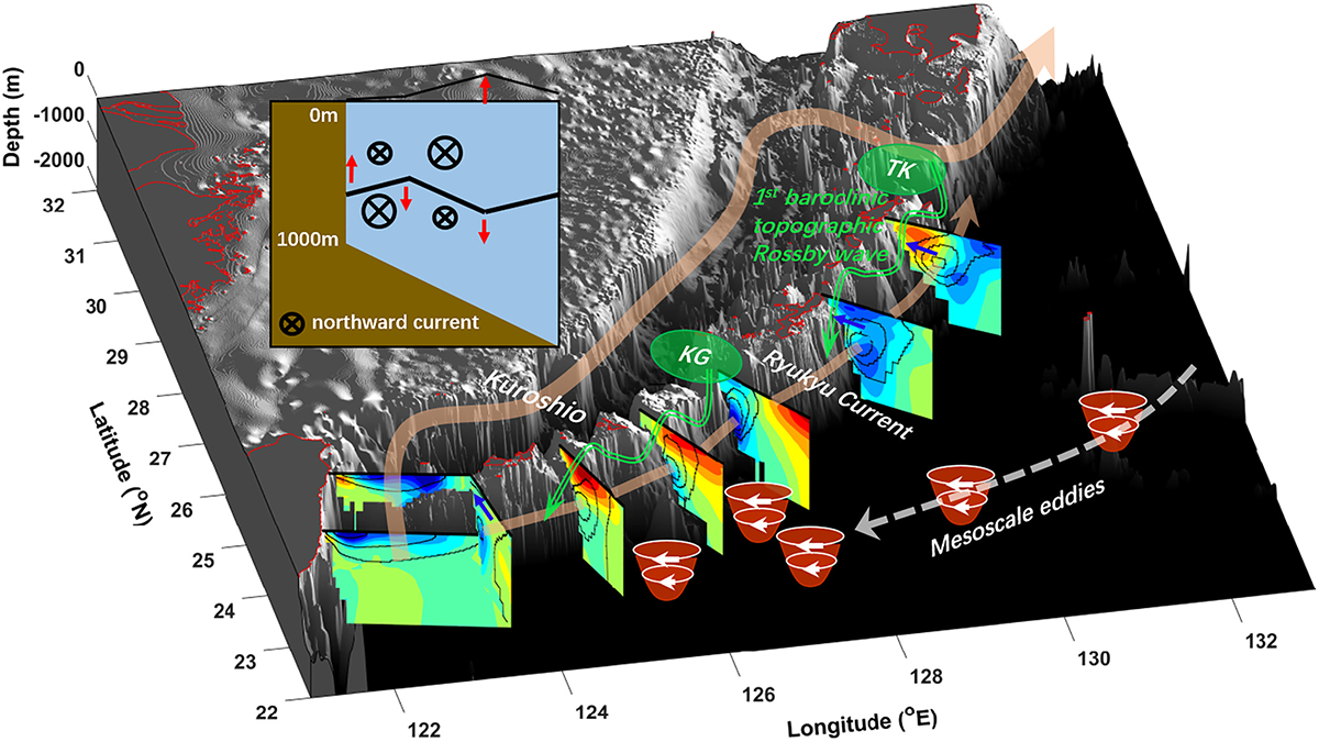
Weakened Kuroshio Slows Down the Ryukyu Current
A combination of the weakened Kuroshio in the Tokara Strait and an increase in anticyclonic eddies led to the slowdown of the Ryukyu Current from 1993 to 2018.
Posted inResearch Spotlights
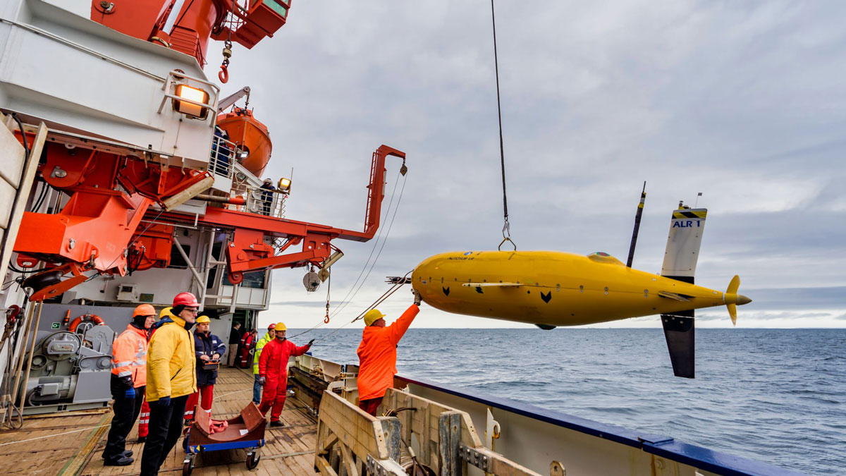
Exploring a Warm Water Inflow Below an Antarctic Ice Shelf
Researchers guided an autonomous underwater submarine to capture the first direct observations of a warm water current flowing in below the Filchner-Ronne Ice Shelf in Antarctica.
Posted inEditors' Highlights
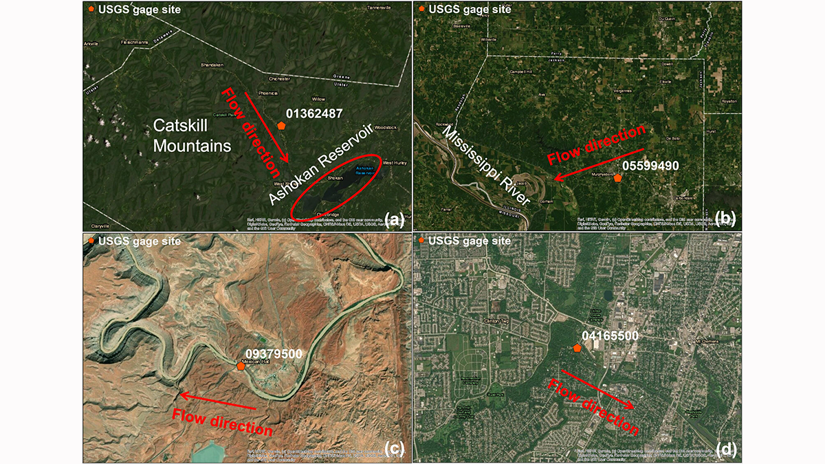
Disentangling River Water Turbidity and its Flow
A new study shows why fine sediments in rivers are not simply proportional to the water flow across the United States.
Posted inResearch Spotlights
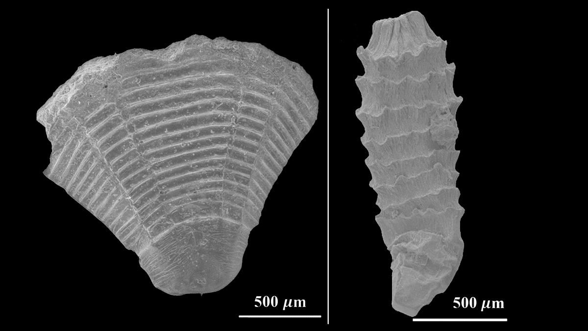
Fluid Dynamics of Tiny, Ancient Marine Animals
Water flow simulations using 3D models of fossils yield new clues to the evolution of organisms known as medusozoans.
Posted inResearch Spotlights
When Winds and Currents Align, Ocean Mixing Goes Deep
Slantwise convection in the Irminger Sea off Greenland appears to mix ocean water to deeper depths than previously thought, representing an important contribution to Atlantic overturning.
Posted inEditors' Highlights
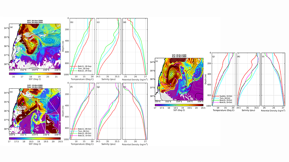
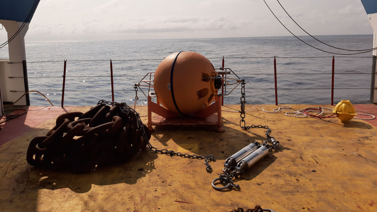
How do Bob and Tom Eddies Meet, Pair-Spin, and Twist?
Autonomous float data reveal that mergers of two eddies, known to have spiraling subducting water surrounding each other, happens more frequently than previously thought.

Posted inEditors' Highlights
Two Kinds of Warm Core Rings Emanate From the Gulf Stream
A new study reveals that long-lived warm core rings found in the “Ring Corridor”, a narrow path north of the Gulf Stream, have two different formation mechanisms.
Posted inENGAGE, News
River Floods Can Trigger Powerful Underwater Landslides
A record-length turbidity current triggered by river flooding has revealed a new link between the surface and the deep sea.

Posted inENGAGE, News
Melting Sea Ice May Mean the End of Driftwood in Iceland
Driftwood floats thousands of kilometers from Siberia to Iceland, but it may drift no longer by 2060 due to climate change.