Strengthening societal resilience by focusing on the interactions between natural hazards, the built environment, and human societies.
disaster preparedness

Posted inResearch Spotlights
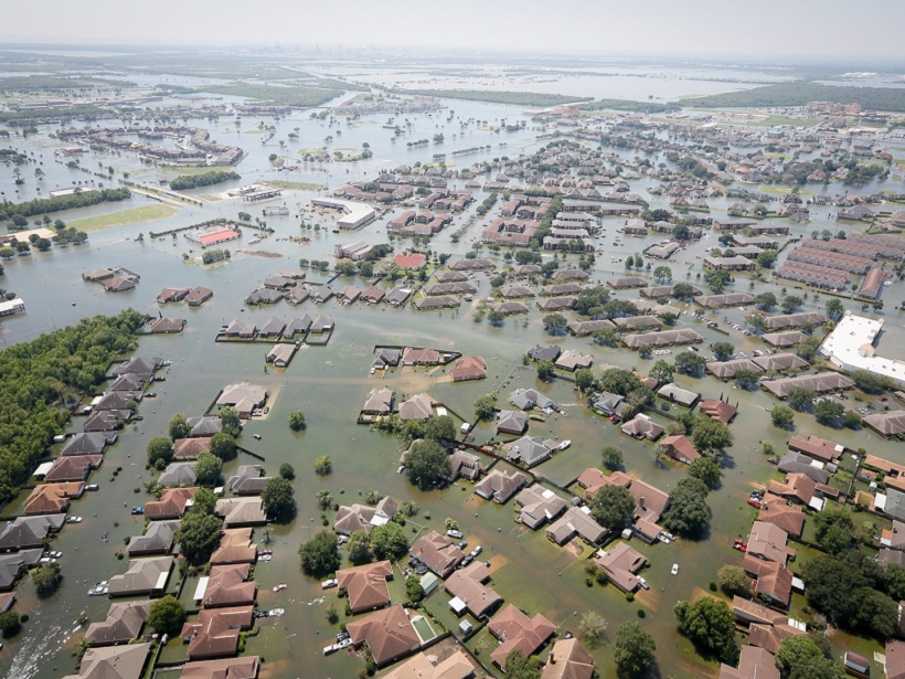
What Is a Nuisance Flood, Exactly?
A more precise definition could help cities and governments prepare and respond to hazards.
Posted inEditors' Highlights
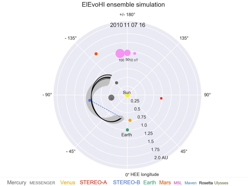
Forecasting the Threat from the Sun
Ensemble techniques are opening a path toward space weather forecasts that give deeper understanding of the risk posed by each solar storm that approaches our planet.

Posted inNews
Steam-Driven Blasts Last Seen at Kīlauea in 1924 May Recur
Sinking magma levels and rockfalls prompt warnings, flight restrictions, and the shutdown of Hawai’i Volcanoes National Park.

Posted inEditors' Vox
Are We Prepared for the Next Mega Eruption?
The frequency of eruptions with a Volcanic Explosivity Index of 7 is only one or two per thousand years but we cannot afford to be complacent.
Posted inResearch Spotlights
Visualizing One of the Most Hazardous Formations in Nature
A network of buoys provides a first glimpse of the seafloor beneath a volatile Italian caldera.

Posted inNews
Alaska Spotlights Its Health Risks from Climate Change
In the only Arctic state in the United States, Alaskans have already been affected by health repercussions of warming. More and worse lie ahead, a new state health report says.
Posted inFeatures
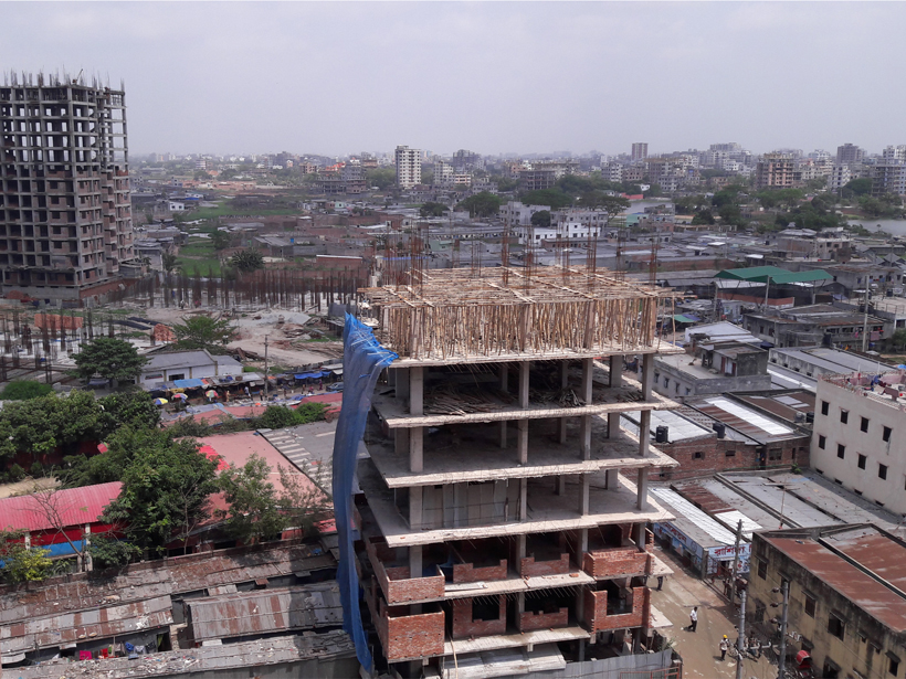
The Wicked Problem of Earthquake Hazard in Developing Countries
Earthquake preparation in Bangladesh is a conundrum, where crucial information is missing and investments often involve painful trade-offs.

Posted inEditors' Vox
Can Atmospheric Science Improve Global Disaster Resilience?
Scientific understanding of atmospheric hazards and their interconnectivity can contribute to international policy and disaster risk management.

Posted inScience Updates
Working Together Toward Better Volcanic Forecasting
A National Academies report highlights challenges and opportunities in volcano science.