
The Seismology at School in Nepal program aims to prepare rural communities for the next big earthquake.
disaster preparedness

Posted inAGU News
Deepwater Horizon’s Legacy of Science
The biggest oil spill in history resulted in billions of dollars in settlements—and a massive scientific movement.
Posted inFeatures
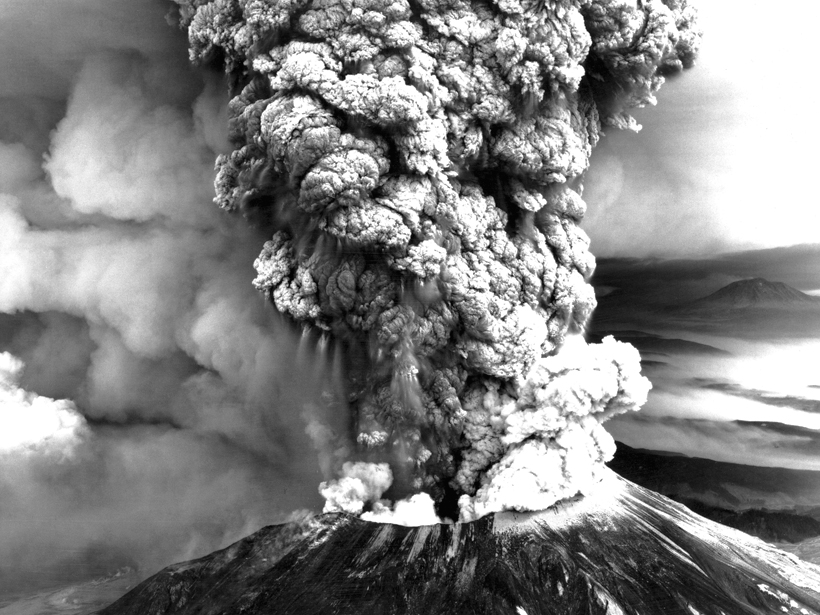
U.S. Readies Health Response for the Next Big Eruption
Forty years after the explosive eruption of Mount St. Helens, scientists, communities, and civic officials are evaluating plans to best protect public health before, during, and after an eruption.

Posted inNews
How to Turn Your Smartphone into an Earthquake Detector
A free smartphone app tracks earthquakes using your phone’s accelerometer. One day, the app could issue emergency warnings to those in danger.

Posted inNews
Sparks May Reveal the Nature of Ash Plumes
In lab experiments and models, researchers uncover how ash can affect the standing shock waves of erupting volcanoes. Their findings may lead to new predictions of volcanic ash hazards.

Posted inEditors' Vox
Society’s High Stakes Game of Chance Against Nature
We can better understand the risks of natural hazards and develop more effective mitigation strategies when geoscience and social science perspectives are combined.

Posted inScience Updates
Exposing Los Angeles’s Shaky Geologic Underbelly
Current calculations might underestimate the susceptibility of Los Angeles to earthquake shaking, so researchers and volunteers are deploying seismic networks near the city to remedy a data shortage.
Posted inNews
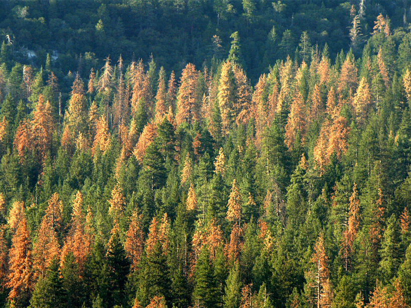
Foretelling Forest Death from Above
A satellite-based early-warning signal may spot the start of a forest’s decline and give forest managers more time to save its life.
Posted inNews
Podcast: Volcano Disaster Prepping
Third Pod from the Sun talks with volcanologist John Ewert, a founder of the U.S. Geological Survey’s Volcano Disaster Assistance Program.
Posted inScience Updates
Local Climate Projections: A Little Money Goes a Long Way
Three Nordic countries collaborate to build a suite of eScience tools to support long-term planning and decision-making in the face of a changing climate.