
Scientists and practitioners have identified research priorities to improve scientific understanding of postfire debris flows and meet decisionmaking challenges posed by this growing hazard.
Earth science
Posted inEditors' Highlights
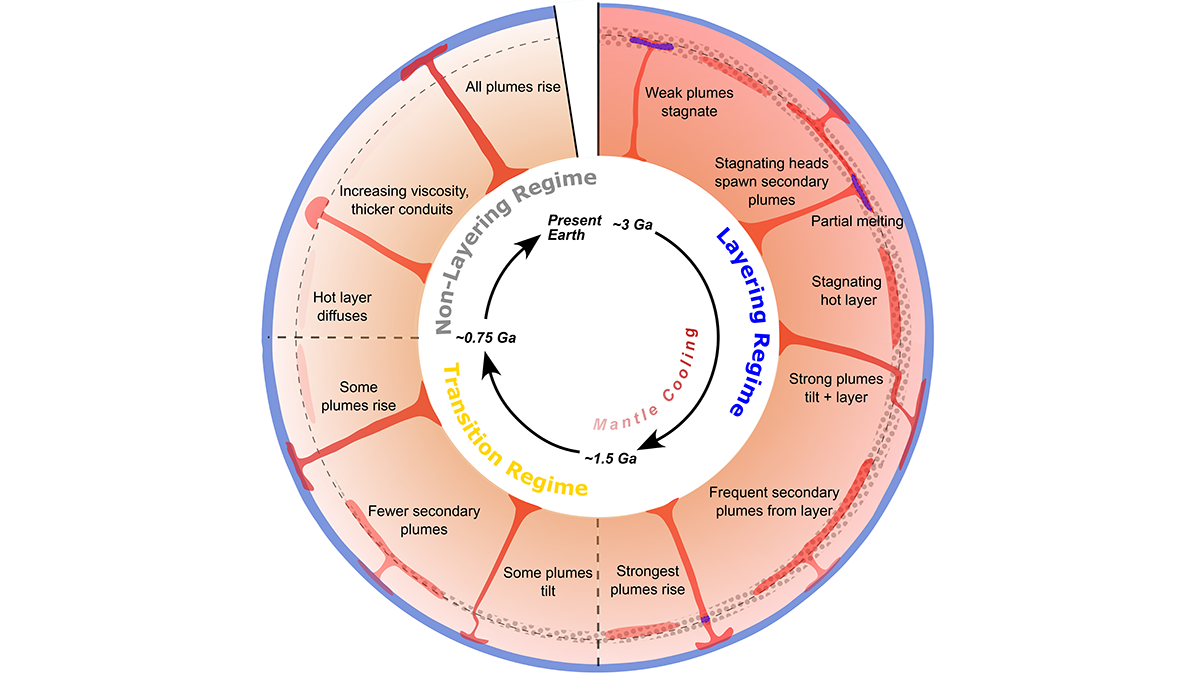
Modeling Mantle Dynamics as the Earth Slowly Cools
An update of the convection code ASPECT enables full coupling of plume dynamics with buoyancy effects of transition zone phase relations, showing how early layering gave way to whole-mantle plumes.
Posted inEditors' Highlights
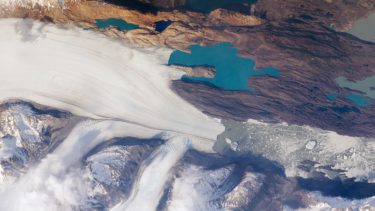
The Pulsed Pace of Glacial Erosion
New data from Lago Argentino, Patagonia reveal that glacial erosion occurs in discrete pulses, which challenges previous ideas that erosion rates have increased over time due to climate change.
Posted inAGU News
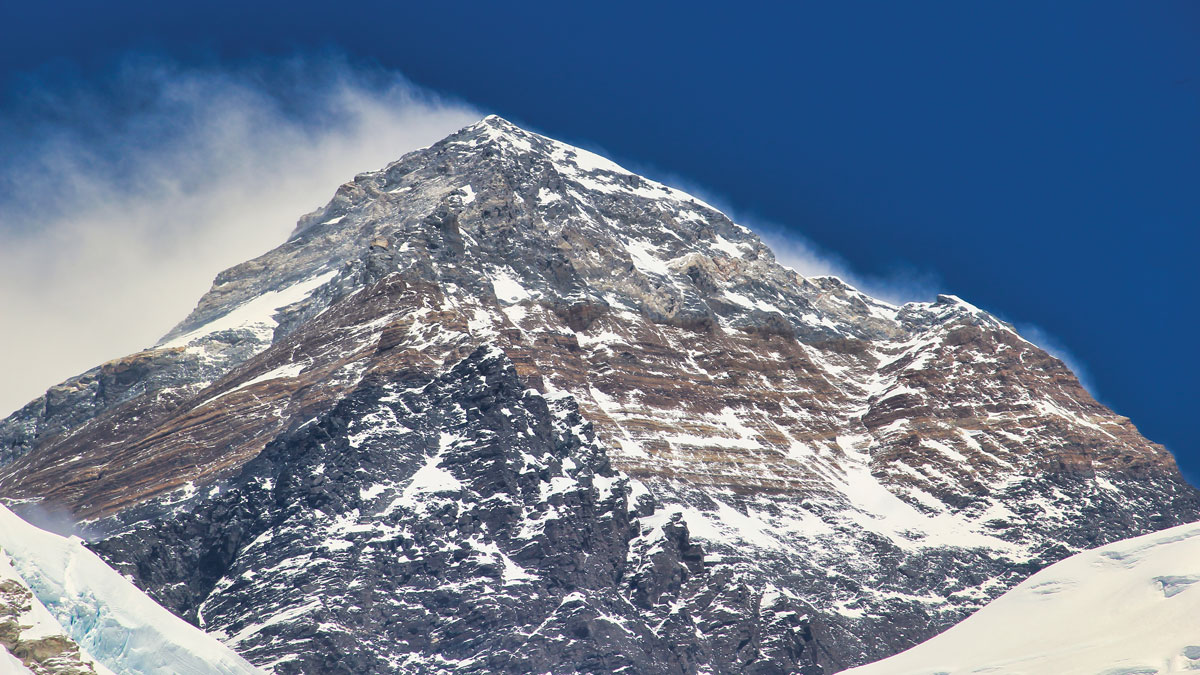
Geologic Mysteries at 8,000 Meters
Our March issue takes you on an epic journey with the rocks of Mount Everest, from seafloor to summit.

Posted inFeatures
How to Build the World’s Highest Mountain
The rocks of Mount Everest’s peak made an epic journey from seafloor to summit.

Posted inNews
Panama Canal Logistics Are at the Mercy of Weather and Climate
Regional weather variability and climate change make operating the canal a challenge.

Posted inEditors' Highlights
Ice boost! Why Rock Avalanches Containing Ice Travel So Far
Researchers identify a new mechanism that allows avalanches containing a mixture of rock and ice to travel very long distances.
Posted inEditors' Highlights
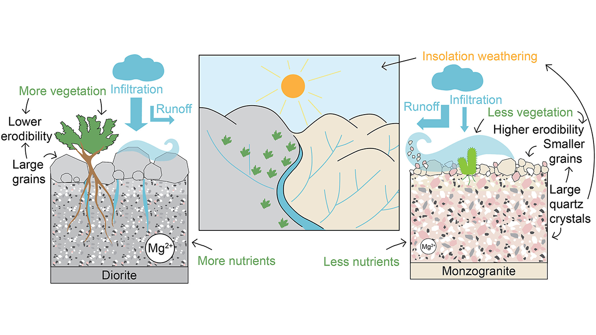
How Rock Type Shapes River Networks and Influences Landscape Evolution
A new study in Chile shows how small differences in rock type can drive large differences in erosion, vegetation, and river networks, illuminating the role of mineralogy in shaping landscapes.

Posted inScience Updates
Sensing Potential, Scientists Refine Thermal Imaging of Ecosystems
At a recent “bake-off,” researchers judged thermal infrared cameras and developed guidelines for their consistent use in studying vegetation temperatures, which illuminate vital ecosystem processes.
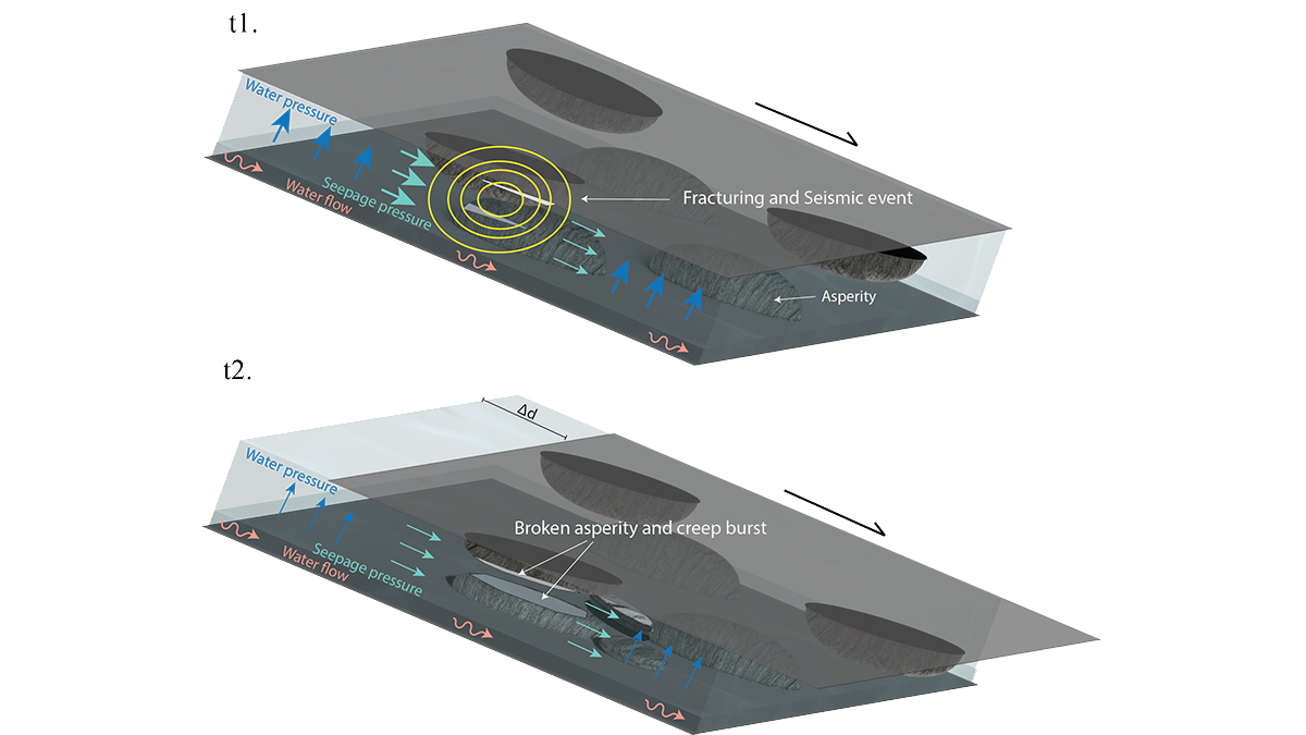
Posted inEditors' Highlights
Will It Run Away? Documenting Creep Bursts in a Slow-Moving Landslide
After 11-years of monitoring a slow-moving landslide and its shear zone in Norway, scientists reveal a complex pattern of creep bursts that require a rethink of the driving mechanisms.