• About
  • Special Reports
  • Topics
    • Climate
    • Earth Science
    • Oceans
    • Space & Planets
    • Health & Ecosystems
    • Culture & Policy
    • Education & Careers
    • Opinions
  • Projects
    • Postcards From the Field
    • ENGAGE
    • Editors’ Highlights
    • Editors’ Vox
    • Eos en Español
    • Eos 简体中文版
    • Print Archive: 2015–2025
  • Policy Tracker
  • Blogs
    • Research & Developments
    • The Landslide Blog
  • Newsletter
  • Submit to Eos
  • AGU.org
  • Career Center
  • Join AGU
  • Give to AGU
  • About
  • Special Reports
  • Topics
    • Climate
    • Earth Science
    • Oceans
    • Space & Planets
    • Health & Ecosystems
    • Culture & Policy
    • Education & Careers
    • Opinions
  • Projects
    • Postcards From the Field
    • ENGAGE
    • Editors’ Highlights
    • Editors’ Vox
    • Eos en Español
    • Eos 简体中文版
    • Print Archive: 2015–2025
  • Policy Tracker
  • Blogs
    • Research & Developments
    • The Landslide Blog
  • Newsletter
  • Submit to Eos
Skip to content
  • AGU.org
  • Career Center
  • Join AGU
  • Give to AGU
Eos

Eos

Science News by AGU

Support Eos
Sign Up for Newsletter
  • About
  • Special Reports
  • Topics
    • Climate
    • Earth Science
    • Oceans
    • Space & Planets
    • Health & Ecosystems
    • Culture & Policy
    • Education & Careers
    • Opinions
  • Projects
    • Postcards From the Field
    • ENGAGE
    • Editors’ Highlights
    • Editors’ Vox
    • Eos en Español
    • Eos 简体中文版
    • Print Archive: 2015–2025
  • Policy Tracker
  • Blogs
    • Research & Developments
    • The Landslide Blog
  • Newsletter
  • Submit to Eos

Earth science

Satellite view of half of Earth against a black background showing parts of East Asia and Oceania; it has land surface temperature data, represented on a blue (cold) to red (hot) rainbow color scale, superimposed on it.
Posted inScience Updates

Geostationary Satellite Applications Expand into Land Monitoring

by Xiangzhong Luo, Misaki Hase, Xuanlong Ma, Yuhei Yamamoto and Kazuhito Ichii 13 March 202613 March 2026

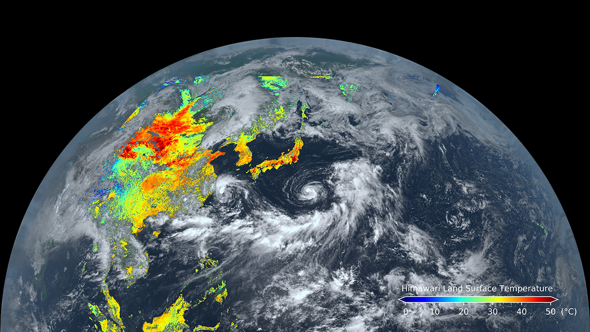
Known for their weather-observing prowess, these satellites can also track land surface processes and disturbances over broad areas in near-real time.

An aerial photo shows a green landscape with a large rock formation in the distance at sunset.
Posted inNews

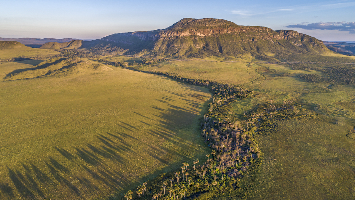
These Underprotected Brazilian Wetlands Store Carbon with Staggering Density

by Grace van Deelen 12 March 202612 March 2026

The Cerrado, largely overlooked in climate science and policy, is a critical carbon sink, according to new research.

Diagram from the article.
Posted inEditors' Highlights

Robustness Through Diversity: Learning from Heterogeneous Aquifers

by Stefan Kollet and Alberto Bellin 12 March 202612 March 2026

Learning from diverse aquifer structures, which are all over the place, leads to robust inverse methods.

Photo of ice sheets.
Posted inEditors' Vox

How Radar Reveals the Hidden Fabric of Ice Sheets

by Benjamin H. Hills, T. J. Young, David Lilien, Tamara Gerber and Matthew Siegfried 9 March 20269 March 2026

A new review describes how measuring the polarization of radar waves in ice reveals glacier crystal structure, with implications for understanding past and future ice flow and sea-level rise.

Satellite images of supraglacial rivers.
Posted inEditors' Highlights

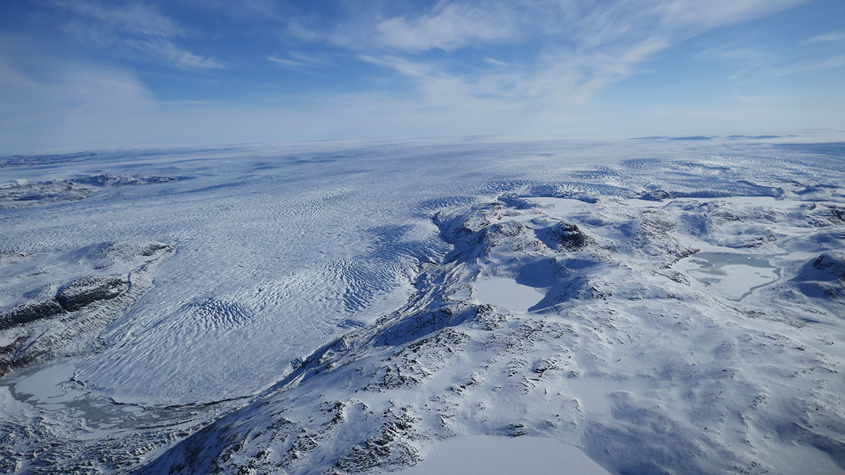
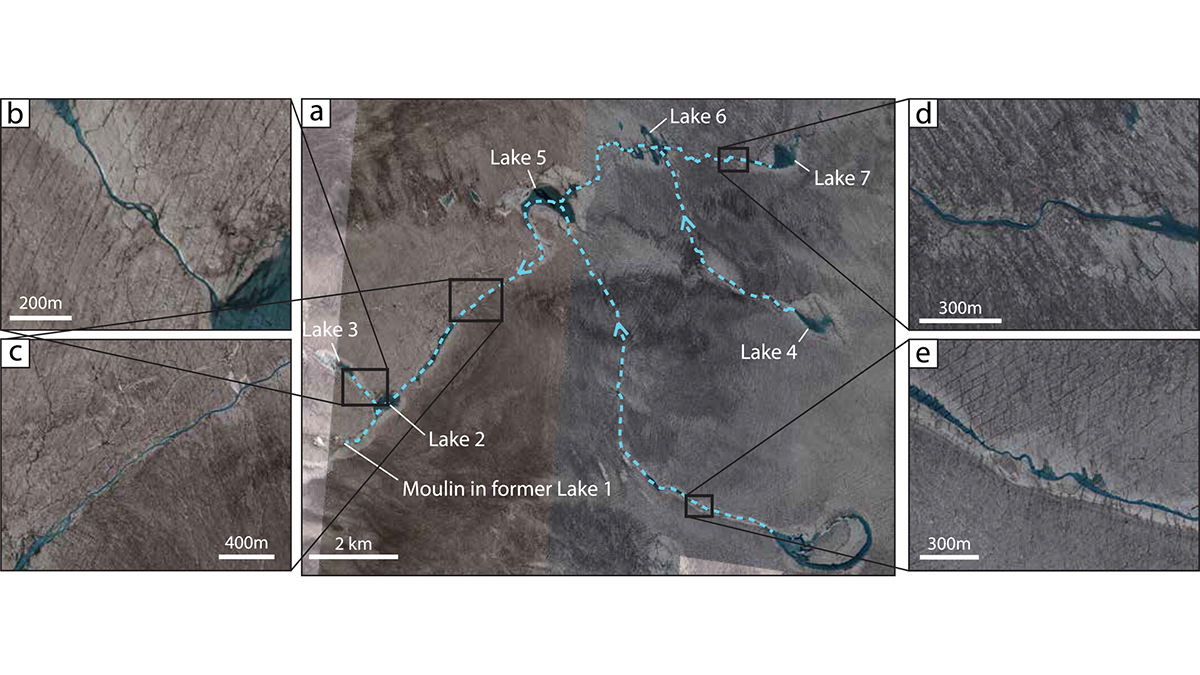
The Fate of the Greenland Ice Sheet: Deep Learning from SkySat Images

by Alberto Montanari 9 March 20269 March 2026

Surface meltwater ponding and drainage in the Greenland Ice Sheet is analyzed at high spatial and temporal resolution through SkySat imagery and deep learning.

Hell’s Kitchen and 42nd Street during the COVID-19-related medical distancing protocol in April 2020.
Posted inNews

COVID-19 Shutdowns Saw Human Emissions Slow, but Atmospheric Methane Surged

by Ryan Green 6 March 20266 March 2026

An uptick in wetland emissions, as well as a scarcity of atmospheric OH radicals, contributed to the counterintuitive methane spike.

Four ovals show a rough outline of Earth and its continents, overlaid with blue and red splotches.
Posted inNews

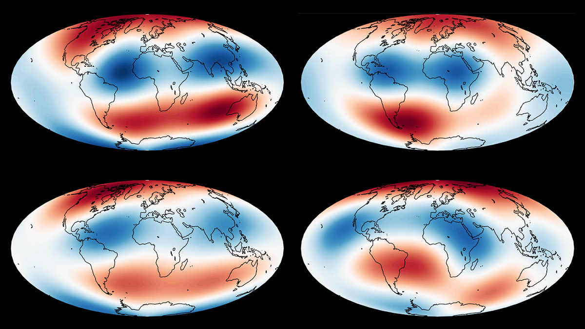
What do BLOBs Have to Do with Earth’s Magnetic Field? A Lot, It Turns Out

by Bill Morris 5 March 20265 March 2026

Enormous provinces of superheated mantle exert a powerful influence over our planet’s magnetic field, researchers have discovered.

A map showing continental mantle earthquakes around the world.
Posted inNews

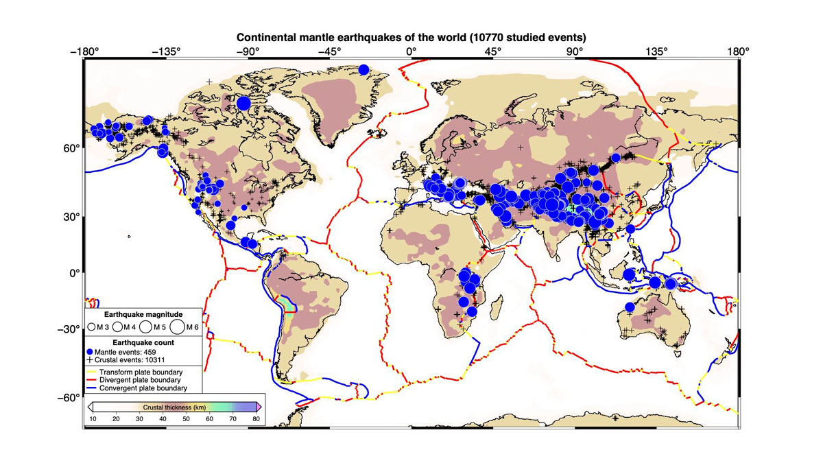
Scientists Create the First Map of Deep Earthquakes Beneath Continents

by Larissa G. Capella 5 March 20265 March 2026

Scientists once thought Earth’s continental mantle was too weak for earthquakes. A new global map of 459 deep tremors suggests otherwise.

Aerial view of an Atacama lithium mine shows three clusters of large rectangular evaporation ponds in shades of blue, teal, and pink scattered across a gray salt flat.
Posted inNews

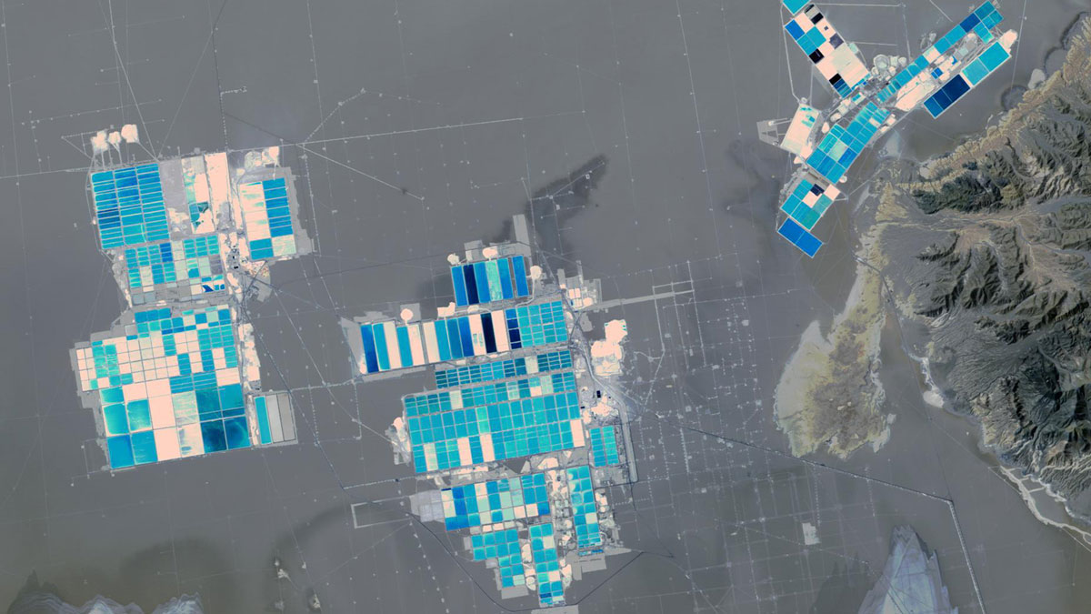
Engineering a Cleaner Way to Extract Lithium

by Andrew Chapman 4 March 20264 March 2026

The new chemical solvent technique could cut water use, speed extraction, and unlock reserves like California’s Salton Sea.

A satellite image shows the edge of an Antarctic ice sheet meeting a frozen ocean.
Posted inResearch & Developments

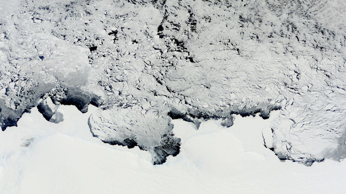
Antarctic Ice Sheet Has Lost a Connecticut-Sized Amount of Ice Over the Past 30 Years

by Grace van Deelen 2 March 20262 March 2026

A new study of Antarctica has found that since 1996, its ice sheet has lost 12,820 square kilometers (nearly 5,000 square miles) of ice—nearly enough to cover the state of Connecticut, or 10 cities the size of Greater Los Angeles.

Posts pagination

Newer posts 1 … 7 8 9 10 11 … 160 Older posts
Over a dark blue-green square appear the words Special Report: The State of the Science 1 Year On.

Features from AGU Publications

Research Spotlights

As Wildfires Increase in the West, So Does Suppression Spending

10 June 202610 June 2026
Editors' Highlights

Soil Biogeochemistry Models Omit Key Processes Due to Geographic Bias

16 June 202616 June 2026
Editors' Vox

Small-Scale Indian Ocean Dynamics Underpin Marine Ecology and Climate

4 June 20263 June 2026
Eos logo at left; AGU logo at right

About Eos
ENGAGE
Awards
Contact

Advertise
Submit
Career Center
Sitemap

© 2026 American Geophysical Union. All rights reserved Powered by Newspack