Understanding how agriculture and land use affect nutrient flows and concentrations in the vast area of the Great Lakes is an essential step to developing sustainable management strategies.
Earth’s Future
Posted inEditors' Highlights
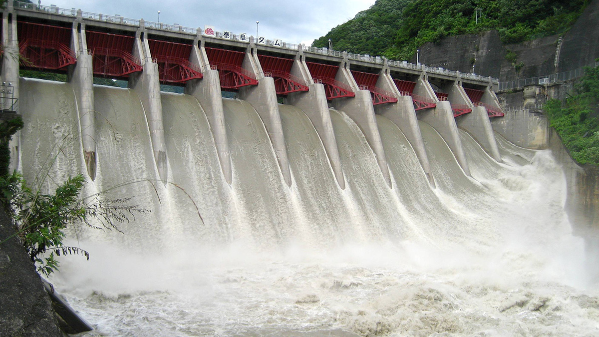
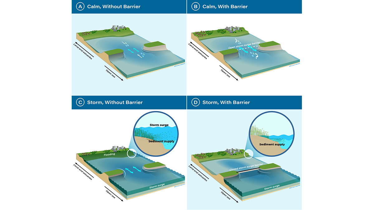
A Turning Point for Estuaries Worldwide
As estuarine barriers are built in response to sea level rise, flooding, and salinization, more research is needed to better understand their implications for human activities and ecosystems.

Posted inEditors' Highlights
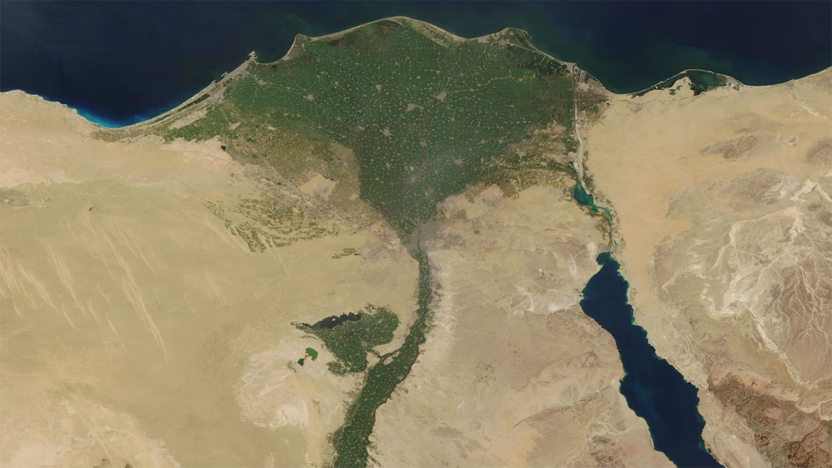
Tracking Heavy Metal Accumulation in the Nile Delta
Sediment measurements show that flow alterations and discharges are driving increasing concentrations of multiple heavy metals in the Nile Delta, threatening ecosystems, agriculture, and human health.
Posted inEditors' Highlights
Suivie de l’accumulation des métaux lourds dans le Delta du Nil
Les analyses de sédiments montrent que la réutilisation de l’eau non traitée et la construction de barrages entraînent l’augmentation des concentrations de métaux lourds dans le Delta du Nil, menaçant gravement les écosystèmes, l’agriculture et la santé humaine.
Posted inResearch Spotlights
How to Build a Climate-Resilient Water Supply
Scientists developed a new model to help water utility companies minimize weather-based disruptions to clean water access.

Posted inEditors' Highlights
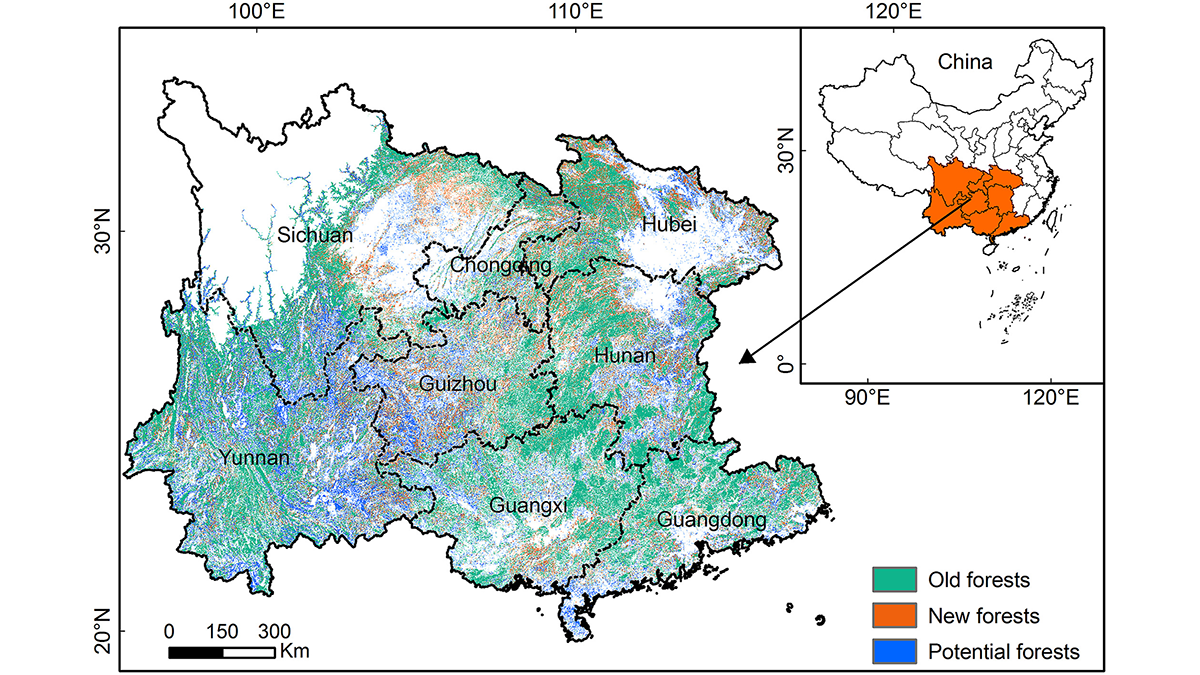
Quantifying the Potential of Forestation for Carbon Storage
Forestation projects in southern China over the past few decades have sequestered large amounts of carbon in tree biomass, but the region is approaching saturation of forest carbon storage capacity.

Posted inEditors' Highlights
An Innovative Approach to Model Complex Hurricane Flood Hazards
A new study shows that it is possible to produce regional assessments of how hurricane flood hazards change due to both evolving storm tides and precipitation rates in a warming climate.

Posted inResearch Spotlights
Far-Flung Forces Caused the 2021 Pacific Northwest Heat Wave
Air from thousands of kilometers away spiraled down to drape the Pacific Northwest in blistering heat.