
The society that led scientists through some of the most groundbreaking discoveries of the past century looks ahead to the next challenges with a Centennial symposium in late June.
geology

Posted inNews
Hiroshima Bomb Created Asteroid Impact–Like Glass
The glass rained from the sky as the bomb annihilated the Japanese city.
Posted inEditors' Highlights
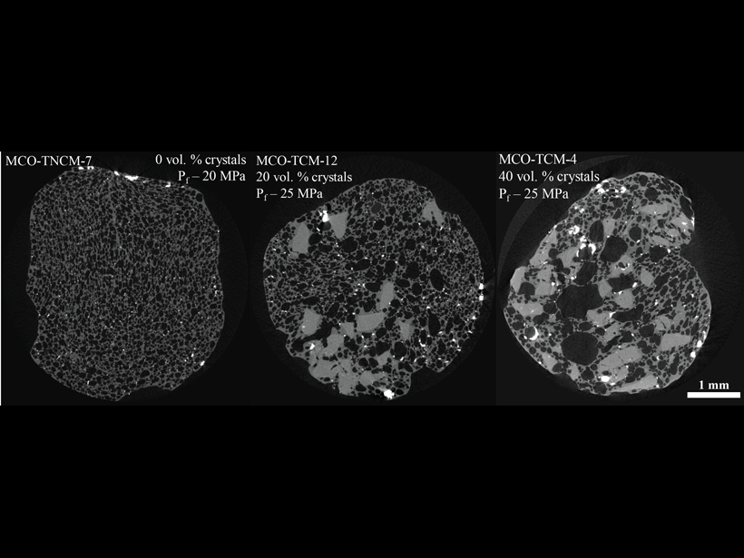
Crystals Connect Bubbles in Explosive Magmas
Hydrous silica-rich magmas can degas through connected bubble pathways when as little as 20% crystals are present, influencing transitions from explosive, Vulcanian-style eruptions to lava effusion.
Posted inNews
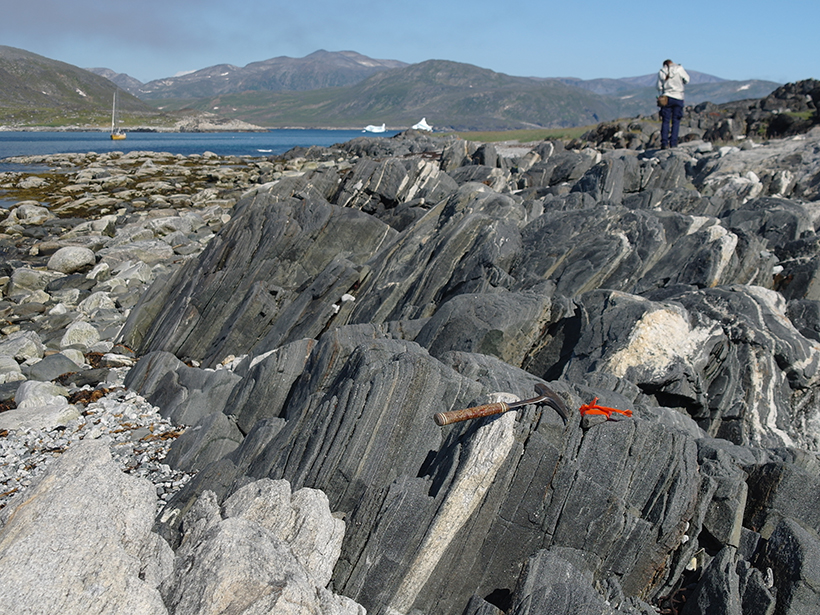
When Water Met Rock
Geologists discover rocks bearing the earliest known evidence of water interacting with rock on Earth’s surface.
Posted inEditors' Highlights
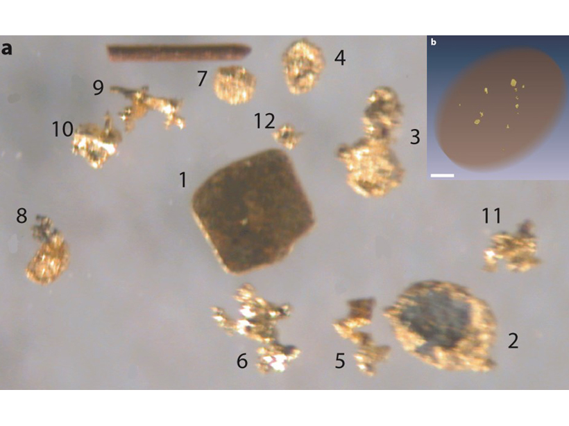
X-Ray Computed Tomography Detects Resolution Scale Gold Grains
A method combining partial-volume and blurring effects can be used to measure small features in computed tomography data volumes.
Posted inNews
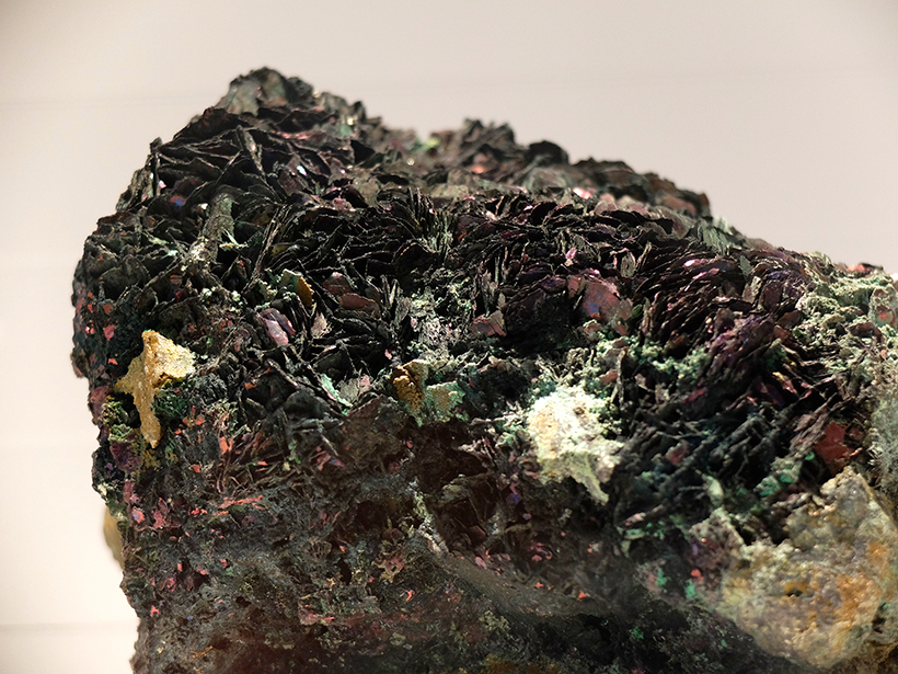
For Some Copper Deposits, Microbes Make Minable Minerals
Copper ores were long thought to form through purely chemical processes, but a recent study provides the strongest evidence yet that microbial metabolism drives mineral production.

Posted inNews
Precariously Balanced Rocks Reveal Earthquake History in Israel
Using the prevalence of unstable rock formations in Israel’s Negev Desert, researchers determined that historical earthquakes in the region were weaker than previously thought.

Posted inNews
Largest Delta Plain in Earth’s History Discovered in Arctic
If this Triassic period delta existed today, its footprint would equal about 1% of all land on Earth.

Posted inScience Updates
Project VoiLA: Volatile Recycling in the Lesser Antilles
Deep water cycle studies have largely focused on subduction of lithosphere formed at fast spreading ridges. However, oceanic plates are more likely to become hydrated as spreading rate decreases.

Posted inEditors' Highlights
Seismic Anisotropy Due to a Compositionally Layered Mantle
Investigating the role of layered rocks and compositional banding on mineral scale in generating seismic anisotropy in the mantle.