Earth scientists and communicators dealing with or studying climate change face many potential stressors. They need support and resources to maintain and improve their emotional well-being.
Hazards & Disasters

Posted inNews
The Layered Legacy of Clyde Wahrhaftig
As the geologist’s beloved guidebook gets a digital makeover, his personal contributions to the field shed light on who he was as a scientist.
Posted inEditors' Highlights
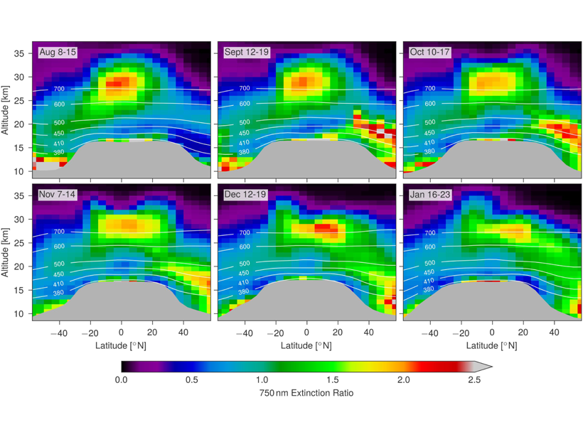
Satellite Measurements of Stratospheric Forest Fire Smoke
Intense boreal forest fires in August 2017 caused smoke plumes that reached record levels in the stratosphere; satellite measurements show that the effects rivaled a moderate volcanic eruption.
Posted inResearch Spotlights
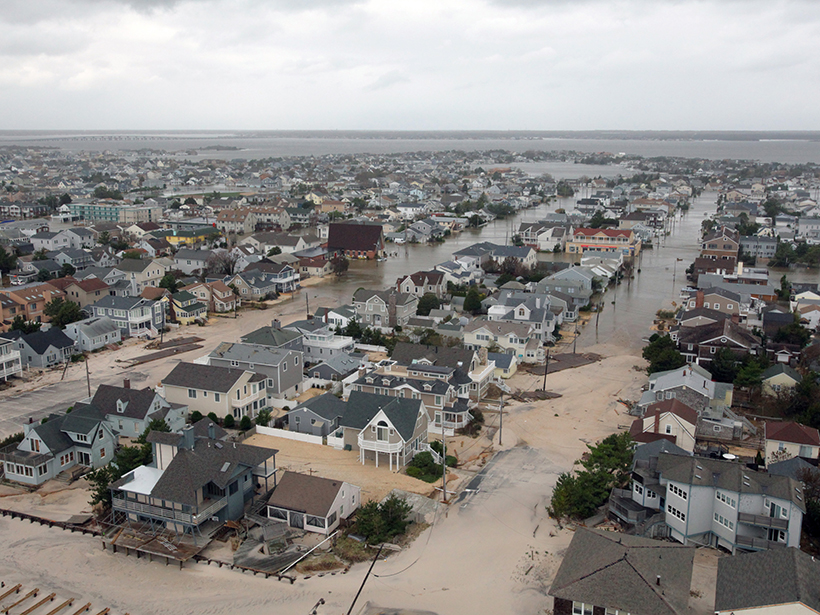
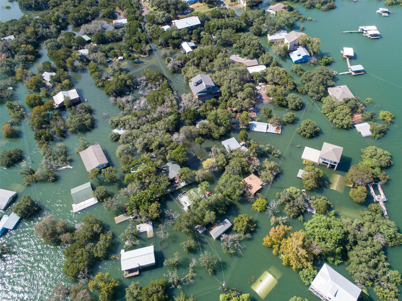
Sea Level Science Grapples with Uncertainty and Usability
Improved transdisciplinary approaches are needed to ensure that research on rising seas is useful for planning in coastal communities.
Posted inResearch Spotlights
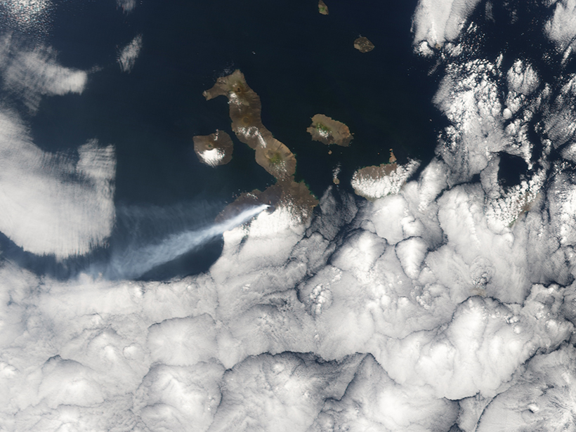
Forecasting Volcanic Eruptions with Artificial Intelligence
A machine learning algorithm automatically detects telltale signs of volcanic unrest.

Posted inResearch Spotlights
Sunlight Stimulates Brown Algae to Release Organic Carbon
Sargassum and other brown algae might be an underappreciated contributor of organic compounds called polyphenols to the open ocean.

Posted inFeatures
No Place to Flee
The Syrian refugee crisis has had far-reaching consequences for geologic risk in neighboring Lebanon, providing insights into the interplay between forced displacement and natural disasters.
Posted inFeatures
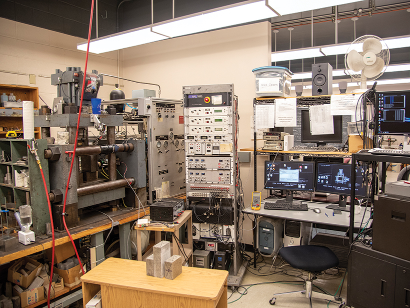
Machine Fault
Applying machine learning to subtle acoustic signals from an earthquake machine has revealed big clues about fault behavior in the lab.
Posted inNews
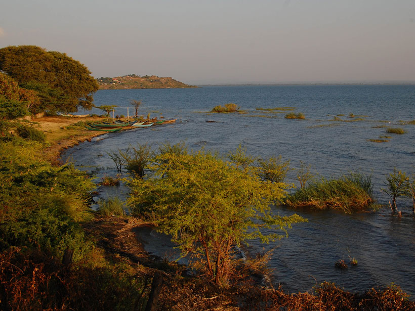
Dire and Drier Future for Lake Victoria
In the past, Lake Victoria dried out swiftly and often when rainfall was limited. Climate change might bring about those conditions again within a century.
Posted inNews
Hearing Explores Resilience to Climate-Related Natural Disasters
Experts call for more tools to help communities mitigate and adapt to climate change to curb the impacts and costs of natural disasters.