
Using examples from the year 2012, a new study estimates the health costs of deaths and illnesses associated with climate-sensitive events.
Hazards & Disasters
Posted inNews
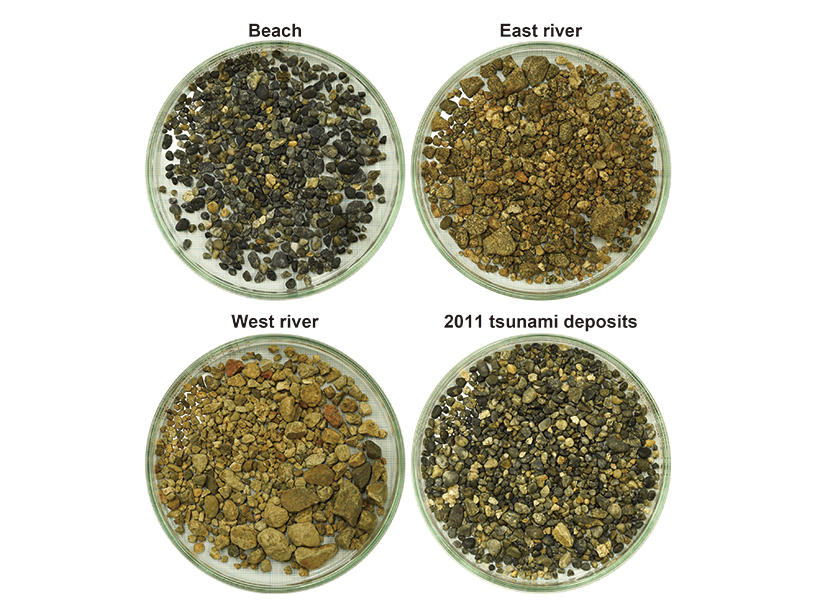
Gravel Gives Clues to the Strength of Paleotsunamis
The roundness of sediment deposits may shed light on how big tsunamis were in the past and how to evaluate hazards in the future.
Posted inNews
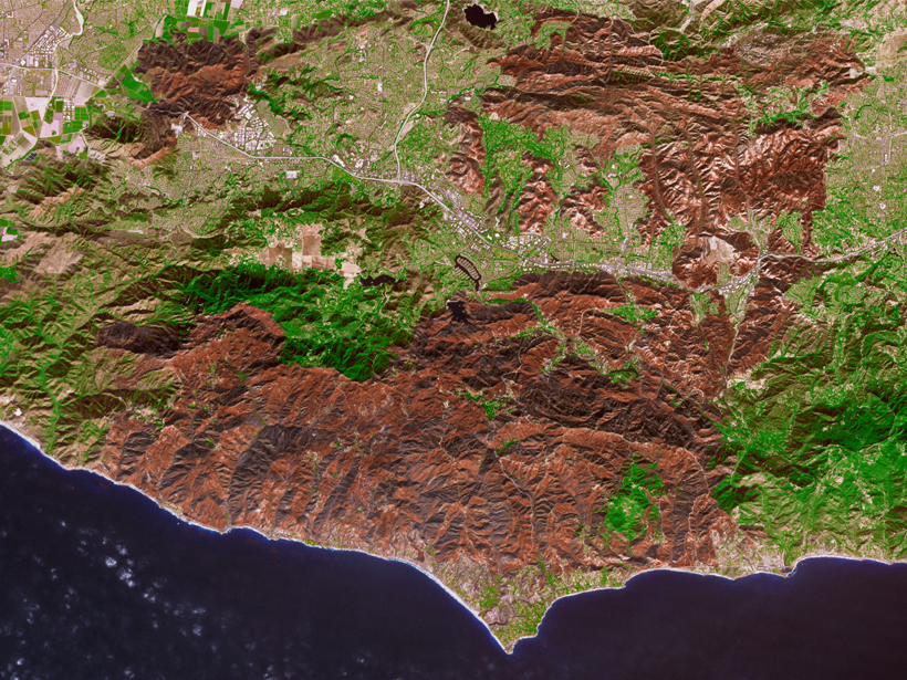
Wildfires Affect Water Resources Long After the Smoke Clears
Wildfires affect watersheds in myriad ways, from reducing evapotranspiration to changing soil repellencies, but new research suggests impacts on snowpack and runoff are the most significant.

Posted inNews
Heat Waves Are Blowing in the Wind
New research indicates that droughts in far-off places contribute to the amount of heat transported to regions experiencing heat waves.

Posted inFeatures
Louise Kellogg: Geoscientist, Mentor, Science Communicator
The geoscientist, who studied Earth’s mantle and believed strongly in the power of mentoring, passed away in April.
Posted inNews
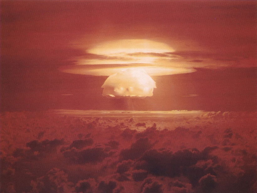
Nuclear Winter May Bring a Decade of Destruction
New climate models present a grim prediction of what would happen worldwide after a nuclear war between the United States and Russia.

Posted inNews
Golden State Blazes Contributed to Atmospheric Carbon Dioxide
A new case study investigates causes and effects of California’s 2017 wildfire season.

Posted inNews
Indigenous Knowledge Puts Industrial Pollution in Perspective
A 3-year project documents how climate change is affecting the sequestration of decades-old mining by-products in Canadian lakes.
Posted inNews
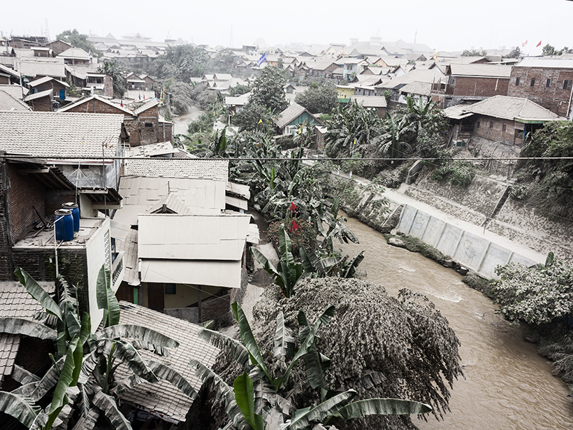
Explosive Volcanic Eruption Powered by Water-Saturated Magma
Little seismic unrest preceded the 2014 eruption of a stratovolcano in Indonesia, which suggests that the eruption was kick-started internally by volatile-triggered overpressure.

Posted inResearch Spotlights
How Are Microplastics Transported to Polar Regions?
New modeling indicates that global subsurface ocean currents distribute submerged microplastics along very different routes than those traveled by floating plastic debris.