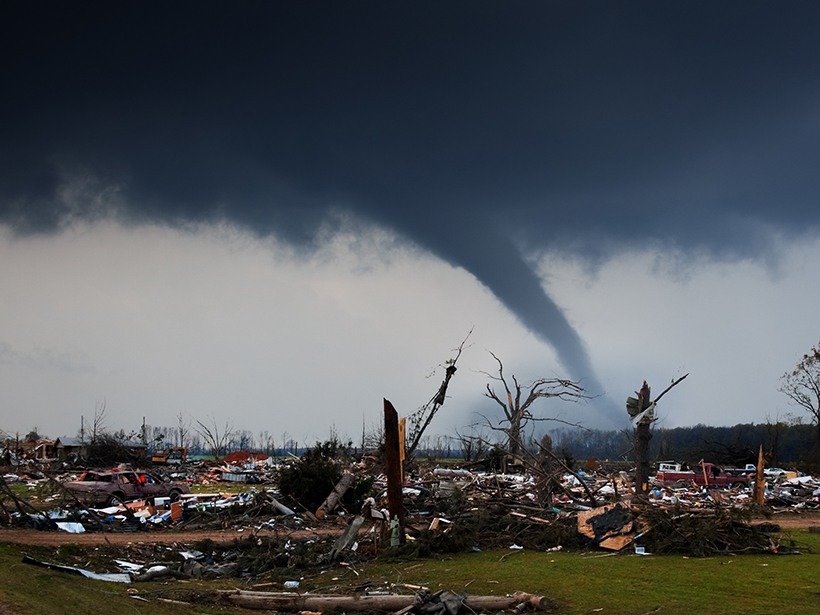
By mining records from 1808 to 2017, researchers can now show just how many lives have likely been saved by technology like radar.
Hazards & Disasters

Posted inResearch Spotlights
What Do People Drink When They Think Their Tap Water Isn’t Safe?
An analysis of nationwide housing data shows that minority households disproportionately bear the multibillion-dollar economic burden that comes from believing their water is unsafe.
Posted inFeatures
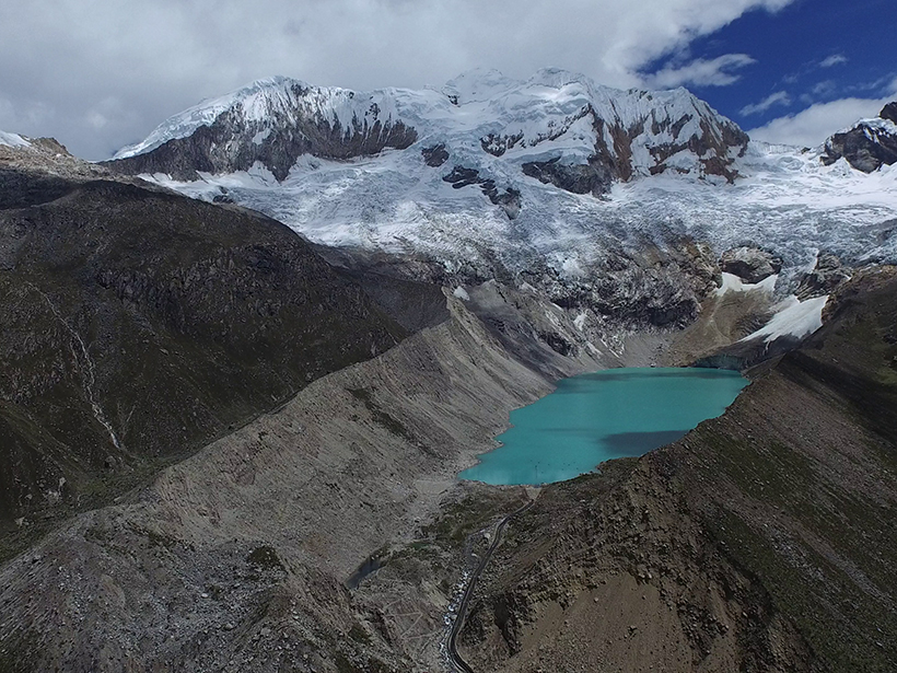
The Dangers of Glacial Lake Floods: Pioneering and Capitulation
During the past 70 years, Peruvian engineers virtually eliminated the risks posed by glacial lake floods. But climate change and a political blind eye are increasing the dangers once again.

Posted inResearch Spotlights
Observing Volcanoes from Space
The first multidecadal, satellite-based study of Latin America’s most active volcanoes could help researchers better predict eruptions.

Posted inNews
Varying Impact of Earthquake- and Monsoon-Induced Landslides
Using nearly 50 years of satellite data and records stretching back millennia, scientists determine the relative frequency—and the erosional power—of monsoon- and earthquake-induced landslides in Nepal.
Posted inEditors' Highlights
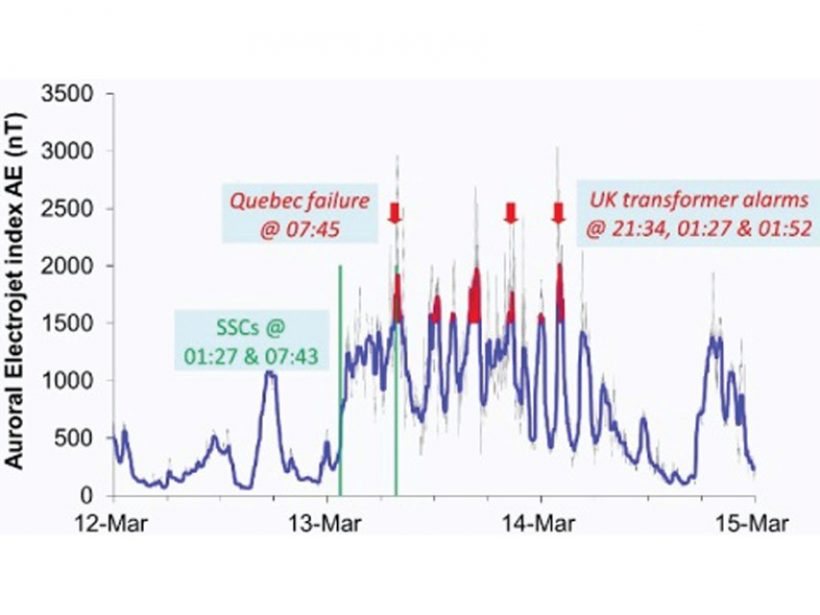
Assessing the Benefits of Improved Space Weather Forecasting
A new framework assesses the economic impact of space weather on power distribution networks and the supply of electricity.
Posted inEditors' Highlights
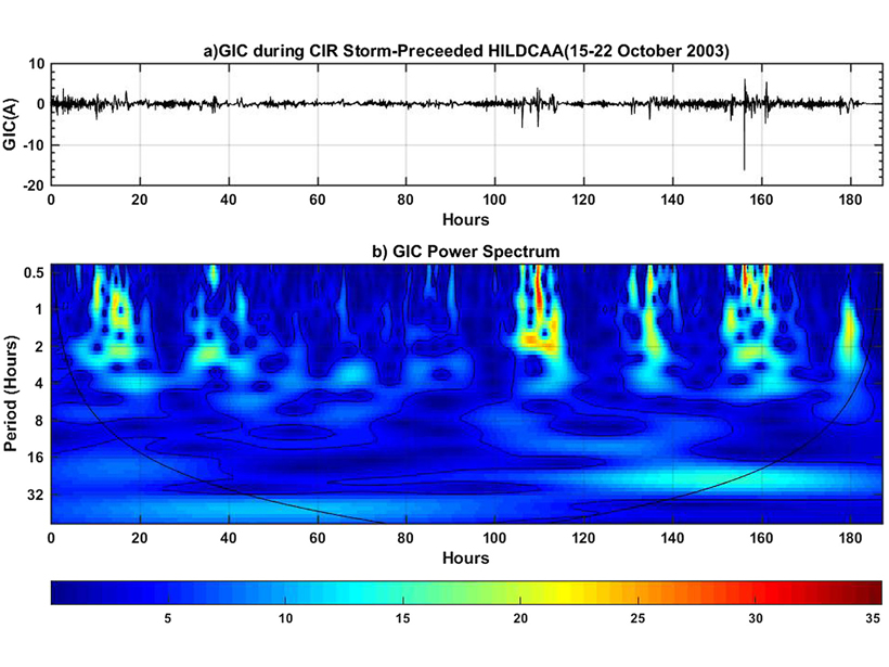
Can Moderate Space Weather Have Major Impacts?
Pipeline corrosion is an example of why we need better awareness of how long-term exposure to moderate space weather may have significant economic impact by slowly degrading vulnerable systems.
Posted inEditors' Vox
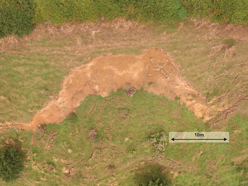
Downhill All The Way: Monitoring Landslides Using Geophysics
Developments in geophysical methods used to monitor surface and subsurface changes prior to landslides can lead to improved prediction and early warning.

Posted inNews
Brief, Repetitive Floods in Coastal Cities Cause Economic Losses
A case study in Annapolis is one of the first assessments of the effects of high-tide flooding on local revenue.
Posted inScience Updates
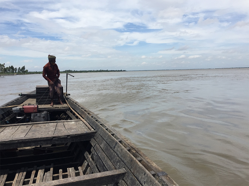
When Floods Cross Borders, Satellite Data Can Help
With so many eyes in the sky, residents living downstream from dams now have many ways to see—and prepare for—potential dangers.