
Los Himalayas han perdido 40% de su masa glaciar desde la Pequeña Edad de Hielo. El Este de Nepal y Bután han sufrido pérdidas de forma más acelerada.
Himalayas

Posted inNews
Himalayas Are Experiencing an “Exceptional” Loss of Glacial Mass
The Himalayas have lost 40% of their glacial mass since the Little Ice Age. East Nepal and Bhutan have experienced the most rapid losses.
Posted inNews
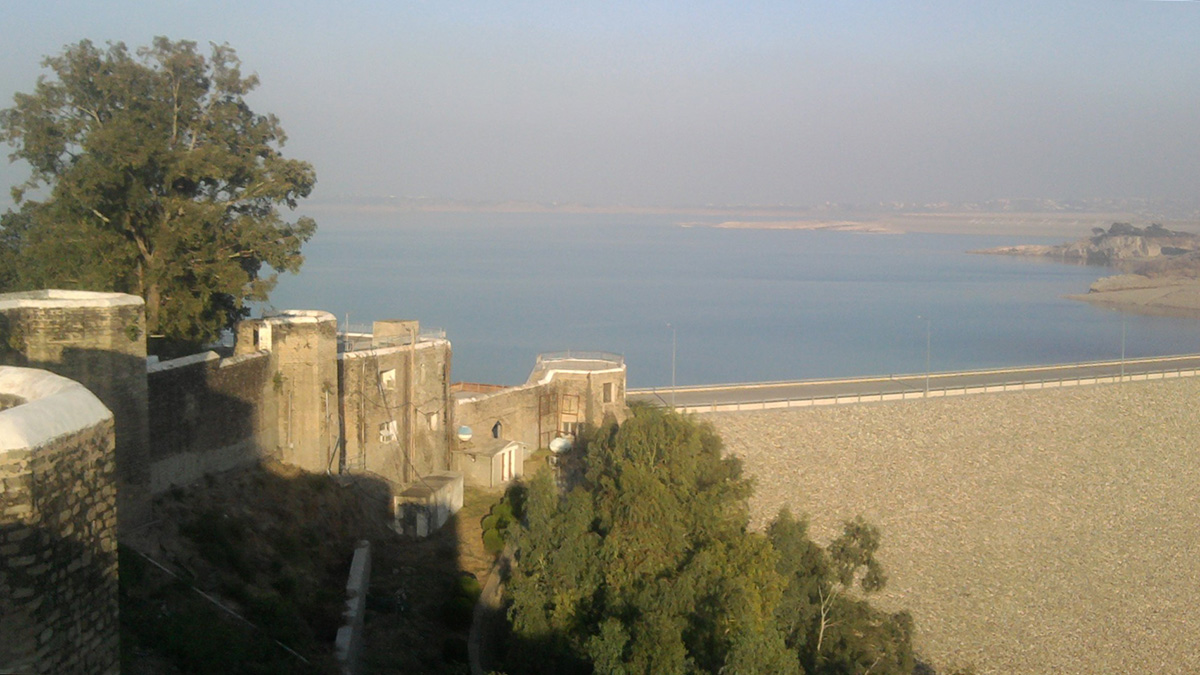
A Monsoon-Filled Reservoir Might Have Nudged a Fault to Fail
New research examines whether a sudden increase in water loading in Pakistan’s Mangla Dam might have been connected to the 2019 New Mirpur earthquake.
Posted inEditors' Highlights
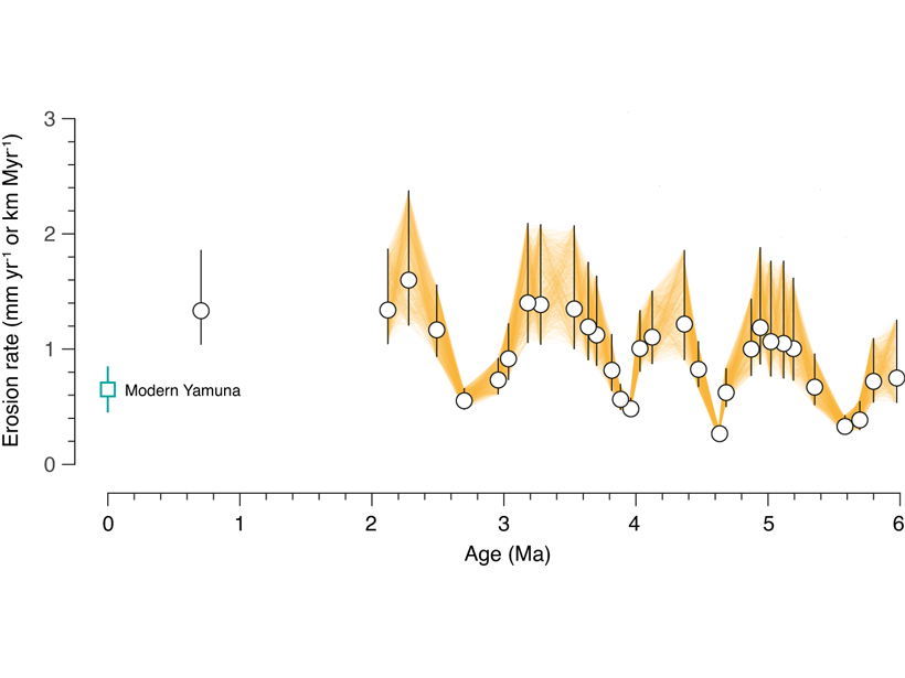
Himalayan Tectonics in the Driver’s Seat, Not Climate?
Earth’s oscillating climate is a natural guess to explain cyclic patterns in erosion, but new sediment data suggests that cyclicity may emerge from tectonic processes adding material to the Himalaya.
Posted inEditors' Highlights
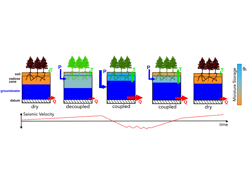
Understanding How Himalayan Water Towers Fill and Drain
Seismic data reveal how water is accumulated and released by Himalayan groundwater reservoirs which are key for predicting future freshwater resources for a large part of South Asia.

Posted inNews
Migrant Workers Among the Most Vulnerable to Himalayan Disasters
Critics say companies are failing to develop adequate emergency procedures to protect construction workers on hydropower plants in the Himalayas.
Posted inScience Updates
Discerning Structure and Seismic Hazards in the Sikkim Himalayas
A dense seismic network in operation since 2019 will provide new insights into the tectonics of seismically active Himalayan regions.

Posted inNews
El Monte Everest a veces puede sentirse más bajo que el K2
Las variaciones de la presión atmosférica en la cima del Everest afectan a la disponibilidad de oxígeno, modificando la percepción de la elevación de la cumbre unos cientos de metros.

Posted inNews
Development and Climate Change Contribute to a Himalayan Tragedy
Infrastructure projects like roads and dams destabilize slopes and compound the effects of glacial floods and avalanches, scientists say.

Posted inNews
Mount Everest Can Sometimes Feel Lower Than K2
Variations in air pressure on the top of Mount Everest affect oxygen availability, changing the perceived elevation of the summit by hundreds of meters.