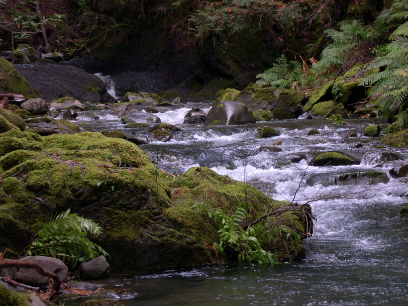
Researchers built a glass-encased test environment that helps them assess streamflow without the confounding factors introduced by bed forms.
landscape & topography

Posted inScience Updates
Seeking Signs of Life and More: NASA’s Mars 2020 Mission
The next Mars rover will be able to land near rugged terrain, giving scientists access to diverse landscapes. It will also cache core samples, a first step in the quest to return samples to Earth.

Posted inResearch Spotlights
Boulders Limit Transport of Sand and Gravel in Steep Rivers
Mountain rivers and streams actively reshape landscapes by eroding material from uplands and depositing it in lowlands. Scientists can now predict this transport in very steep streams.

Posted inNews
Scientists Offer New Explanation for Island's Unexpected Uplift
Researchers developed a new timeline for the rise, fall, and rise again of a puzzling island in the Azores.
Posted inResearch Spotlights
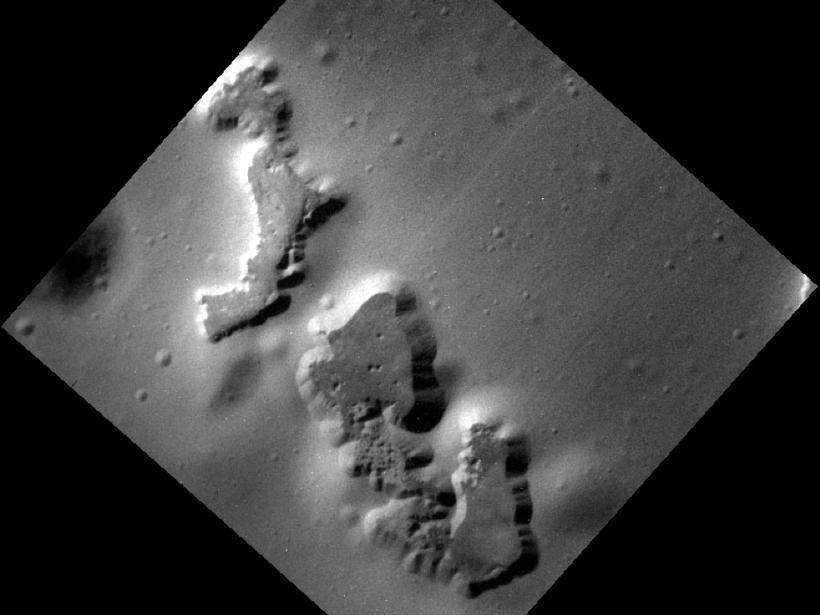
Unprecedented Views of Mercury Constrain Hollow Formation
The consistently shallow depths of the depressions scattered across Mercury's surface suggest their morphology is not determined by the thickness of a volatile-rich outer layer.
Posted inAGU News
Harman Receives 2016 Early Career Hydrologic Science Award
Ciaran Harman will receive the 2016 Early Career Hydrologic Science Award at the 2016 American Geophysical Union Fall Meeting, to be held 12–16 December in San Francisco, Calif. The award is for significant early-career contributions to hydrologic science.
Posted inAGU News
Duvall Receives 2016 Luna B. Leopold Young Scientist Award
Alison R. Duvall will receive the 2016 Luna B. Leopold Young Scientist Award at the 2016 American Geophysical Union Fall Meeting, to be held 12–16 December in San Francisco, Calif. The award recognizes "a young scientist for making a significant and outstanding contribution that advances the field of Earth and planetary surface processes."
Posted inResearch Spotlights
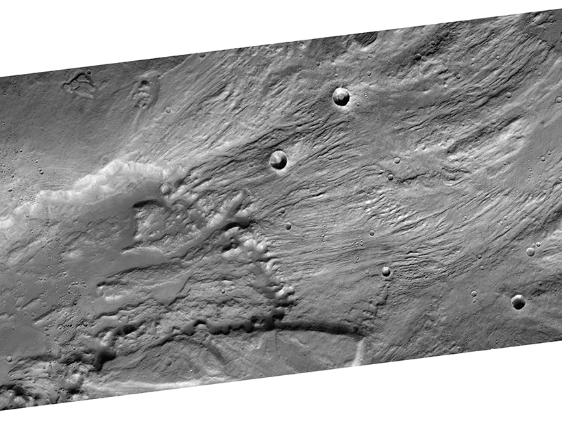
Reconstructing Catastrophic Floods on Earth and Mars
A new theoretical model suggests that ancient floods that carved canyons on Earth and Mars may have been much smaller but lasted longer than previously thought.
Posted inScience Updates
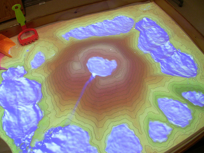
Augmented Reality Turns a Sandbox into a Geoscience Lesson
Superimposing responsive digital effects onto sand in a sandbox places educators, students, and policy makers in an augmented reality, offering a hands-on way to explore geoscience processes.

Posted inNews
Earth Fissures May No Longer Get Mapped in Arizona
A program that monitors giant cracks in the ground that suddenly appear after heavy rain could become a casualty of budget cuts to the Arizona Geological Survey.