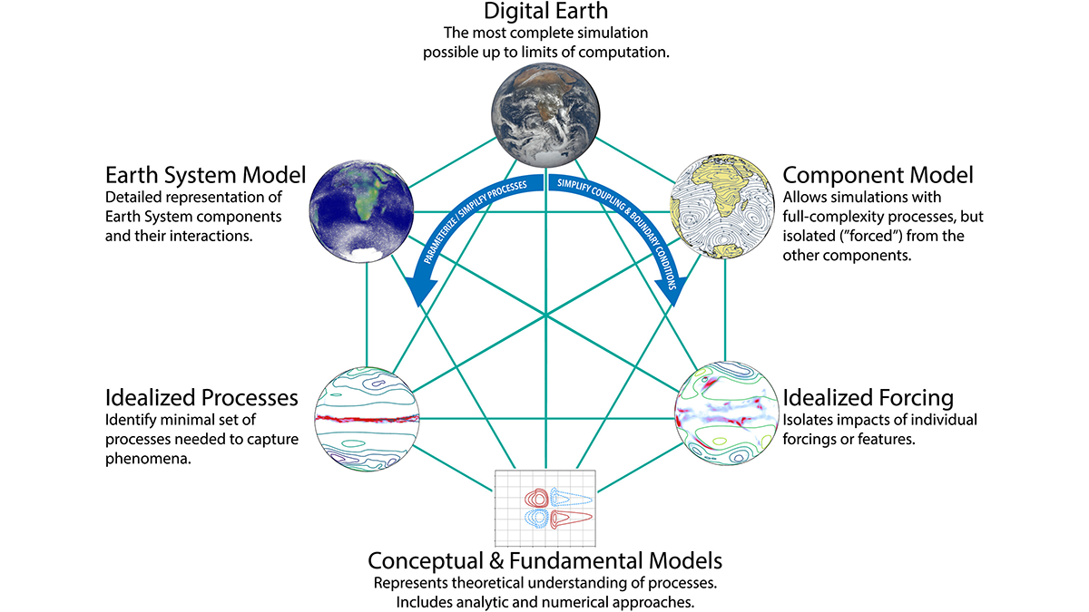
As models that simulate Earth’s climate system become increasingly complex, the use of simpler and more flexible idealized models remains important for science and education.
machine learning & AI

Posted inResearch Spotlights
Machine Learning Simulates 1,000 Years of Climate
The Deep Learning Earth System Model is competitive with CMIP6 models and uses less computational power.
Posted inEditors' Highlights
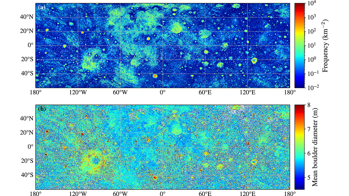
Nearly 94 Million Boulders Mapped on the Moon Using Deep Learning
Scientists used a deep learning algorithm to map the size and location of nearly 94 million boulders on the lunar surface, highlighting differences in boulder densities and size distributions.

Posted inNews
Machine Learning Model Flags Early, Invisible Signs of Marsh Decline
Decreases in underground plant biomass could signal future marsh loss and prompt conservation measures.

Posted inEditors' Highlights
Rock Solid Augmentation: AI-Driven Digital Rock Analysis
Boosting digital rock images with AI-powered augmentation and quality analysis could improve subsurface engineering decisions.

Posted inResearch Spotlights
Storm Prediction Gets 10 Times Faster Thanks to AI
Forecasters hope new algorithms will lead to earlier warnings of when dangerous weather is on the way.
Posted inEditors' Highlights
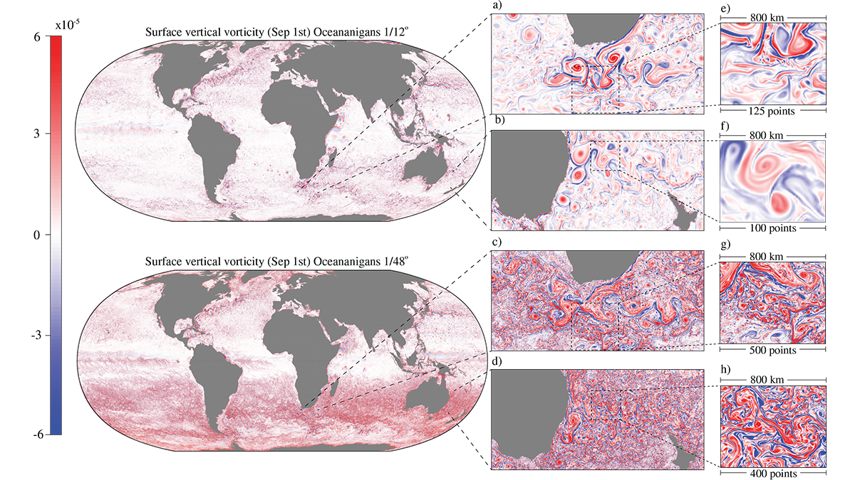
A Leap Toward Next-Generation Ocean Models
GPU-optimized ocean modeling achieves decade-long simulations in a day, enabling mesoscale-resolving climate simulations that open new opportunities for long-term planning in a changing climate.

Posted inScience Updates
A Two-Step Approach to Training Earth Scientists in AI
Researchers learned machine learning methods during a boot camp, then applied their new knowledge to real-world research problems during a hackathon.
Posted inEditors' Highlights
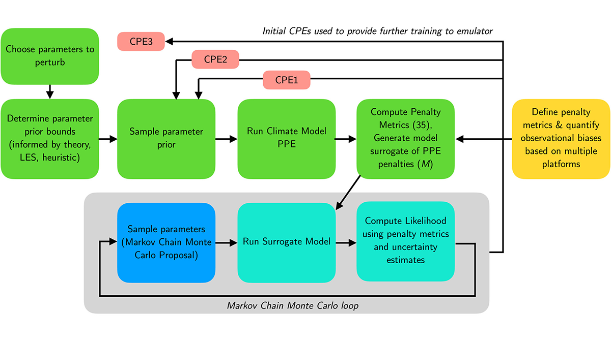
Calibrating Climate Models with Machine Learning
Using machine learning, researchers automatically calibrate a comprehensive climate model, improving simulations of difficult features and taking steps toward more reliable climate projections.

Posted inEditors' Highlights
Machine Learning Provides a New Perspective of Low-level Clouds
Low-level clouds over the oceans, extensively studied for their role in climate change, are re-examined from a new perspective that applies machine learning to radar observations.