Scientists develop a novel machine learning-based technique that is equally effective in gaining information from observations about the unobserved state variables in the midlatitudes and tropics.
machine learning & AI
Posted inEditors' Vox
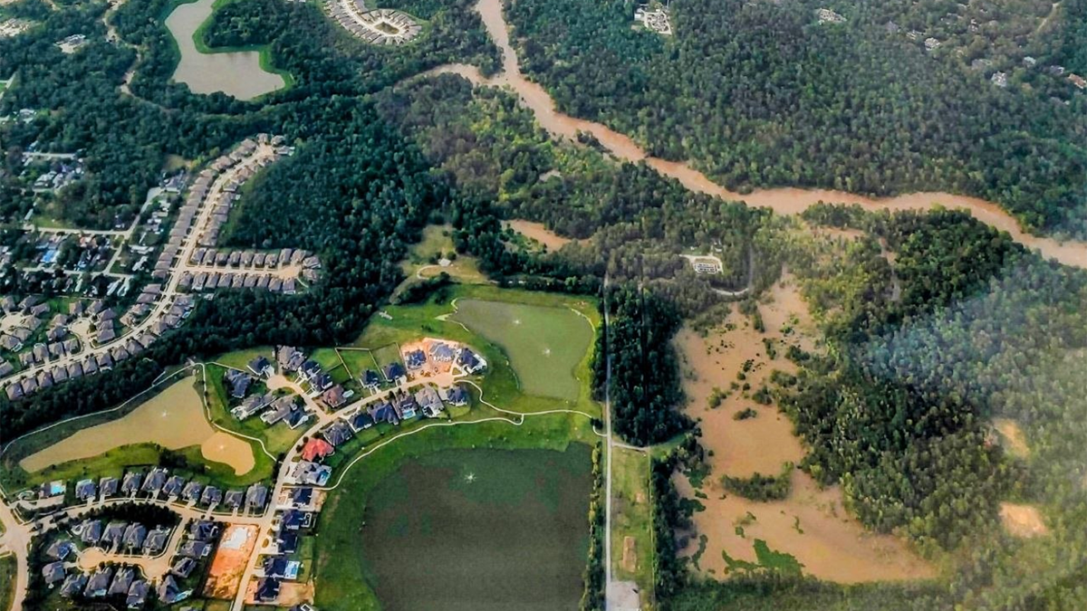
Synergistic Integration of Flood Inundation Modeling Methods
Recent flood modeling advances are trending into silos that compete rather than complement each other, hampering the opportunity for transformative progress toward protecting lives and communities.

Posted inEditors' Highlights
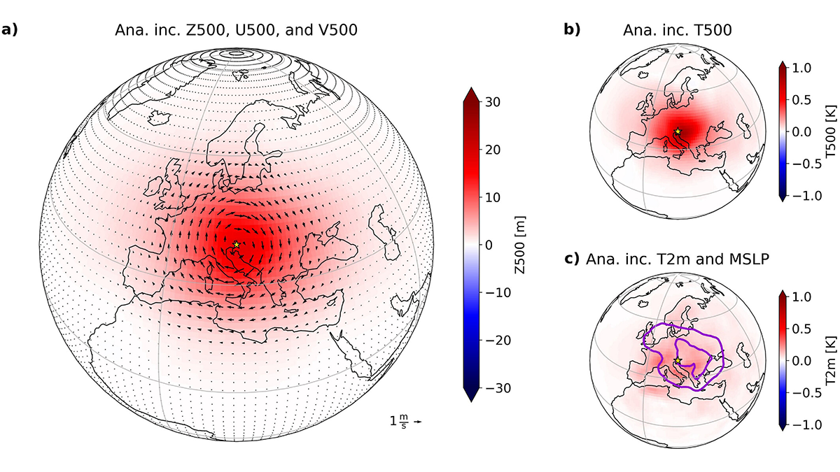
Machine Learning Could Enhance Earth System Modeling
Based on tests of a machine learning-based (ML) hybrid model, combining ML with established physics-based frameworks represents a promising path toward developing ML-based Earth system models.
Posted inEditors' Highlights
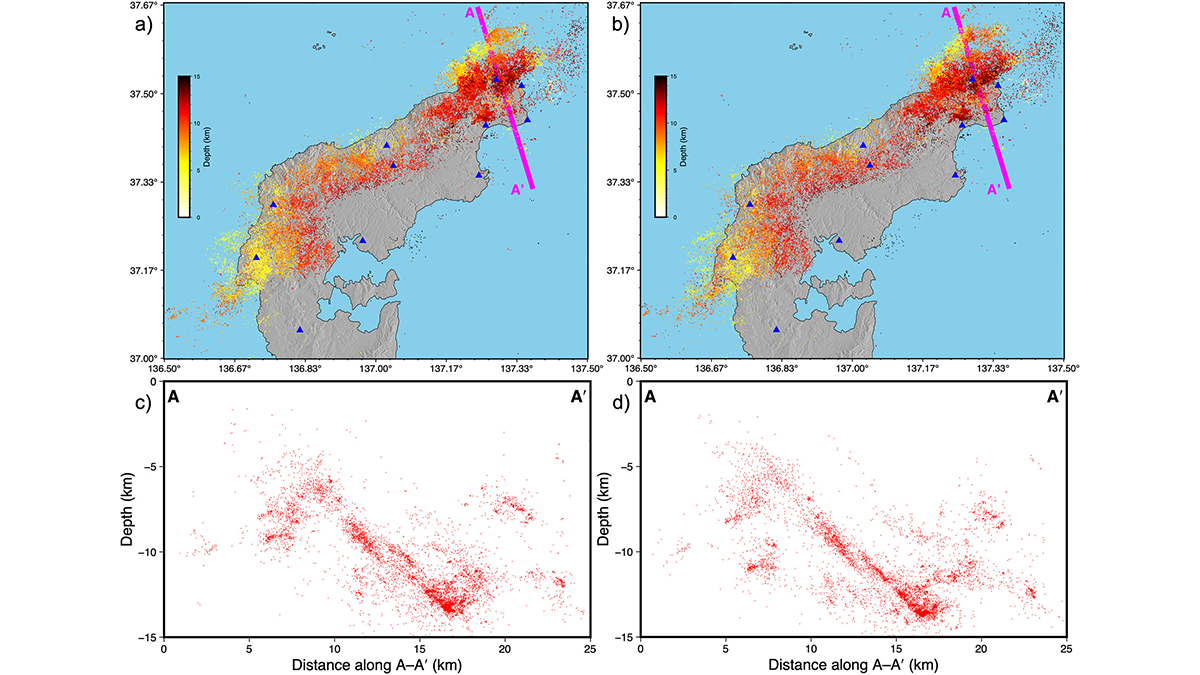
Taming the Seismicity Tsunami with a Scalable Bayesian Framework
By combining the power of artificial intelligence with advanced physics simulations, a new framework called “SPIDER” allows us to map seismic activity with unprecedented clarity.

Posted inEditors' Highlights
The Multi-Faceted Water Footprint of Data Centers
Data centers powering artificial intelligence consume significant amounts of water, highlighting the need for greater transparency regarding water use in both existing and planned facilities.
Posted inEditors' Highlights
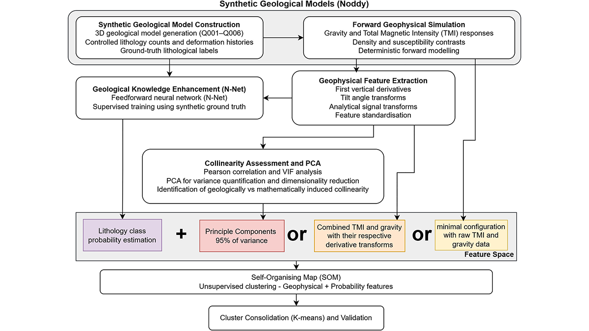
Collinearity is Not Always a Problem in Machine Learning
Collinearity is not always a showstopper for statistical machine learning (at least not for self-organizing maps).
Posted inNews
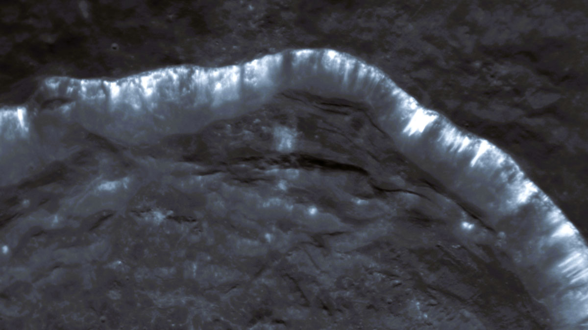
Oozing Gas Could Be Making Stripes in Mercury’s Craters
Scientists are using new computational tools to analyze troves of old spacecraft data to better understand one of Mercury’s unsolved mysteries.
Posted inEditors' Highlights
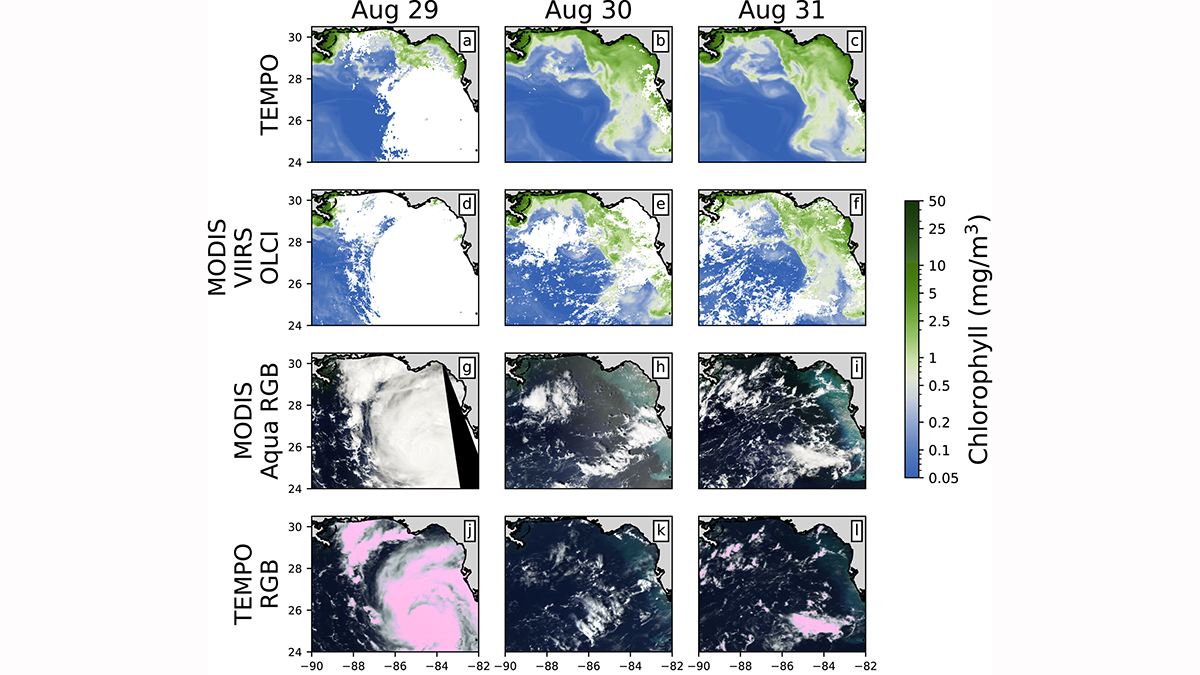
Monitoring Ocean Color From Deep Space: A TEMPO Study
Scientists apply machine learning to demonstrate that geosynchronous satellites can be used to assess the health of oceans from deep space.
Posted inNews
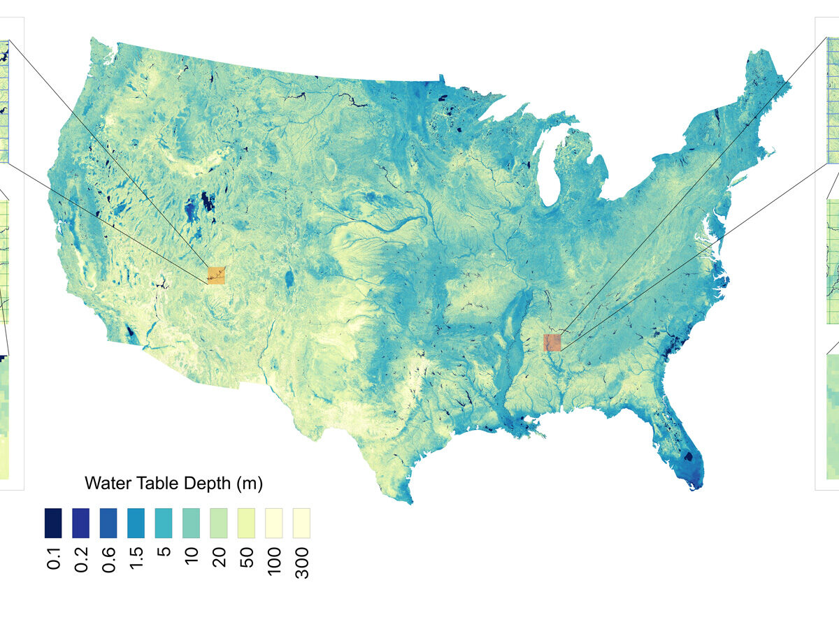
Report: 13 Great Lakes’ Worth of Water Underlies the Contiguous United States
Researchers used 1 million data points and a machine learning algorithm to estimate groundwater stores with higher resolution than ever before.
Posted inEditors' Vox
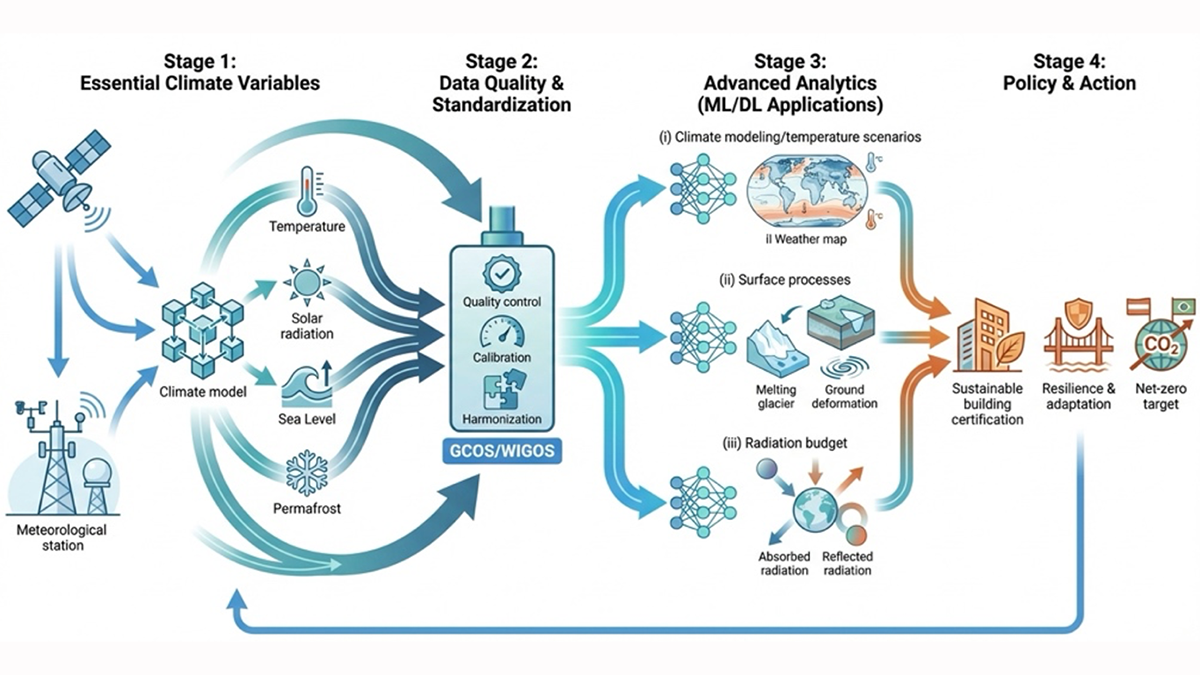
Bridging the Gap: Transforming Reliable Climate Data into Climate Policy
A new special collection welcomes research that bridges the gap between rigorous Essential Climate Variable (ECV) monitoring, AI analytics, and climate policy.